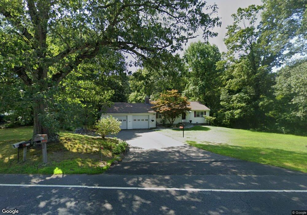
657 Whittemore Rd Middlebury, CT 06762
Estimated Value: $442,000 - $511,000
3
Beds
1
Bath
1,488
Sq Ft
$311/Sq Ft
Est. Value
About This Home
This home is located at 657 Whittemore Rd, Middlebury, CT 06762 and is currently estimated at $463,304, approximately $311 per square foot. 657 Whittemore Rd is a home located in New Haven County with nearby schools including Middlebury Elementary School, Memorial Middle School, and Pomperaug Regional High School.
Ownership History
Date
Name
Owned For
Owner Type
Purchase Details
Closed on
Apr 3, 2000
Sold by
Frigon Marc
Bought by
Durao Mark and Lacy Phyllis
Current Estimated Value
Home Financials for this Owner
Home Financials are based on the most recent Mortgage that was taken out on this home.
Original Mortgage
$148,000
Interest Rate
8.4%
Purchase Details
Closed on
Nov 8, 1996
Sold by
Cappello Joe and Cappello Nancy
Bought by
Frigon Marc and Frigon Laura
Create a Home Valuation Report for This Property
The Home Valuation Report is an in-depth analysis detailing your home's value as well as a comparison with similar homes in the area
Home Values in the Area
Average Home Value in this Area
Purchase History
| Date | Buyer | Sale Price | Title Company |
|---|---|---|---|
| Durao Mark | $188,000 | -- | |
| Durao Mark | $188,000 | -- | |
| Frigon Marc | $155,000 | -- | |
| Frigon Marc | $155,000 | -- |
Source: Public Records
Mortgage History
| Date | Status | Borrower | Loan Amount |
|---|---|---|---|
| Closed | Frigon Marc | $172,000 | |
| Closed | Frigon Marc | $141,945 | |
| Closed | Frigon Marc | $148,000 |
Source: Public Records
Tax History Compared to Growth
Tax History
| Year | Tax Paid | Tax Assessment Tax Assessment Total Assessment is a certain percentage of the fair market value that is determined by local assessors to be the total taxable value of land and additions on the property. | Land | Improvement |
|---|---|---|---|---|
| 2025 | $7,337 | $225,600 | $62,400 | $163,200 |
| 2024 | $7,355 | $225,600 | $62,400 | $163,200 |
| 2023 | $7,278 | $225,600 | $62,400 | $163,200 |
| 2022 | $7,052 | $225,600 | $62,400 | $163,200 |
| 2021 | $5,667 | $162,700 | $71,100 | $91,600 |
| 2020 | $5,711 | $162,700 | $71,100 | $91,600 |
| 2019 | $5,434 | $162,700 | $71,100 | $91,600 |
| 2018 | $5,289 | $162,700 | $71,100 | $91,600 |
| 2017 | $5,123 | $162,700 | $71,100 | $91,600 |
| 2016 | $5,300 | $170,900 | $83,400 | $87,500 |
| 2015 | $5,148 | $170,900 | $83,400 | $87,500 |
| 2014 | $5,014 | $170,900 | $83,400 | $87,500 |
Source: Public Records
Map
Nearby Homes
- 51 Cross Rd
- 116 Yale Ave
- 73 Yale Ave
- 383 Leonard Rd
- 3 Pine Ridge Unit 23
- 32 Yale Ave
- 225 Crest Rd
- 587 Shadduck Rd
- 0 Ferndale Ave
- 126 Colonial Ave
- 72 Carriage Dr
- 105 Jericho Rd
- 66 Artillery Rd
- 0 Evelyn Dr Unit 24124911
- 141 Joshua Town Rd
- 111 Dwyer Rd
- 61 Campfield Rd
- 1 Umberfield Rd
- 11 Upper Whittemore Rd
- 0 Mason Ave