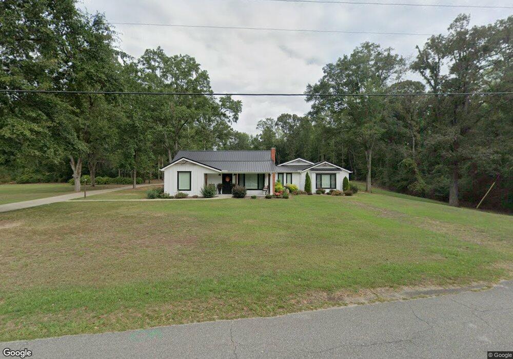
657 Wyatt Rd Clanton, AL 35045
Estimated Value: $254,000 - $299,000
Studio
--
Bath
2,001
Sq Ft
$136/Sq Ft
Est. Value
About This Home
This home is located at 657 Wyatt Rd, Clanton, AL 35045 and is currently estimated at $272,107, approximately $135 per square foot. 657 Wyatt Rd is a home with nearby schools including Clanton Elementary School, Thorsby High School, and Isabella High School.
Ownership History
Date
Name
Owned For
Owner Type
Purchase Details
Closed on
Aug 2, 2019
Sold by
Porter Marika
Bought by
Porter Marika and Knowles Shawn L
Current Estimated Value
Home Financials for this Owner
Home Financials are based on the most recent Mortgage that was taken out on this home.
Original Mortgage
$162,400
Outstanding Balance
$142,012
Interest Rate
3.73%
Estimated Equity
$130,095
Purchase Details
Closed on
Feb 1, 2019
Sold by
Wyatt Royce Albert and Wyatt Royce A
Bought by
Porter Marika
Purchase Details
Closed on
Aug 26, 2016
Sold by
Wyatt Royce Albert and Wyatt Donna J
Bought by
Wyatt Royce A
Create a Home Valuation Report for This Property
The Home Valuation Report is an in-depth analysis detailing your home's value as well as a comparison with similar homes in the area
Purchase History
| Date | Buyer | Sale Price | Title Company |
|---|---|---|---|
| Porter Marika | -- | None Available | |
| Porter Marika | $67,000 | None Available | |
| Wyatt Royce A | -- | None Available |
Source: Public Records
Mortgage History
| Date | Status | Borrower | Loan Amount |
|---|---|---|---|
| Open | Porter Marika | $162,400 |
Source: Public Records
Tax History
| Year | Tax Paid | Tax Assessment Tax Assessment Total Assessment is a certain percentage of the fair market value that is determined by local assessors to be the total taxable value of land and additions on the property. | Land | Improvement |
|---|---|---|---|---|
| 2024 | $2,182 | $51,820 | $6,080 | $45,740 |
| 2023 | $2,182 | $50,600 | $6,080 | $44,520 |
| 2022 | $1,553 | $19,720 | $2,860 | $16,860 |
| 2021 | $1,451 | $17,210 | $2,670 | $14,540 |
| 2020 | $1,451 | $17,210 | $2,670 | $14,540 |
| 2019 | $664 | $6,810 | $1,640 | $5,170 |
| 2018 | $579 | $15,600 | $0 | $0 |
| 2017 | $579 | $0 | $0 | $0 |
| 2016 | $485 | $0 | $0 | $0 |
| 2015 | $496 | $0 | $0 | $0 |
| 2013 | -- | $5,620 | $0 | $0 |
Source: Public Records
Map
Nearby Homes
- 103 Windover Dr
- 103 Randall Cir
- 110 Round Forest Dr Unit 4
- 104 Adriane St
- 1302 Lay Dam Rd
- 1306 Lay Dam Rd
- 1912 Lay Dam Rd
- 1003 Lay Dam Rd
- 800 Airport Rd
- 6101 Alabama 145
- 0 County Road 32 Unit 21440953
- 504 Adams St
- 01 Alabama 145
- 803 3rd St N
- 311 Thrash Rd
- 106 Bethany Ln
- 75 County Road 920
- 72 Park Dr S
- 168 County Road 454
- 111 Morris Ave
- 630 Wyatt Rd
- 308 Barry St
- 1114 Harriet St
- 1111 Harriet St
- 300 Windover Dr
- 980 Pinedale Rd
- 0 Wyatt Rd Unit 1 458730
- 0 Wyatt Rd Unit 550153
- 0 Wyatt Rd Unit 601417
- 616 Wyatt Rd
- 711 Wyatt Rd
- 203 Windover Dr
- 268 Windover Dr
- 208 Barry St
- 614 Wyatt Rd
- 1101 Harriet St
- 104 Windover Dr
- 601 Wyatt Rd
- 204 Paige St
- 1006 Pinedale Rd
Your Personal Tour Guide
Ask me questions while you tour the home.