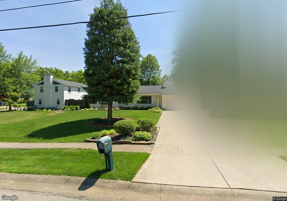
6571 Apache Cir Cincinnati, OH 45243
Estimated Value: $446,000 - $629,000
3
Beds
2
Baths
2,027
Sq Ft
$268/Sq Ft
Est. Value
About This Home
This home is located at 6571 Apache Cir, Cincinnati, OH 45243 and is currently estimated at $542,438, approximately $267 per square foot. 6571 Apache Cir is a home located in Hamilton County with nearby schools including Madeira Elementary School, Madeira Middle School, and Madeira High School.
Ownership History
Date
Name
Owned For
Owner Type
Purchase Details
Closed on
Feb 22, 2008
Sold by
Myers David W and Myers Annabelle
Bought by
Myers David W and Myers Annabelle
Current Estimated Value
Purchase Details
Closed on
Aug 29, 1997
Sold by
Olinger Brian M and Olinger Amy B
Bought by
Myers David W and Myers Annabelle
Home Financials for this Owner
Home Financials are based on the most recent Mortgage that was taken out on this home.
Original Mortgage
$116,500
Outstanding Balance
$15,365
Interest Rate
7.57%
Estimated Equity
$527,073
Purchase Details
Closed on
Mar 11, 1993
Sold by
Olinger Dorothy L
Bought by
Olinger Brian M and Olinger Amy B
Home Financials for this Owner
Home Financials are based on the most recent Mortgage that was taken out on this home.
Original Mortgage
$112,500
Interest Rate
7.84%
Create a Home Valuation Report for This Property
The Home Valuation Report is an in-depth analysis detailing your home's value as well as a comparison with similar homes in the area
Home Values in the Area
Average Home Value in this Area
Purchase History
| Date | Buyer | Sale Price | Title Company |
|---|---|---|---|
| Myers David W | -- | Attorney | |
| Myers David W | $156,500 | -- | |
| Olinger Brian M | -- | -- |
Source: Public Records
Mortgage History
| Date | Status | Borrower | Loan Amount |
|---|---|---|---|
| Open | Myers David W | $116,500 | |
| Previous Owner | Olinger Brian M | $112,500 |
Source: Public Records
Tax History
| Year | Tax Paid | Tax Assessment Tax Assessment Total Assessment is a certain percentage of the fair market value that is determined by local assessors to be the total taxable value of land and additions on the property. | Land | Improvement |
|---|---|---|---|---|
| 2025 | $7,431 | $136,633 | $47,320 | $89,313 |
| 2023 | $7,387 | $136,633 | $47,320 | $89,313 |
| 2022 | $6,330 | $98,042 | $36,050 | $61,992 |
| 2021 | $6,183 | $98,042 | $36,050 | $61,992 |
| 2020 | $5,734 | $98,042 | $36,050 | $61,992 |
| 2019 | $6,012 | $95,186 | $35,000 | $60,186 |
| 2018 | $6,061 | $95,186 | $35,000 | $60,186 |
| 2017 | $5,739 | $95,186 | $35,000 | $60,186 |
| 2016 | $4,076 | $66,802 | $15,481 | $51,321 |
| 2015 | $3,778 | $66,802 | $15,481 | $51,321 |
| 2014 | $3,801 | $66,802 | $15,481 | $51,321 |
| 2013 | $4,085 | $68,870 | $15,960 | $52,910 |
Source: Public Records
Map
Nearby Homes
- 6752 Rose Crest Ave
- 6495 Dawson Rd
- 7406 Dawson Rd
- 7469 Camargo Rd
- 7437 Madeira Pines Dr
- 6095 Kenwood Rd
- 7474 Dawson Rd
- 5995 Crabtree Ln
- 7151 Euclid Ave
- 6242 Fulsher Ln
- 7133 Fowler Ave
- 7159 Hosbrook Rd
- 7317 Euclid Ave
- 7220 Mar Del Dr
- 7335 Demar Rd
- 6300 Miami Rd
- 6041 Johnson St
- 7321 Hosbrook Rd
- 7708 Ahwenasa Ln
- 7156 Maple Ave
- 6567 Apache Cir
- 6585 Apache Cir
- 6626 Apache Cir
- 6559 Apache Cir
- 6634 Apache Cir
- 6608 Apache Cir
- 6574 Apache Cir
- 6640 Apache Cir
- 6580 Apache Cir
- 6555 Apache Cir
- 6596 Apache Cir
- 6568 Apache Cir
- 6584 Apache Cir
- 6590 Apache Cir
- 6603 Apache Cir
- 6558 Apache Cir
- 6644 Apache Cir
- 6564 Apache Cir
- 6609 Apache Cir
- 6551 Apache Cir
Your Personal Tour Guide
Ask me questions while you tour the home.