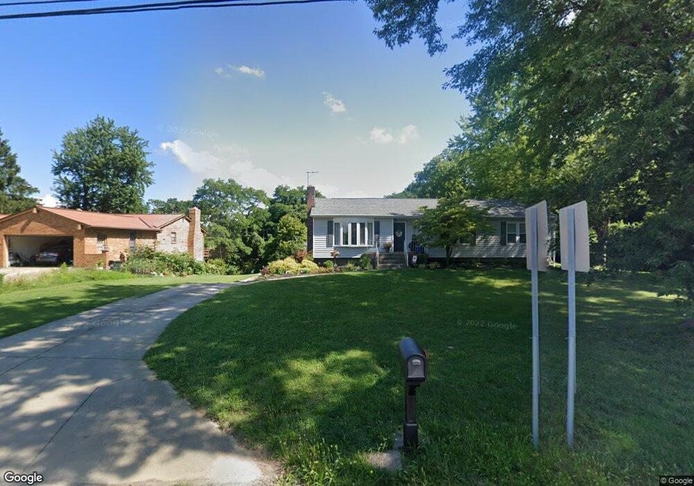
6572 Bridgetown Rd Cincinnati, OH 45248
Estimated Value: $305,484 - $387,000
3
Beds
3
Baths
1,620
Sq Ft
$214/Sq Ft
Est. Value
About This Home
This home is located at 6572 Bridgetown Rd, Cincinnati, OH 45248 and is currently estimated at $346,121, approximately $213 per square foot. 6572 Bridgetown Rd is a home located in Hamilton County with nearby schools including John Foster Dulles Elementary School, Rapid Run Middle School, and Oak Hills High School.
Ownership History
Date
Name
Owned For
Owner Type
Purchase Details
Closed on
Jun 25, 2018
Sold by
Anness Harold L
Bought by
Steinmetz Brianna Marie and Steinmetz Randy J
Current Estimated Value
Home Financials for this Owner
Home Financials are based on the most recent Mortgage that was taken out on this home.
Original Mortgage
$96,000
Outstanding Balance
$83,198
Interest Rate
4.5%
Mortgage Type
Unknown
Estimated Equity
$262,923
Create a Home Valuation Report for This Property
The Home Valuation Report is an in-depth analysis detailing your home's value as well as a comparison with similar homes in the area
Home Values in the Area
Average Home Value in this Area
Purchase History
| Date | Buyer | Sale Price | Title Company |
|---|---|---|---|
| Steinmetz Brianna Marie | -- | None Available | |
| Annes Harold L | $120,000 | None Available |
Source: Public Records
Mortgage History
| Date | Status | Borrower | Loan Amount |
|---|---|---|---|
| Open | Annes Harold L | $96,000 |
Source: Public Records
Tax History Compared to Growth
Tax History
| Year | Tax Paid | Tax Assessment Tax Assessment Total Assessment is a certain percentage of the fair market value that is determined by local assessors to be the total taxable value of land and additions on the property. | Land | Improvement |
|---|---|---|---|---|
| 2024 | $4,333 | $94,749 | $19,492 | $75,257 |
| 2023 | $4,369 | $94,749 | $19,492 | $75,257 |
| 2022 | $2,019 | $42,001 | $18,190 | $23,811 |
| 2021 | $1,815 | $42,001 | $18,190 | $23,811 |
| 2020 | $1,839 | $42,001 | $18,190 | $23,811 |
| 2019 | $3,098 | $60,218 | $16,240 | $43,978 |
| 2018 | $3,102 | $60,218 | $16,240 | $43,978 |
| 2017 | $2,924 | $60,218 | $16,240 | $43,978 |
| 2016 | $2,998 | $61,502 | $16,065 | $45,437 |
| 2015 | $3,026 | $61,502 | $16,065 | $45,437 |
| 2014 | $3,030 | $61,502 | $16,065 | $45,437 |
| 2013 | $2,767 | $60,295 | $15,750 | $44,545 |
Source: Public Records
Map
Nearby Homes
- 6492 Sherrybrook Dr
- 3300 Kuliga Park Dr
- 3823 Springoak Dr
- 6463 Werk Rd
- 6359 Werk Rd
- 3227 Algus Ln
- 3340 Markdale Ct
- 6662 Taylor Rd
- 2 Ebenezer Rd
- 3040 Werkridge Dr
- 3072 Werkridge Dr
- 6026 Musketeer Dr
- 3593 Sandal Ln
- 2659 Devils Backbone Rd
- 3740 Sandal Ln
- 5963 Oakapple Dr
- 3832 Ebenezer Rd
- 3605 Coral Gables Rd
- 6548 Springmyer Dr
- 3354 Fiddlers Green Rd
- 6582 Bridgetown Rd
- 6592 Bridgetown Rd
- 6575 Bridgetown Rd
- 6565 Bridgetown Rd
- 6585 Bridgetown Rd
- 6555 Bridgetown Rd
- 6602 Bridgetown Rd
- 6595 Bridgetown Rd
- 6545 Bridgetown Rd
- 6605 Bridgetown Rd
- 6612 Bridgetown Rd
- 6603 Powner Farm Dr
- 6526 Bridgetown Rd
- 6616 Bridgetown Rd
- 3470 South Rd
- 3432 South Rd
- 6630 Bridgetown Rd
- 6510 Bridgetown Rd
- 6601 Powner Farm Dr
- 6605 Powner Farm Dr