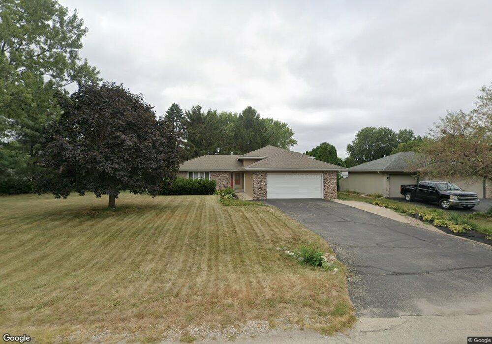
6572 Hayfield Ln Loves Park, IL 61111
Estimated Value: $253,709 - $282,000
3
Beds
2
Baths
2,108
Sq Ft
$129/Sq Ft
Est. Value
About This Home
This home is located at 6572 Hayfield Ln, Loves Park, IL 61111 and is currently estimated at $271,927, approximately $128 per square foot. 6572 Hayfield Ln is a home located in Winnebago County with nearby schools including Olson Park Elementary School, Harlem Middle School, and Harlem High School.
Ownership History
Date
Name
Owned For
Owner Type
Purchase Details
Closed on
Jul 30, 2019
Sold by
Woodliff Dorian H
Bought by
Dejong Alisha M and Dejong Nicholas Wayne
Current Estimated Value
Home Financials for this Owner
Home Financials are based on the most recent Mortgage that was taken out on this home.
Original Mortgage
$155,200
Outstanding Balance
$136,066
Interest Rate
3.75%
Mortgage Type
New Conventional
Estimated Equity
$135,861
Purchase Details
Closed on
Apr 10, 2016
Sold by
Panayiota Sarantopoulos
Bought by
Woodliff Dorian H and Woodliff Lori Ann
Home Financials for this Owner
Home Financials are based on the most recent Mortgage that was taken out on this home.
Original Mortgage
$127,500
Interest Rate
3.73%
Mortgage Type
VA
Create a Home Valuation Report for This Property
The Home Valuation Report is an in-depth analysis detailing your home's value as well as a comparison with similar homes in the area
Home Values in the Area
Average Home Value in this Area
Purchase History
| Date | Buyer | Sale Price | Title Company |
|---|---|---|---|
| Dejong Alisha M | $160,000 | Lambert J Laird | |
| Woodliff Dorian H | -- | Nlt |
Source: Public Records
Mortgage History
| Date | Status | Borrower | Loan Amount |
|---|---|---|---|
| Open | Dejong Alisha M | $155,200 | |
| Previous Owner | Woodliff Dorian H | $127,500 |
Source: Public Records
Tax History Compared to Growth
Tax History
| Year | Tax Paid | Tax Assessment Tax Assessment Total Assessment is a certain percentage of the fair market value that is determined by local assessors to be the total taxable value of land and additions on the property. | Land | Improvement |
|---|---|---|---|---|
| 2024 | $4,570 | $61,251 | $10,261 | $50,990 |
| 2023 | $4,337 | $54,397 | $9,113 | $45,284 |
| 2022 | $4,251 | $49,614 | $8,312 | $41,302 |
| 2021 | $4,010 | $46,144 | $7,731 | $38,413 |
| 2020 | $3,687 | $43,955 | $7,364 | $36,591 |
| 2019 | $3,776 | $42,103 | $7,054 | $35,049 |
| 2018 | $0 | $40,723 | $6,823 | $33,900 |
| 2017 | $3,903 | $39,606 | $6,636 | $32,970 |
| 2016 | $3,903 | $38,818 | $6,504 | $32,314 |
| 2015 | $3,869 | $38,139 | $6,390 | $31,749 |
| 2014 | $3,827 | $38,139 | $6,390 | $31,749 |
Source: Public Records
Map
Nearby Homes
- 6606 Hayfield Ln
- 6562 Hayfield Ln
- 5038 Hummingbird Trail
- 5022 Hummingbird Trail
- 6607 Hayfield Ln
- 6612 Hayfield Ln
- 6601 Hayfield Ln
- 6575 Hayfield Ln
- 6615 Hayfield Ln
- 6569 Hayfield Ln
- 5004 Hummingbird Trail
- 6559 Hayfield Ln
- 6618 Hayfield Ln
- 6621 Hayfield Ln
- 6565 Stallion Ct
- 5055 Hummingbird Trail
- 6630 Red Barn Rd
- 4982 Hummingbird Trail
- 6638 Red Barn Rd
- 5071 Hummingbird Trail