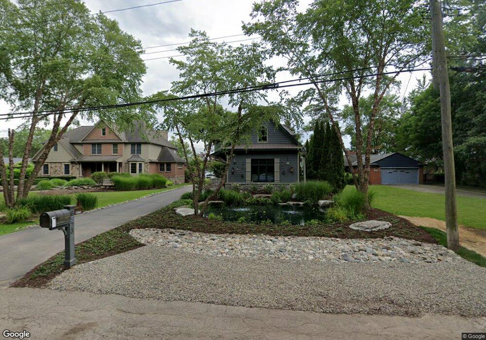
6573 Alden Dr Unit Bldg-Unit West Bloomfield, MI 48324
Estimated Value: $1,077,000 - $1,551,565
3
Beds
3
Baths
3,870
Sq Ft
$346/Sq Ft
Est. Value
About This Home
This home is located at 6573 Alden Dr Unit Bldg-Unit, West Bloomfield, MI 48324 and is currently estimated at $1,340,391, approximately $346 per square foot. 6573 Alden Dr Unit Bldg-Unit is a home located in Oakland County with nearby schools including Our Lady Of Refuge School, Lakecrest Baptist School, and St Mary's Preparatory School.
Ownership History
Date
Name
Owned For
Owner Type
Purchase Details
Closed on
Dec 23, 2019
Sold by
Conrad Scott and Conrad Denise
Bought by
Conrad Scott and Conrad Denise
Current Estimated Value
Purchase Details
Closed on
Oct 5, 2018
Sold by
Davis Richard L and Davis Lauren S
Bought by
Conrad Scott A and Conrad Denise A
Purchase Details
Closed on
Dec 18, 2001
Sold by
Richard L Davis Ii Tr
Bought by
Davis R
Purchase Details
Closed on
Sep 5, 2000
Sold by
Davis Ii R
Bought by
Richard L Davis Ii Tr
Create a Home Valuation Report for This Property
The Home Valuation Report is an in-depth analysis detailing your home's value as well as a comparison with similar homes in the area
Home Values in the Area
Average Home Value in this Area
Purchase History
| Date | Buyer | Sale Price | Title Company |
|---|---|---|---|
| Conrad Scott | -- | None Available | |
| Conrad Scott A | $955,000 | Devon Title Agency | |
| Davis R | -- | -- | |
| Richard L Davis Ii Tr | -- | -- |
Source: Public Records
Tax History Compared to Growth
Tax History
| Year | Tax Paid | Tax Assessment Tax Assessment Total Assessment is a certain percentage of the fair market value that is determined by local assessors to be the total taxable value of land and additions on the property. | Land | Improvement |
|---|---|---|---|---|
| 2024 | $13,129 | $593,570 | $0 | $0 |
| 2022 | $12,571 | $531,100 | $80,590 | $450,510 |
| 2021 | $19,103 | $526,850 | $0 | $0 |
| 2020 | $12,318 | $539,130 | $80,590 | $458,540 |
| 2018 | $12,551 | $428,630 | $80,590 | $348,040 |
| 2015 | -- | $389,670 | $0 | $0 |
| 2014 | -- | $355,550 | $0 | $0 |
| 2011 | -- | $286,170 | $0 | $0 |
Source: Public Records
Map
Nearby Homes
- 6289 Lindsay Ct
- 7110 Commerce Rd
- 6420 Commerce Rd
- 6707 Heatherwood Dr
- 7185 Aaronway Dr
- 2877 W Bloomfield Oaks Dr
- 7240 Aaronway Dr
- 2236 Locklin Ln
- 7304 Ilanaway Dr
- 7146 Arrowood Dr
- 7260 Willow Oak Dr
- 6057 Beachwood Dr
- 6726 Red Cedar Ln
- 6620 Red Cedar Ln Unit 37
- 3115 Westacres Dr
- 3632 Fieldview Ave
- 6034 Beachwood Dr
- 5809 Hartwick Dr
- 6768 Buckland Ave
- 1992 Swaranne Dr