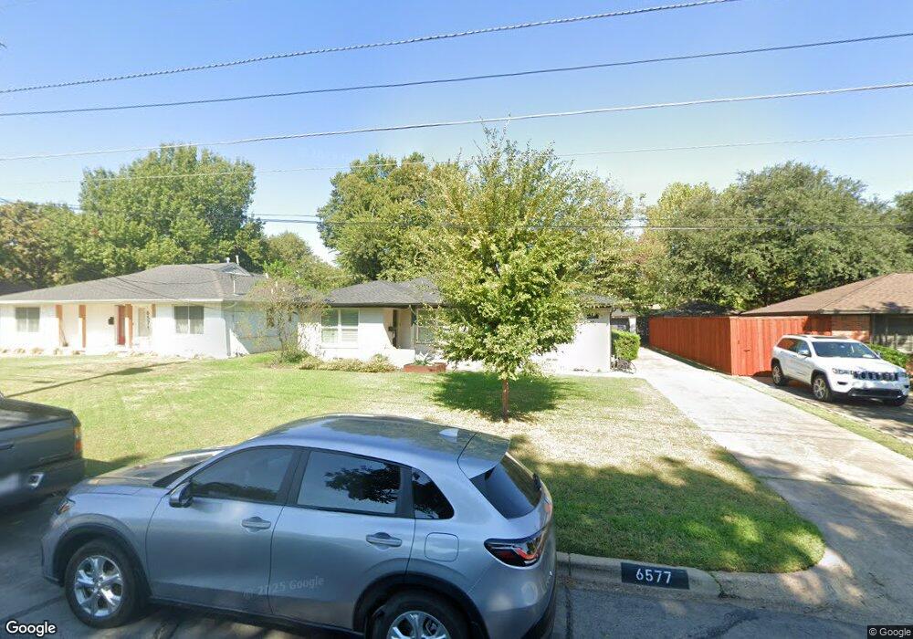
6577 Patrick Dr Dallas, TX 75214
Northeast Dallas NeighborhoodEstimated Value: $627,367 - $810,000
3
Beds
2
Baths
1,510
Sq Ft
$459/Sq Ft
Est. Value
About This Home
This home is located at 6577 Patrick Dr, Dallas, TX 75214 and is currently estimated at $692,592, approximately $458 per square foot. 6577 Patrick Dr is a home located in Dallas County with nearby schools including Lakewood Elementary School, J L Long Middle School, and Woodrow Wilson High School.
Ownership History
Date
Name
Owned For
Owner Type
Purchase Details
Closed on
Jul 1, 2024
Sold by
Robertson Mary Elizabeth and Hooper Cole Steele
Bought by
Turner Parker and Turner Sara Meador
Current Estimated Value
Home Financials for this Owner
Home Financials are based on the most recent Mortgage that was taken out on this home.
Original Mortgage
$196,500
Outstanding Balance
$194,166
Interest Rate
7.02%
Mortgage Type
New Conventional
Estimated Equity
$498,426
Purchase Details
Closed on
Aug 28, 2020
Sold by
Texas Agave Properties Llc
Bought by
Hooper Cole Steele and Robertson Nary Elizabeth
Home Financials for this Owner
Home Financials are based on the most recent Mortgage that was taken out on this home.
Original Mortgage
$445,500
Interest Rate
2.9%
Mortgage Type
New Conventional
Purchase Details
Closed on
Aug 1, 2013
Sold by
Estate Of Virginia M Millard
Bought by
Martin Paul Scott
Create a Home Valuation Report for This Property
The Home Valuation Report is an in-depth analysis detailing your home's value as well as a comparison with similar homes in the area
Home Values in the Area
Average Home Value in this Area
Purchase History
| Date | Buyer | Sale Price | Title Company |
|---|---|---|---|
| Turner Parker | -- | None Listed On Document | |
| Hooper Cole Steele | -- | None Available | |
| Martin Paul Scott | -- | None Available |
Source: Public Records
Mortgage History
| Date | Status | Borrower | Loan Amount |
|---|---|---|---|
| Open | Turner Parker | $196,500 | |
| Previous Owner | Hooper Cole Steele | $445,500 |
Source: Public Records
Tax History
| Year | Tax Paid | Tax Assessment Tax Assessment Total Assessment is a certain percentage of the fair market value that is determined by local assessors to be the total taxable value of land and additions on the property. | Land | Improvement |
|---|---|---|---|---|
| 2025 | $10,705 | $647,040 | $326,610 | $320,430 |
| 2024 | $10,705 | $647,720 | $240,000 | $407,720 |
| 2023 | $10,705 | $563,570 | $240,000 | $323,570 |
| 2022 | $14,091 | $563,570 | $240,000 | $323,570 |
| 2021 | $12,714 | $481,950 | $160,000 | $321,950 |
| 2020 | $8,047 | $296,640 | $160,000 | $136,640 |
| 2019 | $8,801 | $309,340 | $160,000 | $149,340 |
| 2018 | $8,412 | $309,340 | $160,000 | $149,340 |
| 2017 | $7,223 | $265,630 | $160,000 | $105,630 |
| 2016 | $7,223 | $265,630 | $160,000 | $105,630 |
| 2015 | $4,907 | $225,680 | $90,000 | $135,680 |
| 2014 | $4,907 | $219,540 | $90,000 | $129,540 |
Source: Public Records
Map
Nearby Homes
- 6609 Patrick Dr
- 6475 Trammel Dr
- 6471 Trammel Dr
- 6611 Blessing Dr
- 6644 Santa Anita Dr
- 6459 Trammel Dr
- 5024 Rexton Ln
- 6737 Ravendale Ln
- 6729 Ravendale Ln
- 6437 Trammel Dr
- 6615 Ridgemont Dr
- 6709 Belford Dr
- 6802 Vada Dr
- 6811 Patrick Dr
- 6725 Braeburn Dr
- 5130 Rexton Ln
- 6446 Lange Cir
- 6463 Highgate Ln
- 6719 Santa Anita Dr
- 6718 Hialeah Dr
- 6571 Patrick Dr
- 6581 Patrick Dr
- 6567 Patrick Dr
- 6605 Patrick Dr
- 4560 Saint Landry Dr
- 6561 Patrick Dr
- 4631 Surf Dr
- 4554 Saint Landry Dr
- 4625 Surf Dr
- 6562 Patrick Dr
- 6615 Patrick Dr
- 6557 Patrick Dr
- 6554 Trammel Dr
- 6558 Trammel Dr
- 6546 Trammel Dr
- 6542 Trammel Dr
- 4621 Surf Dr
- 4550 Saint Landry Dr
- 6619 Patrick Dr
- 6538 Trammel Dr
Your Personal Tour Guide
Ask me questions while you tour the home.