Estimated Value: $166,000 - $209,000
3
Beds
1
Bath
1,036
Sq Ft
$173/Sq Ft
Est. Value
About This Home
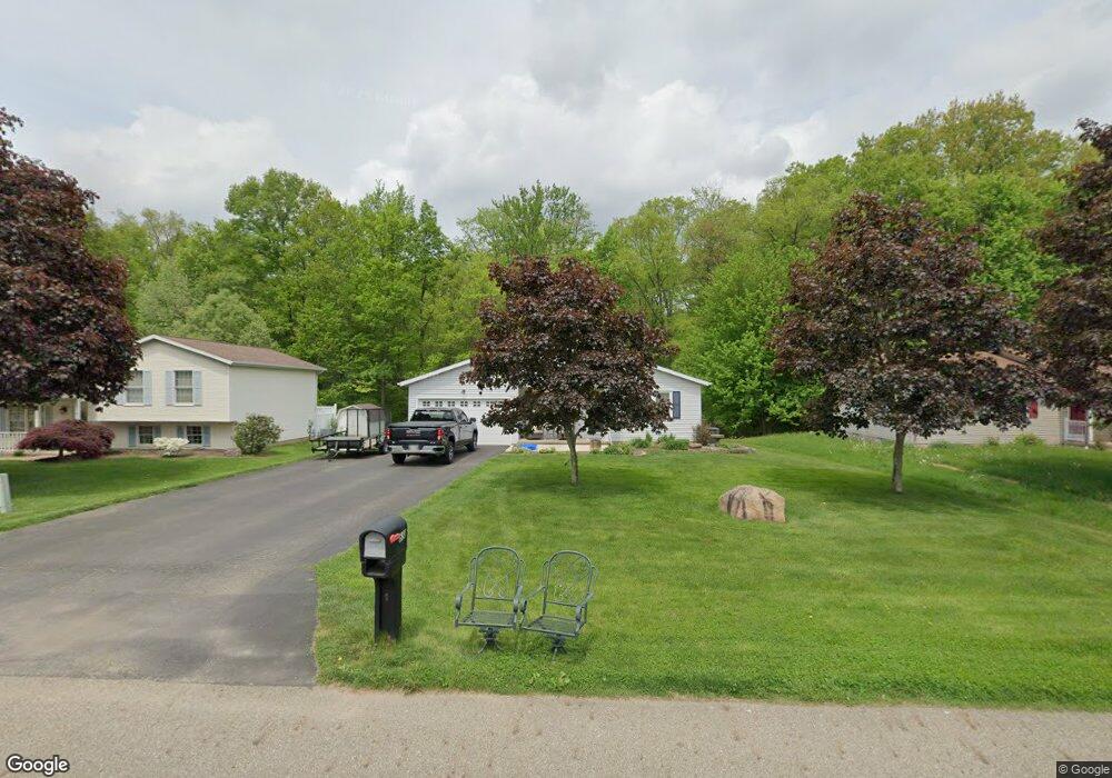
This home is located at 658 Brittany Ln, Salem, OH 44460 and is currently estimated at $179,058, approximately $172 per square foot. 658 Brittany Ln is a home located in Columbiana County with nearby schools including Reilly Elementary School, Buckeye Elementary School, and Salem Junior High School.
Ownership History
Date
Name
Owned For
Owner Type
Purchase Details
Closed on
Aug 26, 2003
Sold by
Green Danny J and Green Alison L
Bought by
Green Danny J and Green Alison L
Current Estimated Value
Home Financials for this Owner
Home Financials are based on the most recent Mortgage that was taken out on this home.
Original Mortgage
$71,000
Outstanding Balance
$28,958
Interest Rate
4.5%
Mortgage Type
Purchase Money Mortgage
Estimated Equity
$150,100
Purchase Details
Closed on
Jul 3, 2001
Sold by
Smith Smith Timothy C Timothy C and Smith Judith A
Bought by
Green Danny J and Phillips Frances A
Home Financials for this Owner
Home Financials are based on the most recent Mortgage that was taken out on this home.
Original Mortgage
$69,615
Interest Rate
7.2%
Purchase Details
Closed on
Sep 8, 1993
Bought by
Smith Timothy C and Smith Or
Create a Home Valuation Report for This Property
The Home Valuation Report is an in-depth analysis detailing your home's value as well as a comparison with similar homes in the area
Home Values in the Area
Average Home Value in this Area
Purchase History
| Date | Buyer | Sale Price | Title Company |
|---|---|---|---|
| Green Danny J | -- | Union Title Company | |
| Green Danny J | $81,900 | Heritage Title Agency | |
| Smith Timothy C | $11,500 | -- |
Source: Public Records
Mortgage History
| Date | Status | Borrower | Loan Amount |
|---|---|---|---|
| Open | Green Danny J | $71,000 | |
| Closed | Green Danny J | $69,615 |
Source: Public Records
Tax History Compared to Growth
Tax History
| Year | Tax Paid | Tax Assessment Tax Assessment Total Assessment is a certain percentage of the fair market value that is determined by local assessors to be the total taxable value of land and additions on the property. | Land | Improvement |
|---|---|---|---|---|
| 2024 | $1,620 | $38,890 | $7,420 | $31,470 |
| 2023 | $1,624 | $38,890 | $7,420 | $31,470 |
| 2022 | $1,510 | $38,890 | $7,420 | $31,470 |
| 2021 | $1,434 | $34,300 | $7,420 | $26,880 |
| 2020 | $1,445 | $34,300 | $7,420 | $26,880 |
| 2019 | $1,444 | $34,300 | $7,420 | $26,880 |
| 2018 | $1,380 | $31,190 | $6,760 | $24,430 |
| 2017 | $1,379 | $31,190 | $6,760 | $24,430 |
| 2016 | $1,339 | $29,790 | $6,270 | $23,520 |
| 2015 | $1,339 | $29,790 | $6,270 | $23,520 |
| 2014 | $1,300 | $29,790 | $6,270 | $23,520 |
Source: Public Records
Map
Nearby Homes
- 935 W Pidgeon Rd
- 944 Jones Dr
- 523 Bethel Dr
- 1750 Allen Dr
- 937 Liberty St
- 312 W Pidgeon Rd
- 156 W Pidgeon Rd
- 1180 Jones Dr
- 1358 Andrew Ave
- 501 Stewart Rd
- 1175 S Lincoln Ave
- 0 Homewood Place
- 909 Somerset Dr Unit A
- 13147 Ohio 14
- 1026 Franklin Ave
- 1357 Pembrooke Dr Unit D
- 676 E 3rd St Unit 684
- 478 N Ellsworth Ave
- 492 N Ellsworth Ave
- 442 Washington St
- 680 Brittany Ln
- 636 Brittany Ln
- 1706 Hearthside Dr
- 620 Brittany Ln
- 1707 Devonshire Dr
- 1703 Hearthside Dr
- 1710 Hearthside Dr
- 1701 Hearthside Dr
- 1711 Devonshire Dr
- 570 Brittany Ln
- 1708 Devonshire Dr
- 1714 Hearthside Dr
- 1713 Devonshire Dr
- 550 Brittany Ln
- 1709 Hearthside Dr
- 1717 Devonshire Dr
- 1712 Devonshire Dr
- 1720 Hearthside Dr
- 1713 Hearthside Dr
- 536 Brittany Ln