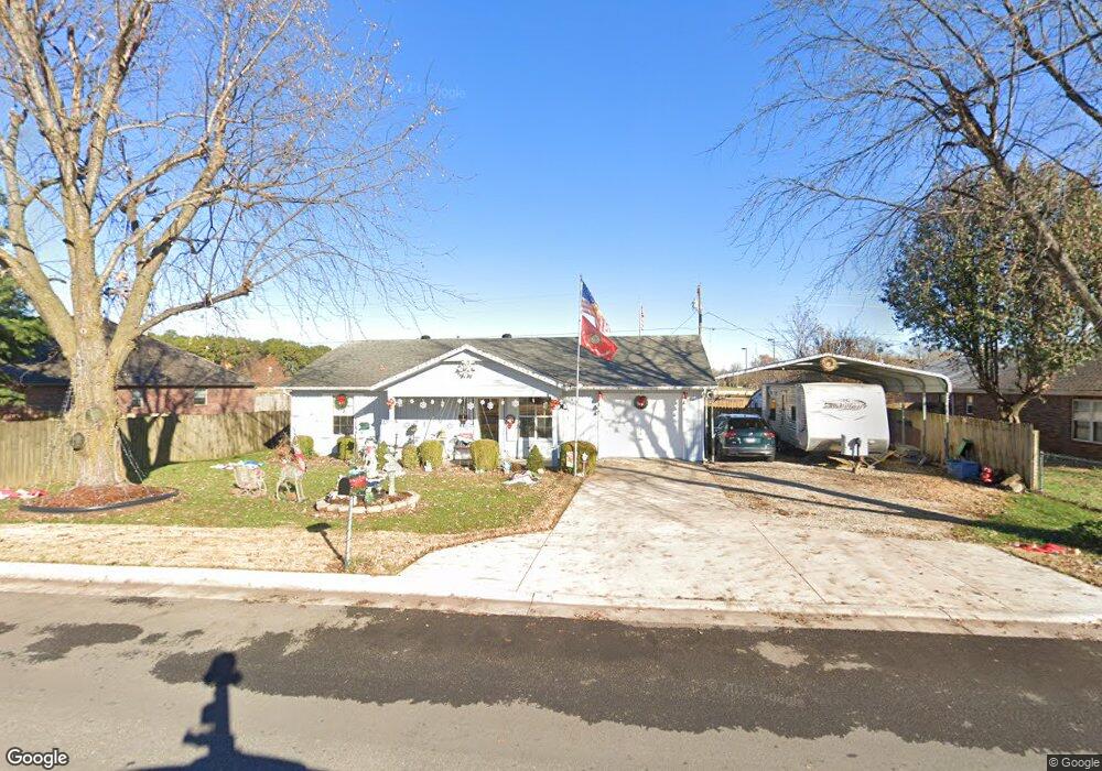
658 Hazelton Rd Pea Ridge, AR 72751
Estimated Value: $203,000 - $271,000
--
Bed
2
Baths
1,154
Sq Ft
$199/Sq Ft
Est. Value
About This Home
This home is located at 658 Hazelton Rd, Pea Ridge, AR 72751 and is currently estimated at $229,505, approximately $198 per square foot. 658 Hazelton Rd is a home located in Benton County with nearby schools including Pea Ridge Primary School, Pea Ridge Intermediate School, and Pea Ridge Middle School.
Ownership History
Date
Name
Owned For
Owner Type
Purchase Details
Closed on
Jul 18, 2000
Bought by
Dod 07 and Dod 18
Current Estimated Value
Purchase Details
Closed on
Jul 3, 2000
Bought by
Maloney
Purchase Details
Closed on
May 26, 2000
Bought by
Maloney
Purchase Details
Closed on
Aug 14, 1995
Bought by
Littlefield
Purchase Details
Closed on
Nov 2, 1993
Bought by
Ault
Purchase Details
Closed on
Dec 29, 1992
Bought by
Cline
Purchase Details
Closed on
May 22, 1991
Bought by
Tyler
Purchase Details
Closed on
May 8, 1987
Bought by
Pittman
Purchase Details
Closed on
Jun 15, 1979
Bought by
Gilmor
Create a Home Valuation Report for This Property
The Home Valuation Report is an in-depth analysis detailing your home's value as well as a comparison with similar homes in the area
Home Values in the Area
Average Home Value in this Area
Purchase History
| Date | Buyer | Sale Price | Title Company |
|---|---|---|---|
| Dod 07 | -- | -- | |
| Maloney | $1,000 | -- | |
| Maloney | $65,000 | -- | |
| Littlefield | $62,000 | -- | |
| Ault | $51,000 | -- | |
| Cline | $49,000 | -- | |
| Tyler | $11,000 | -- | |
| Pittman | $3,000 | -- | |
| Gilmor | $8,000 | -- |
Source: Public Records
Tax History Compared to Growth
Tax History
| Year | Tax Paid | Tax Assessment Tax Assessment Total Assessment is a certain percentage of the fair market value that is determined by local assessors to be the total taxable value of land and additions on the property. | Land | Improvement |
|---|---|---|---|---|
| 2025 | $1,095 | $36,729 | $10,000 | $26,729 |
| 2024 | $1,072 | $36,729 | $10,000 | $26,729 |
| 2023 | $1,021 | $24,670 | $3,800 | $20,870 |
| 2022 | $644 | $24,670 | $3,800 | $20,870 |
| 2021 | $589 | $24,670 | $3,800 | $20,870 |
| 2020 | $573 | $15,600 | $2,800 | $12,800 |
| 2019 | $573 | $15,600 | $2,800 | $12,800 |
| 2018 | $598 | $15,600 | $2,800 | $12,800 |
| 2017 | $491 | $15,600 | $2,800 | $12,800 |
| 2016 | $491 | $15,600 | $2,800 | $12,800 |
| 2015 | $793 | $13,930 | $3,000 | $10,930 |
| 2014 | $443 | $13,930 | $3,000 | $10,930 |
Source: Public Records
Map
Nearby Homes
- 1285 Weston St
- 435 Mcculloch St
- 296 Van Dorn St
- 2000 Decker Rd
- 1809 Abbott Ln
- 2310 Carper Ln
- 117 Van Dorn St
- 208 Wilson Blvd
- 200 Wilson Blvd
- 108 Dobson St
- 446 W Pickens Rd
- 1703 Cuppett Cir
- 1701 Cuppett Cir
- 1717 Cuppett Cir
- 1715 Cuppett Cir
- 264 Mcintosh St
- 1307 Joyce St
- 1305 Joyce St
- 340 Baker St
- 1808 Abbott Ln
- 696 Hazelton Rd
- 10 Acres Hazelton Rd
- 704 Hazelton Rd
- 703 Hazelton Rd
- 0.27AC Weston St
- 855 Weston St
- 976 Weston St
- 760 Hazelton Rd
- 815 Weston St
- 816 Weston St
- 1008 Weston St
- 788 Hazelton Rd
- 10.02AC Hazelton Rd
- 580 Weston Loop Unit A & B
- 550 Weston Loop Unit A & B
- 1040 Weston St
- 3.21 Acres Patterson Rd
- 0 Off Hoffman St Unit 1199596
- 0 Off Hoffman St Unit 1218649