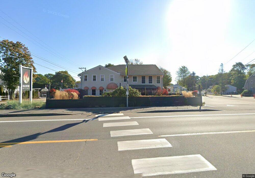
658 Main St Ogunquit, ME 03907
Ogunquit Neighborhood
Studio
--
Bath
5,220
Sq Ft
0.37
Acres
About This Home
This home is located at 658 Main St, Ogunquit, ME 03907. 658 Main St is a home located in York County with nearby schools including Wells Junior High School, Wells Elementary School, and Wells High School.
Ownership History
Date
Name
Owned For
Owner Type
Purchase Details
Closed on
Oct 30, 2017
Sold by
Doherty Development Llc
Bought by
Laflin Properties Llc
Home Financials for this Owner
Home Financials are based on the most recent Mortgage that was taken out on this home.
Original Mortgage
$640,000
Outstanding Balance
$535,294
Interest Rate
3.78%
Mortgage Type
Purchase Money Mortgage
Purchase Details
Closed on
Mar 16, 2006
Sold by
Mather Lisa M and Mather Philip C
Bought by
Doherty Dev Llc
Home Financials for this Owner
Home Financials are based on the most recent Mortgage that was taken out on this home.
Original Mortgage
$437,500
Interest Rate
6.27%
Mortgage Type
Commercial
Create a Home Valuation Report for This Property
The Home Valuation Report is an in-depth analysis detailing your home's value as well as a comparison with similar homes in the area
Home Values in the Area
Average Home Value in this Area
Purchase History
| Date | Buyer | Sale Price | Title Company |
|---|---|---|---|
| Laflin Properties Llc | -- | -- | |
| Doherty Dev Llc | -- | -- |
Source: Public Records
Mortgage History
| Date | Status | Borrower | Loan Amount |
|---|---|---|---|
| Open | Laflin Properties Llc | $640,000 | |
| Closed | Doherty Dev Llc | $437,500 |
Source: Public Records
Tax History Compared to Growth
Tax History
| Year | Tax Paid | Tax Assessment Tax Assessment Total Assessment is a certain percentage of the fair market value that is determined by local assessors to be the total taxable value of land and additions on the property. | Land | Improvement |
|---|---|---|---|---|
| 2024 | $7,586 | $1,174,300 | $621,800 | $552,500 |
| 2023 | $7,586 | $1,174,300 | $621,800 | $552,500 |
| 2022 | $7,422 | $1,174,300 | $621,800 | $552,500 |
| 2021 | $7,535 | $925,700 | $444,400 | $481,300 |
| 2020 | $7,406 | $925,700 | $444,400 | $481,300 |
| 2019 | $7,406 | $925,700 | $444,400 | $481,300 |
| 2018 | $7,322 | $925,700 | $444,400 | $481,300 |
| 2017 | $7,017 | $925,700 | $444,400 | $481,300 |
| 2016 | $7,216 | $892,000 | $444,400 | $447,600 |
| 2015 | $7,198 | $892,000 | $444,400 | $447,600 |
| 2014 | $6,922 | $892,000 | $444,400 | $447,600 |
Source: Public Records
Map
Nearby Homes
- 64 Old Kings Hwy
- 31 Rebecca Rd
- 32 Queens Way
- 191 Tatnic Rd Unit 73
- 14 Valleybrook Rd Unit 14
- 168 Ocean Ave
- 25 Shore Rd Unit A
- 1 Old County Rd Unit 165
- 1 Old County Rd Unit 132
- 12 Scotch Hill Trail Unit 2
- 59 Meadow Ln
- 314 Ocean Ave
- 248 Berwick Rd
- 47 Village Green Dr
- 89 Main St
- 14 Maple St
- 200 Shore Rd
- 412 Post Rd Unit 304
- 33 Rocky Ln
- 106 S Tibbetts Ave
- 14 Ocean St
- 2 Ocean St Unit 2
- 3 Ocean St
- 42 Ocean St Unit 36
- 42 Ocean St Unit 35
- 42 Ocean St Unit 2
- 42 Ocean St Unit 1
- 17 Ocean St Unit 56
- 17 Ocean St Unit 55
- 17 Ocean St Unit 54
- 17 Ocean St Unit 53
- 18 Ocean St Unit 52
- 18 Ocean St Unit 51
- 18 Ocean St Unit 50
- 18 Ocean St Unit 49
- 18 Ocean St Unit 48
- 18 Ocean St
- 19 Ocean St Unit 6
- 19 Ocean St Unit 5
- 19 Ocean St Unit 4
