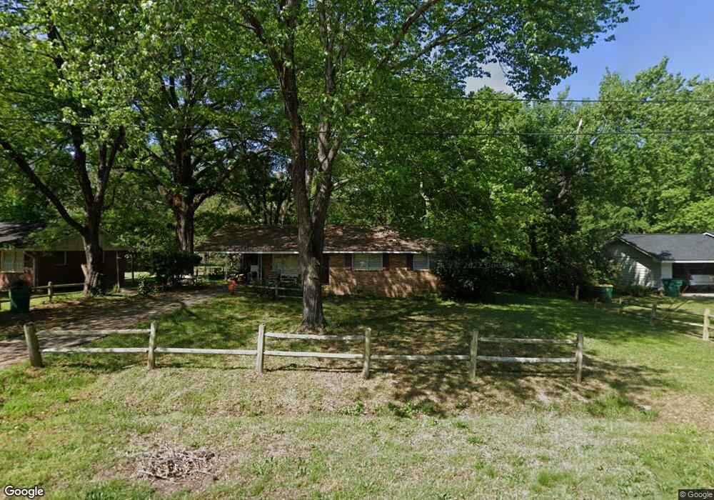
658 Meadowbrook Dr Winder, GA 30680
Estimated Value: $288,967 - $313,000
3
Beds
2
Baths
1,591
Sq Ft
$190/Sq Ft
Est. Value
About This Home
This home is located at 658 Meadowbrook Dr, Winder, GA 30680 and is currently estimated at $302,742, approximately $190 per square foot. 658 Meadowbrook Dr is a home located in Barrow County with nearby schools including County Line Elementary School, Russell Middle School, and Winder-Barrow High School.
Ownership History
Date
Name
Owned For
Owner Type
Purchase Details
Closed on
Jul 13, 2005
Sold by
Ferm & Son Ents
Bought by
Carlisle Robert and Burton Sharonda
Current Estimated Value
Home Financials for this Owner
Home Financials are based on the most recent Mortgage that was taken out on this home.
Original Mortgage
$146,800
Outstanding Balance
$74,078
Interest Rate
5.54%
Mortgage Type
VA
Estimated Equity
$228,664
Purchase Details
Closed on
Mar 19, 2003
Sold by
Kirkpatrick Bobby G and Kirkpatrick Wanda
Bought by
Mcdonald Tiffany M
Home Financials for this Owner
Home Financials are based on the most recent Mortgage that was taken out on this home.
Original Mortgage
$105,500
Interest Rate
5.82%
Purchase Details
Closed on
Jun 29, 1990
Bought by
Wilson Wayne O
Create a Home Valuation Report for This Property
The Home Valuation Report is an in-depth analysis detailing your home's value as well as a comparison with similar homes in the area
Home Values in the Area
Average Home Value in this Area
Purchase History
| Date | Buyer | Sale Price | Title Company |
|---|---|---|---|
| Carlisle Robert | $148,000 | -- | |
| Mcdonald Tiffany M | $110,000 | -- | |
| Wilson Wayne O | $67,300 | -- |
Source: Public Records
Mortgage History
| Date | Status | Borrower | Loan Amount |
|---|---|---|---|
| Open | Carlisle Robert | $146,800 | |
| Previous Owner | Mcdonald Tiffany M | $105,500 |
Source: Public Records
Tax History Compared to Growth
Tax History
| Year | Tax Paid | Tax Assessment Tax Assessment Total Assessment is a certain percentage of the fair market value that is determined by local assessors to be the total taxable value of land and additions on the property. | Land | Improvement |
|---|---|---|---|---|
| 2025 | $1,160 | $90,982 | $20,000 | $70,982 |
| 2024 | $1,142 | $88,919 | $20,000 | $68,919 |
| 2023 | $812 | $88,919 | $20,000 | $68,919 |
| 2022 | $916 | $65,526 | $18,000 | $47,526 |
| 2021 | $652 | $52,477 | $14,400 | $38,077 |
| 2020 | $623 | $49,327 | $14,400 | $34,927 |
| 2019 | $554 | $43,378 | $11,600 | $31,778 |
| 2018 | $143 | $43,378 | $11,600 | $31,778 |
| 2017 | $1,227 | $41,130 | $11,600 | $29,530 |
| 2016 | $50 | $41,130 | $11,600 | $29,530 |
| 2015 | $50 | $41,130 | $11,600 | $29,530 |
| 2014 | $50 | $36,390 | $6,860 | $29,530 |
| 2013 | -- | $34,342 | $6,860 | $27,482 |
Source: Public Records
Map
Nearby Homes
- 381 W Candler St
- 273 Partridge Trail
- 436 Northcrest Dr
- 171 Brookview Terrace
- 421 N 5th Ave
- 0 E Northcrest Dr Unit 10648147
- 326 Miles Patrick Rd
- 281 Springdale Dr
- 469 Plantation Dr
- Cary C Plan at Lake Shore
- Marion A Plan at Lake Shore
- Cary A Plan at Lake Shore
- 713 Mallard Dr
- 128 Mcneal Rd
- 217 Bellview St
- 303 Rocky Point Ct
- 845 Idlewood Rd
- 27 Creekside Dr
- 292 Natchez Cir
- 284 E 5th Ave
- 656 Meadowbrook Dr
- 662 Meadowbrook Dr
- 664 Meadowbrook Dr
- 654 Meadowbrook Dr
- 515 Greenvalley Dr
- 519 Greenvalley Dr
- 657 Meadowbrook Dr
- 157 Sims St
- 668 Meadowbrook Dr
- 523 Greenvalley Dr
- 169 Langford St
- 156 Sims St Unit Lot 3E
- 155 Sims St
- 180 Settle St
- 527 Greenvalley Dr
- 167 Langford St
- 512 Greenvalley Dr
- 670 Meadowbrook Dr
- 518 Greenvalley Dr
- 178 Settle St