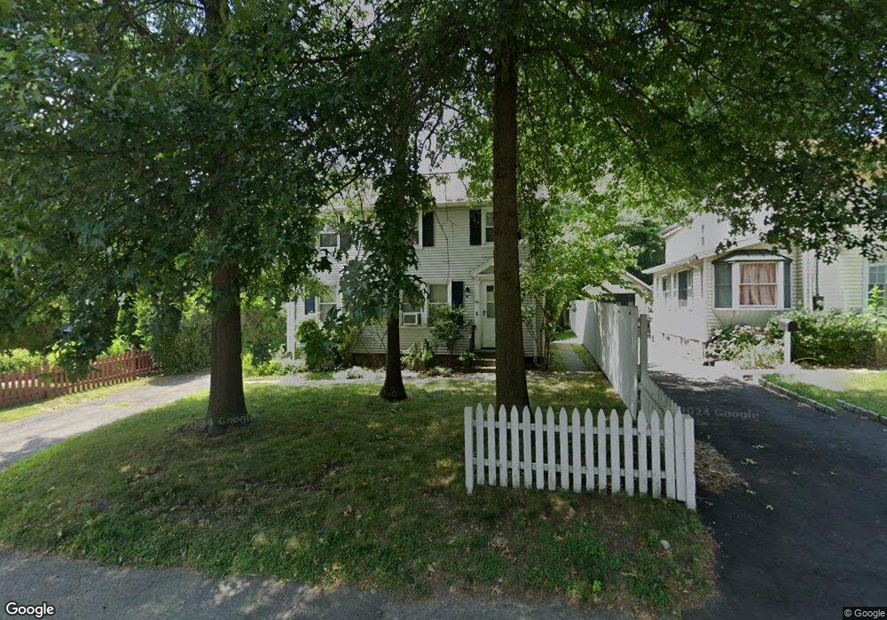
658 Newfield Ave Unit 1ST F Stamford, CT 06905
Mid Ridge NeighborhoodEstimated Value: $642,246 - $883,000
2
Beds
1
Bath
650
Sq Ft
$1,221/Sq Ft
Est. Value
About This Home
This home is located at 658 Newfield Ave Unit 1ST F, Stamford, CT 06905 and is currently estimated at $793,562, approximately $1,220 per square foot. 658 Newfield Ave Unit 1ST F is a home located in Fairfield County with nearby schools including Julia A. Stark Elementary School, Dolan School, and Stamford High School.
Ownership History
Date
Name
Owned For
Owner Type
Purchase Details
Closed on
Jun 26, 2019
Sold by
667 Cove Road Inc
Bought by
Phikev Llc
Current Estimated Value
Purchase Details
Closed on
Jun 30, 1995
Sold by
Bongiorno Bros
Bought by
667 Cove Rd Inc
Purchase Details
Closed on
Apr 6, 1994
Sold by
Gabrielle Francesco and Gabrielle Assunta
Bought by
Bongiorno Bros
Purchase Details
Closed on
Mar 30, 1988
Sold by
Guarneri Mary
Bought by
Gabrielo Francesco
Home Financials for this Owner
Home Financials are based on the most recent Mortgage that was taken out on this home.
Original Mortgage
$115,000
Interest Rate
9.89%
Mortgage Type
Purchase Money Mortgage
Create a Home Valuation Report for This Property
The Home Valuation Report is an in-depth analysis detailing your home's value as well as a comparison with similar homes in the area
Home Values in the Area
Average Home Value in this Area
Purchase History
| Date | Buyer | Sale Price | Title Company |
|---|---|---|---|
| Phikev Llc | $400,000 | -- | |
| Phikev Llc | $400,000 | -- | |
| 667 Cove Rd Inc | $170,000 | -- | |
| 667 Cove Rd Inc | $170,000 | -- | |
| Bongiorno Bros | $105,000 | -- | |
| Bongiorno Bros | $105,000 | -- | |
| Gabrielo Francesco | $202,000 | -- |
Source: Public Records
Mortgage History
| Date | Status | Borrower | Loan Amount |
|---|---|---|---|
| Previous Owner | Gabrielo Francesco | $115,000 |
Source: Public Records
Tax History Compared to Growth
Tax History
| Year | Tax Paid | Tax Assessment Tax Assessment Total Assessment is a certain percentage of the fair market value that is determined by local assessors to be the total taxable value of land and additions on the property. | Land | Improvement |
|---|---|---|---|---|
| 2025 | $7,934 | $335,320 | $188,400 | $146,920 |
| 2024 | $7,759 | $335,320 | $188,400 | $146,920 |
| 2023 | $8,336 | $335,320 | $188,400 | $146,920 |
| 2022 | $6,690 | $250,200 | $136,520 | $113,680 |
| 2021 | $6,618 | $250,200 | $136,520 | $113,680 |
| 2020 | $6,448 | $250,200 | $136,520 | $113,680 |
| 2019 | $6,448 | $250,200 | $136,520 | $113,680 |
| 2018 | $6,210 | $250,200 | $136,520 | $113,680 |
| 2017 | $5,489 | $204,140 | $114,700 | $89,440 |
| 2016 | $5,159 | $204,140 | $114,700 | $89,440 |
| 2015 | $5,024 | $204,140 | $114,700 | $89,440 |
| 2014 | $4,856 | $204,140 | $114,700 | $89,440 |
Source: Public Records
Map
Nearby Homes
- 24 Haig Ave
- 22 Hastings Ln
- 543 Newfield Ave
- 100 Hirsch Rd
- 172 Joffre Ave
- 30 Lindsey Ave
- 31 Sussex Place
- 27 Crane Rd N
- 182 Turner Rd
- 143 Overbrook Dr
- 78 Elizabeth Ave
- 31 Bellmere Ave
- 31 Gray Farms Rd
- 39 Camore St
- 51 Glendale Rd
- 31 Chatfield St
- 59 Holbrook Dr
- 88 Pine Hill Ave
- 433 High Ridge Rd
- 825 Hope St Unit 4