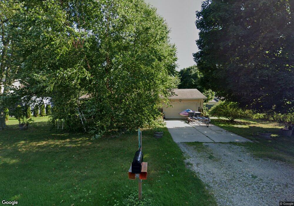
658 Royal Crest Dr Saint Joseph, MI 49085
Vineland NeighborhoodEstimated Value: $232,000 - $283,000
3
Beds
1
Bath
1,030
Sq Ft
$246/Sq Ft
Est. Value
About This Home
This home is located at 658 Royal Crest Dr, Saint Joseph, MI 49085 and is currently estimated at $253,604, approximately $246 per square foot. 658 Royal Crest Dr is a home located in Berrien County with nearby schools including Upton Middle School, St. Joseph High School, and Brookview Montessori School.
Ownership History
Date
Name
Owned For
Owner Type
Purchase Details
Closed on
Feb 7, 2023
Sold by
Hall Family Trust
Bought by
Hall John M
Current Estimated Value
Purchase Details
Closed on
Nov 23, 2022
Sold by
Hall B Gail
Bought by
Hall Family Trust
Purchase Details
Closed on
Oct 22, 2021
Sold by
Hall John M and Hall Family Trust
Bought by
Hall John M
Purchase Details
Closed on
Jan 9, 2020
Sold by
Hall John M and Hall Gail B
Bought by
Hall B Gail
Purchase Details
Closed on
Jan 3, 2020
Sold by
Hall John M and Hall Gail
Bought by
Hall B Gail
Purchase Details
Closed on
Jul 27, 2011
Sold by
Hall John M and Hall Gail B
Bought by
Hall John M and Hall Gail B
Purchase Details
Closed on
Dec 1, 1975
Create a Home Valuation Report for This Property
The Home Valuation Report is an in-depth analysis detailing your home's value as well as a comparison with similar homes in the area
Home Values in the Area
Average Home Value in this Area
Purchase History
| Date | Buyer | Sale Price | Title Company |
|---|---|---|---|
| Hall John M | -- | -- | |
| Hall Family Trust | -- | -- | |
| Hall John M | -- | None Available | |
| Hall B Gail | -- | None Listed On Document | |
| Hall B Gail | -- | None Available | |
| Hall Family Trust | -- | None Listed On Document | |
| Hall John M | -- | None Available | |
| -- | $29,500 | -- |
Source: Public Records
Tax History Compared to Growth
Tax History
| Year | Tax Paid | Tax Assessment Tax Assessment Total Assessment is a certain percentage of the fair market value that is determined by local assessors to be the total taxable value of land and additions on the property. | Land | Improvement |
|---|---|---|---|---|
| 2025 | $2,475 | $97,100 | $0 | $0 |
| 2024 | $2,803 | $94,700 | $0 | $0 |
| 2023 | $2,670 | $76,600 | $0 | $0 |
| 2022 | $1,341 | $72,900 | $0 | $0 |
| 2021 | $2,220 | $74,100 | $22,900 | $51,200 |
| 2020 | $1,925 | $70,100 | $0 | $0 |
| 2019 | $1,841 | $65,300 | $18,400 | $46,900 |
| 2018 | $1,757 | $65,300 | $0 | $0 |
| 2017 | $1,731 | $64,100 | $0 | $0 |
| 2016 | $1,691 | $62,500 | $0 | $0 |
| 2015 | $1,663 | $59,500 | $0 | $0 |
| 2014 | $1,133 | $57,600 | $0 | $0 |
Source: Public Records
Map
Nearby Homes
- 792 Lonesome Pine Trail
- 530 Manitou Rd
- 670 Marvin Ave
- 631 Marvin Ave
- 3215 Meade Ct
- 317 Maiden Ln
- 940 Vineland Rd
- 753 Lattimer Dr
- 2960 Niles Rd
- 649 Grant Ave
- 398121 Anchors Way
- 484 W Glenlord Rd
- 1153 W Glenlord Rd Unit 22
- 3423 Niles Rd
- 4010 Deja Dr
- 2841 Niles Rd
- 00 Niles Rd
- 3553 Martin Path
- 3620 Katherine Ln Unit 1
- 3545 Wyndwicke Dr
- 672 Royal Crest Dr
- 641 Lonesome Pine Trail
- 625 Lonesome Pine Trail
- 655 Lonesome Pine Trail
- 657 Royal Crest Dr
- 690 Royal Crest Dr
- 628 Royal Crest Dr
- 643 Royal Crest Dr
- 607 Lonesome Pine Trail
- 627 Royal Crest Dr
- 689 Royal Crest Dr
- 702 Royal Crest Dr
- 640 Lonesome Pine Trail
- 687 Lonesome Pine Trail
- 608 Royal Crest Dr
- 626 Lonesome Pine Trail
- 591 Lonesome Pine Trail
- 656 Lonesome Pine Trail
- 609 Royal Crest Dr
- 705 Royal Crest Dr