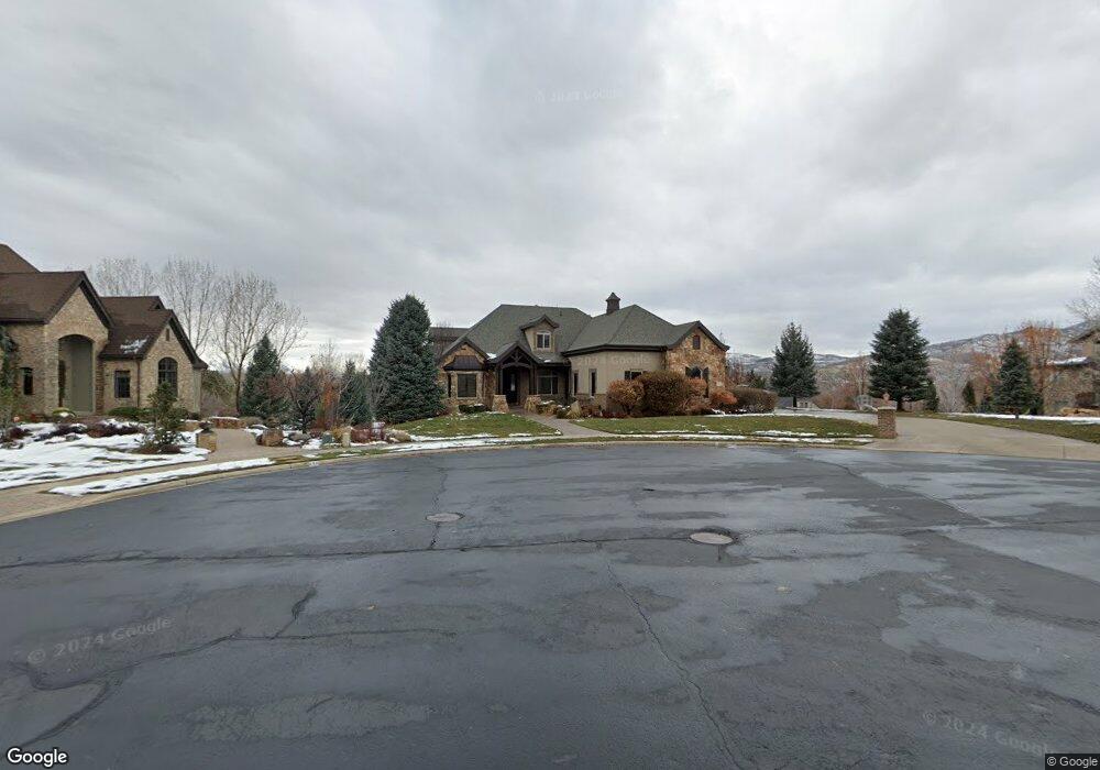
658 S Pheasant Ridge Cir Unit 10 Alpine, UT 84004
Estimated Value: $1,971,000 - $2,257,000
5
Beds
6
Baths
4,189
Sq Ft
$513/Sq Ft
Est. Value
About This Home
This home is located at 658 S Pheasant Ridge Cir Unit 10, Alpine, UT 84004 and is currently estimated at $2,148,478, approximately $512 per square foot. 658 S Pheasant Ridge Cir Unit 10 is a home located in Utah County with nearby schools including Westfield School, Timberline Middle School, and Lone Peak High School.
Ownership History
Date
Name
Owned For
Owner Type
Purchase Details
Closed on
May 15, 2025
Sold by
Valencia Jessie M and Hazard Gregory W
Bought by
Mazal Jorge and Crockett Ashley
Current Estimated Value
Purchase Details
Closed on
Jan 29, 2010
Sold by
Westbrook Rick D and Westbrook Holly
Bought by
Hazard Gregory W and Hazard Jessie M
Purchase Details
Closed on
Feb 8, 2008
Sold by
Westbrook Rick D and Westbrook Holly
Bought by
Westbrook Rick D and Westbrook Holly
Purchase Details
Closed on
May 10, 2004
Sold by
Sundance Homes Llc
Bought by
Westbrook Rick D and Westbrook Holly
Create a Home Valuation Report for This Property
The Home Valuation Report is an in-depth analysis detailing your home's value as well as a comparison with similar homes in the area
Home Values in the Area
Average Home Value in this Area
Purchase History
| Date | Buyer | Sale Price | Title Company |
|---|---|---|---|
| Mazal Jorge | -- | Cottonwood Title | |
| Hazard Gregory W | -- | Select Title Insurance Agen | |
| Westbrook Rick D | -- | None Available | |
| Westbrook Rick D | -- | Signature Title Insurance Ag | |
| Sundance Homes Llc | -- | Signature Title Insurance Ag |
Source: Public Records
Tax History Compared to Growth
Tax History
| Year | Tax Paid | Tax Assessment Tax Assessment Total Assessment is a certain percentage of the fair market value that is determined by local assessors to be the total taxable value of land and additions on the property. | Land | Improvement |
|---|---|---|---|---|
| 2025 | $8,941 | $1,058,805 | $757,500 | $1,167,600 |
| 2024 | $8,941 | $1,042,030 | $0 | $0 |
| 2023 | $8,626 | $1,079,375 | $0 | $0 |
| 2022 | $8,747 | $1,062,930 | $0 | $0 |
| 2021 | $7,056 | $1,331,900 | $429,600 | $902,300 |
| 2020 | $6,998 | $1,292,800 | $390,500 | $902,300 |
| 2019 | $6,692 | $1,290,600 | $390,500 | $900,100 |
| 2018 | $6,484 | $1,235,500 | $390,500 | $845,000 |
| 2017 | $5,892 | $597,410 | $0 | $0 |
| 2016 | $5,658 | $534,930 | $0 | $0 |
| 2015 | $5,467 | $488,950 | $0 | $0 |
| 2014 | $4,893 | $432,850 | $0 | $0 |
Source: Public Records
Map
Nearby Homes
- 629 S Pheasant Ridge Cir
- 682 Healey Blvd
- 909 Ridge Ln
- 88 W Cascade Ave
- 201 E Red Pine Dr Unit 17
- 546 River Meadow Dr
- 250 S Main St Unit 7
- 250 S Main St Unit 20
- 250 S Main St Unit 25
- 177 W Canyon Crest Rd
- 259 Twin River Loop
- 30 S Main St
- 48 N 100 E
- 4224 W Park Dr
- 1063 E Alpine Dr
- 1263 E Chapman Ct
- 1292 E 810 S
- 19 N Lone Peak Dr
- 5984 W 11200 N Unit 1
- 5377 W Evergreen Way
- 378 E Pheasant Ridge Dr
- 378 E Pheasant Ridge Dr Unit 7
- 690 S Pheasant Ridge Cir
- 690 S Pheasant Ridge Cir Unit 11
- 626 S Pheasant Ridge Cir
- 626 S Pheasant Ridge Cir Unit 6
- 626 S Pheasant Ridge
- 661 S Pheasant Ridge Ct
- 661 S Pheasant Ridge Ct Unit 9
- 661 S Pheasant Ridge Ct Unit 9
- 653 S Pheasant Ridge Cir
- 653 S Pheasant Ridge Cir Unit 15
- 376 Carlisle Ave
- 629 S Pheasant Ridge Ct
- 629 S Pheasant Ridge Ct Unit 8
- 681 S Pheasant Ridge Cir
- 629 S Pheasant Ridge Ct
- 629 S Pheasant Ridge Ct Unit 8
- 397 E Pheasant Ridge Dr
- 397 E Pheasant Ridge Dr Unit 5