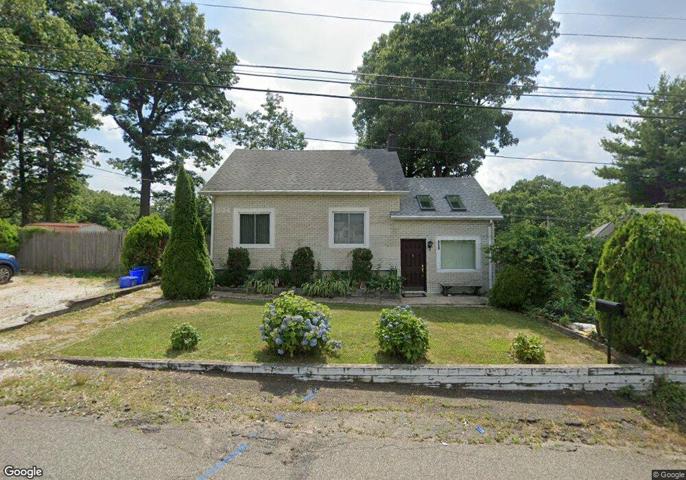
658 Woodland Ave South Amboy, NJ 08879
Estimated Value: $418,349 - $464,000
2
Beds
1
Bath
1,374
Sq Ft
$327/Sq Ft
Est. Value
About This Home
This home is located at 658 Woodland Ave, South Amboy, NJ 08879 and is currently estimated at $448,837, approximately $326 per square foot. 658 Woodland Ave is a home located in Middlesex County with nearby schools including Old Bridge High School, Matawan Montessori Academy, and St. Joseph Elementary School.
Ownership History
Date
Name
Owned For
Owner Type
Purchase Details
Closed on
Sep 10, 2013
Sold by
Brigando Marianne
Bought by
Baran Wayne J and Baran Veronica
Current Estimated Value
Home Financials for this Owner
Home Financials are based on the most recent Mortgage that was taken out on this home.
Original Mortgage
$118,950
Outstanding Balance
$88,835
Interest Rate
4.42%
Mortgage Type
New Conventional
Estimated Equity
$360,002
Create a Home Valuation Report for This Property
The Home Valuation Report is an in-depth analysis detailing your home's value as well as a comparison with similar homes in the area
Home Values in the Area
Average Home Value in this Area
Purchase History
| Date | Buyer | Sale Price | Title Company |
|---|---|---|---|
| Baran Wayne J | $183,000 | Prestige Title Agency Inc |
Source: Public Records
Mortgage History
| Date | Status | Borrower | Loan Amount |
|---|---|---|---|
| Open | Baran Wayne J | $118,950 |
Source: Public Records
Tax History Compared to Growth
Tax History
| Year | Tax Paid | Tax Assessment Tax Assessment Total Assessment is a certain percentage of the fair market value that is determined by local assessors to be the total taxable value of land and additions on the property. | Land | Improvement |
|---|---|---|---|---|
| 2025 | $5,947 | $103,800 | $42,000 | $61,800 |
| 2024 | $5,703 | $103,800 | $42,000 | $61,800 |
| 2023 | $5,703 | $103,800 | $42,000 | $61,800 |
| 2022 | $5,549 | $103,800 | $42,000 | $61,800 |
| 2021 | $5,446 | $103,800 | $42,000 | $61,800 |
| 2020 | $5,381 | $103,800 | $42,000 | $61,800 |
| 2019 | $5,295 | $103,800 | $42,000 | $61,800 |
| 2018 | $5,236 | $103,800 | $42,000 | $61,800 |
| 2017 | $5,073 | $103,800 | $42,000 | $61,800 |
| 2016 | $4,972 | $103,800 | $42,000 | $61,800 |
| 2015 | $4,885 | $103,800 | $42,000 | $61,800 |
| 2014 | $4,826 | $103,800 | $42,000 | $61,800 |
Source: Public Records
Map
Nearby Homes
- 310 Woodland Ave
- 737 Prospect Ave
- 438 Brookside Ave
- 243 Alpine Way
- 169 Norwood Ave
- 239 Alpine Way
- 429 Lea Ave
- 615 Greenwood Ave
- 940 Grove Ave
- 146 Orchard Ave
- 250 Brookside Ave
- 281 Prospect Ave
- 16 Harbor Bay Cir
- 21 Lantana Way
- 301 Shoreland Cir
- 809 Summerfield Ave
- 110 Summerfield Ave
- 235 Garfield Ave
- 238 Shoreland Cir
- 9 Picaron Place Unit 46
- 656 Woodland Ave
- 663 Woodland Ave
- 655 Woodland Ave
- 308 Norwood Ave
- 652 Woodland Ave
- 667 Woodland Ave
- 306 Norwood Ave
- 643 Cook Ave
- 643 Cook Ave Unit 1
- 640 Cook Ave
- 142 Norwood Ave
- 637 Cook Ave
- 648 Woodland Ave
- 144 Norwood Ave
- 312 Woodland Ave
- 305 Norwood Ave
- 127 Laurence Pkwy
- 670 Woodland Ave
- 125 Laurence Pkwy
- 315 Woodland Ave