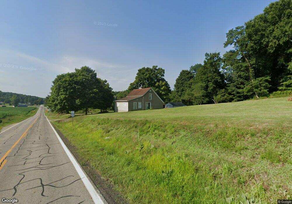
6583 State Route 204 NE Mount Perry, OH 43760
Estimated Value: $523,802 - $545,000
4
Beds
3
Baths
2,991
Sq Ft
$178/Sq Ft
Est. Value
About This Home
This home is located at 6583 State Route 204 NE, Mount Perry, OH 43760 and is currently estimated at $531,601, approximately $177 per square foot. 6583 State Route 204 NE is a home located in Perry County with nearby schools including Sheridan High School and Calvary Christian School.
Ownership History
Date
Name
Owned For
Owner Type
Purchase Details
Closed on
May 26, 2020
Sold by
Miller Martin Edward
Bought by
Miller Benjamin R
Current Estimated Value
Home Financials for this Owner
Home Financials are based on the most recent Mortgage that was taken out on this home.
Original Mortgage
$65,000
Interest Rate
3.2%
Mortgage Type
New Conventional
Purchase Details
Closed on
May 9, 2017
Sold by
Wiley Quintin E and Wiley Sarah L Blackwell
Bought by
Miller Benjamin R and Miller Martin Edward
Purchase Details
Closed on
Mar 25, 2016
Sold by
Lyons Richard L
Bought by
Wiley Quintin E and Blackwell Wiley Sarah L
Home Financials for this Owner
Home Financials are based on the most recent Mortgage that was taken out on this home.
Original Mortgage
$102,150
Interest Rate
3.65%
Mortgage Type
VA
Purchase Details
Closed on
Dec 1, 2014
Sold by
Miller Deborah S and Lyons Richard L
Bought by
Miller Deborah S and Lyons Richad L
Create a Home Valuation Report for This Property
The Home Valuation Report is an in-depth analysis detailing your home's value as well as a comparison with similar homes in the area
Home Values in the Area
Average Home Value in this Area
Purchase History
| Date | Buyer | Sale Price | Title Company |
|---|---|---|---|
| Miller Benjamin R | -- | None Available | |
| Miller Benjamin R | -- | Mid Ohio Title Agency Inc | |
| Wiley Quintin E | $100,000 | Van Horn Title | |
| Miller Deborah S | -- | None Available |
Source: Public Records
Mortgage History
| Date | Status | Borrower | Loan Amount |
|---|---|---|---|
| Previous Owner | Miller Benjamin R | $65,000 | |
| Previous Owner | Wiley Quintin E | $102,150 |
Source: Public Records
Tax History Compared to Growth
Tax History
| Year | Tax Paid | Tax Assessment Tax Assessment Total Assessment is a certain percentage of the fair market value that is determined by local assessors to be the total taxable value of land and additions on the property. | Land | Improvement |
|---|---|---|---|---|
| 2024 | $5,021 | $133,480 | $9,660 | $123,820 |
| 2023 | $5,023 | $133,480 | $9,660 | $123,820 |
| 2022 | $4,956 | $105,120 | $6,780 | $98,340 |
| 2021 | $4,261 | $105,120 | $6,780 | $98,340 |
| 2020 | $4,259 | $105,120 | $6,780 | $98,340 |
| 2019 | $4,633 | $11,610 | $11,610 | $0 |
| 2018 | $5,037 | $140,290 | $11,610 | $128,680 |
| 2017 | $4,671 | $140,290 | $11,610 | $128,680 |
| 2016 | $3,870 | $96,810 | $7,410 | $89,400 |
| 2015 | $2,283 | $114,330 | $13,520 | $100,810 |
| 2014 | $4,394 | $114,330 | $13,520 | $100,810 |
| 2013 | $4,457 | $114,330 | $13,520 | $100,810 |
| 2012 | -- | $114,330 | $13,520 | $100,810 |
Source: Public Records
Map
Nearby Homes
- 0 Us Highway 22
- 9945 Wesley Chapel 47 Rd
- 6335 Cimarron Rd
- 9758 Wesley Chapel Rd
- 10294 Township Road 57 NE
- 11284 State Route 668 N
- 8045 Old Town Rd
- 10705 Township Road 92
- 0 Us-22
- 0 Ohio 669
- 7170 Old Town Rd
- 5540 Hoover St
- 2128 County Road 51
- 2105 Gard Ln
- 7882 State Route 669 NE
- 2967 Opera Rd
- 4190 State Route 669 NE
- 16711 Bowser Rd
- 7705 Ohio 345
- 12330 Palmer Rd
- 6583 State Route 204 NE
- 6553 NE Strt#204
- 6553 State Route 204 NE
- 5922 Us Highway 22
- 5922 State Rt 22
- 5922 U S 22 Unit 22
- 14957 Township Highway 49 Unit 30
- 12890 Township Highway 49 Unit 429
- 14941 Township Highway 49 Unit 30
- 13095 Township Highway 49 Unit 429
- 13620 Township Highway 49 Unit 59
- 14240 Township Highway 49 Unit 61
- 13540 Township Highway 49 Unit 59
- 14273 Township Rd
- 5938 Township Road 95
- 10825 Township Road 49
- 10825 Township Highway 49
- 5834 Township Road 95
- 10842 Township Road 49
- 5884 State Rt 22