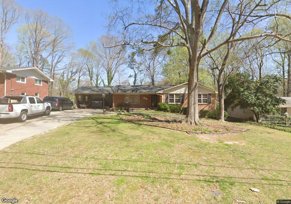
6584 Katie Ln Morrow, GA 30260
Estimated Value: $270,647 - $305,000
5
Beds
3
Baths
2,460
Sq Ft
$117/Sq Ft
Est. Value
About This Home
This home is located at 6584 Katie Ln, Morrow, GA 30260 and is currently estimated at $287,412, approximately $116 per square foot. 6584 Katie Ln is a home located in Clayton County with nearby schools including William M. Mcgarrah Elementary School, Rex Mill Middle School, and Mount Zion High School.
Ownership History
Date
Name
Owned For
Owner Type
Purchase Details
Closed on
Oct 12, 2018
Sold by
Pietras Daniel S
Bought by
Prince Negil
Current Estimated Value
Home Financials for this Owner
Home Financials are based on the most recent Mortgage that was taken out on this home.
Original Mortgage
$150,588
Outstanding Balance
$131,601
Interest Rate
4.6%
Mortgage Type
New Conventional
Estimated Equity
$155,811
Purchase Details
Closed on
Jul 30, 1997
Sold by
Owens Martin A and Owens Catherine S
Bought by
Pietras Daniel S and Pietras Susan J
Home Financials for this Owner
Home Financials are based on the most recent Mortgage that was taken out on this home.
Original Mortgage
$96,000
Interest Rate
7.59%
Mortgage Type
New Conventional
Create a Home Valuation Report for This Property
The Home Valuation Report is an in-depth analysis detailing your home's value as well as a comparison with similar homes in the area
Home Values in the Area
Average Home Value in this Area
Purchase History
| Date | Buyer | Sale Price | Title Company |
|---|---|---|---|
| Prince Negil | $148,499 | -- | |
| Pietras Daniel S | $99,000 | -- |
Source: Public Records
Mortgage History
| Date | Status | Borrower | Loan Amount |
|---|---|---|---|
| Open | Prince Negil | $150,588 | |
| Previous Owner | Pietras Daniel S | $96,000 |
Source: Public Records
Tax History Compared to Growth
Tax History
| Year | Tax Paid | Tax Assessment Tax Assessment Total Assessment is a certain percentage of the fair market value that is determined by local assessors to be the total taxable value of land and additions on the property. | Land | Improvement |
|---|---|---|---|---|
| 2024 | $59 | $117,640 | $8,000 | $109,640 |
| 2023 | $3,381 | $93,640 | $8,000 | $85,640 |
| 2022 | $35 | $93,880 | $8,000 | $85,880 |
| 2021 | $2,846 | $81,160 | $8,000 | $73,160 |
| 2020 | $2,300 | $66,638 | $8,000 | $58,638 |
| 2019 | $1,988 | $58,110 | $8,000 | $50,110 |
| 2018 | $1,820 | $43,961 | $8,000 | $35,961 |
| 2017 | $1,908 | $46,028 | $8,000 | $38,028 |
| 2016 | $1,931 | $46,607 | $8,000 | $38,607 |
| 2015 | $1,523 | $0 | $0 | $0 |
| 2014 | $1,349 | $43,029 | $8,000 | $35,029 |
Source: Public Records
Map
Nearby Homes
- 2933 Bretton Dr
- 6485 Bobolink Ct
- 2881 Panther Ct
- 6486 Aquila Dr
- 2845 Heritage Ln
- 2783 Mill Lake Way
- 6498 Carolyn Ct
- 6697 Cambridge Dr
- 6348 Towhee Way
- 6357 Towhee Way
- 6371 Towhee Way
- 6365 Towhee Way
- 6389 Warbler Ct
- 6383 Warbler Ct
- 6379 Warbler Ct
- 6387 Warbler Ct
- 6381 Warbler Ct
- 6377 Warbler Ct
- 6375 Warbler Ct
- 6574 Katie Ln
- 6566 Katie Ln
- 6583 Katie Ln
- 6573 Katie Ln
- 6593 Katie Ln
- 2946 Bretton Dr
- 6556 Katie Ln
- 6565 Katie Ln
- 2912 Bretton Dr
- 2956 Bretton Dr
- 2949 Bobolink Dr
- 2953 Bobolink Dr
- 6555 Katie Ln
- 0 Bretton Dr Unit 3215141
- 0 Bretton Dr Unit 7264084
- 0 Bretton Dr Unit 3140734
- 0 Bretton Dr Unit 3166467
- 0 Bretton Dr Unit 3175040
- 0 Bretton Dr Unit 7078680
- 0 Bretton Dr Unit 7490099