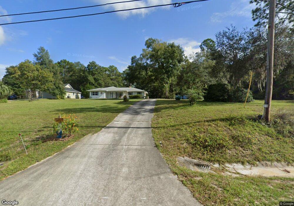
6585 Brooklyn Bay Rd Keystone Heights, FL 32656
Estimated Value: $280,000 - $359,000
2
Beds
2
Baths
1,462
Sq Ft
$223/Sq Ft
Est. Value
About This Home
This home is located at 6585 Brooklyn Bay Rd, Keystone Heights, FL 32656 and is currently estimated at $326,675, approximately $223 per square foot. 6585 Brooklyn Bay Rd is a home located in Clay County with nearby schools including Keystone Heights Elementary School and Keystone Heights Junior/Senior High School.
Ownership History
Date
Name
Owned For
Owner Type
Purchase Details
Closed on
Sep 27, 2001
Sold by
Turner Wilbur E and Turner Dorothy
Bought by
Henderson Larry B and Henderson Donna J
Current Estimated Value
Home Financials for this Owner
Home Financials are based on the most recent Mortgage that was taken out on this home.
Original Mortgage
$85,000
Interest Rate
6.89%
Purchase Details
Closed on
Sep 28, 2000
Sold by
Jonnafay Talbott Charles A
Bought by
Turner Wilbur E
Create a Home Valuation Report for This Property
The Home Valuation Report is an in-depth analysis detailing your home's value as well as a comparison with similar homes in the area
Home Values in the Area
Average Home Value in this Area
Purchase History
| Date | Buyer | Sale Price | Title Company |
|---|---|---|---|
| Henderson Larry B | $115,000 | North Central Title Inc | |
| Turner Wilbur E | $103,000 | North Central Title Inc |
Source: Public Records
Mortgage History
| Date | Status | Borrower | Loan Amount |
|---|---|---|---|
| Closed | Henderson Larry B | $85,000 |
Source: Public Records
Tax History Compared to Growth
Tax History
| Year | Tax Paid | Tax Assessment Tax Assessment Total Assessment is a certain percentage of the fair market value that is determined by local assessors to be the total taxable value of land and additions on the property. | Land | Improvement |
|---|---|---|---|---|
| 2024 | $1,804 | $141,000 | -- | -- |
| 2023 | $1,804 | $136,894 | $0 | $0 |
| 2022 | $1,475 | $122,567 | $0 | $0 |
| 2021 | $1,469 | $118,998 | $0 | $0 |
| 2020 | $1,424 | $117,356 | $0 | $0 |
| 2019 | $1,399 | $114,718 | $0 | $0 |
| 2018 | $1,276 | $112,579 | $0 | $0 |
| 2017 | $1,265 | $110,263 | $0 | $0 |
| 2016 | $1,259 | $107,995 | $0 | $0 |
| 2015 | $1,298 | $107,244 | $0 | $0 |
| 2014 | $1,265 | $106,393 | $0 | $0 |
Source: Public Records
Map
Nearby Homes
- 6330 Alliance Ave
- 6379 Antioch Ave
- 6361 Antioch Ave
- 6353 Antioch Ave
- 7142 Knox St
- 6343 Amherst Ave
- 6392 Amherst Ave
- 6470 Brooklyn Bay Rd
- 6335 Payne Rd
- 6706 Baja Ct
- 6358 Reed Dr
- 6294 Alliance Ave
- 7157 Wesleyan Rd
- 7086 Sewanee St
- 7058 Sewanee St
- 6312 Auburn Rd
- 6490 Woodland Dr
- 7202 Notre Dame St
- 6266 Little Lake Geneva Rd
- 6615 Camelot Ct
- 6581 Brooklyn Bay Rd
- 6577 Brooklyn Bay Rd
- 6582 Brooklyn Bay Rd
- 6596 Brooklyn Bay Rd
- 6578 Brooklyn Bay Rd
- 6586 Brooklyn Bay Rd
- 6574 Brooklyn Bay Rd
- 6602 Brooklyn Bay Rd
- 6375 Clance Rd
- 6559 Brooklyn Bay Rd
- 6606 Brooklyn Bay Rd
- 6570 Brooklyn Bay Rd
- 6610 Brooklyn Bay Rd
- 6566 Brooklyn Bay Rd
- 6562 Brooklyn Bay Rd
- 6614 Brooklyn Bay Rd
- 6558 Brooklyn Bay Rd
- 6359 Clance Rd
- 6554 Brooklyn Bay Rd
- 6624 Brooklyn Bay Rd