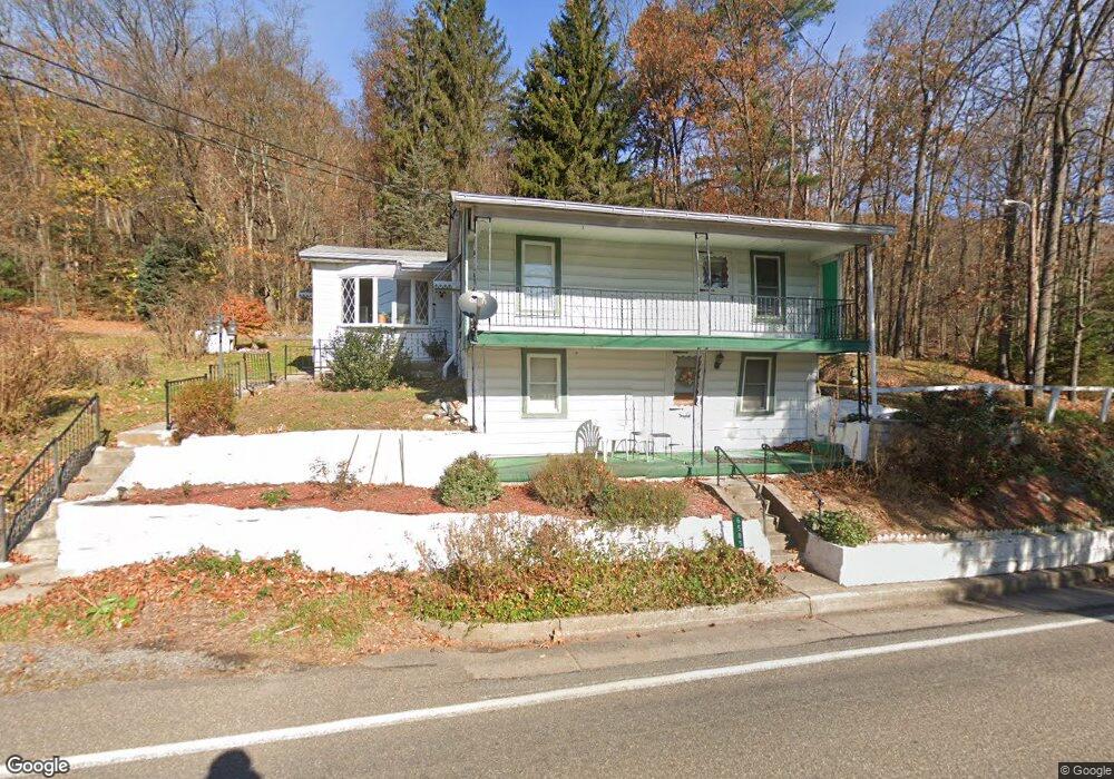
6585 Upper Rd Shamokin, PA 17872
Estimated Value: $130,000 - $182,000
2
Beds
1
Bath
844
Sq Ft
$192/Sq Ft
Est. Value
About This Home
This home is located at 6585 Upper Rd, Shamokin, PA 17872 and is currently estimated at $161,738, approximately $191 per square foot. 6585 Upper Rd is a home located in Northumberland County with nearby schools including Shamokin Area Elementary School, Shamokin Area Middle School, and Shamokin Area High School.
Ownership History
Date
Name
Owned For
Owner Type
Purchase Details
Closed on
Jul 29, 2022
Sold by
Koch Cheryl A and Koch Dale A
Bought by
Frain Dallas and Hurst Lawrence Gregory
Current Estimated Value
Home Financials for this Owner
Home Financials are based on the most recent Mortgage that was taken out on this home.
Original Mortgage
$147,184
Outstanding Balance
$140,925
Interest Rate
5.7%
Mortgage Type
FHA
Estimated Equity
$20,813
Purchase Details
Closed on
Apr 7, 2010
Sold by
Zeigenfuse Dorothy
Bought by
Koch Cheryl A
Create a Home Valuation Report for This Property
The Home Valuation Report is an in-depth analysis detailing your home's value as well as a comparison with similar homes in the area
Home Values in the Area
Average Home Value in this Area
Purchase History
| Date | Buyer | Sale Price | Title Company |
|---|---|---|---|
| Frain Dallas | $149,900 | None Listed On Document | |
| Koch Cheryl A | -- | None Available |
Source: Public Records
Mortgage History
| Date | Status | Borrower | Loan Amount |
|---|---|---|---|
| Open | Frain Dallas | $147,184 |
Source: Public Records
Tax History Compared to Growth
Tax History
| Year | Tax Paid | Tax Assessment Tax Assessment Total Assessment is a certain percentage of the fair market value that is determined by local assessors to be the total taxable value of land and additions on the property. | Land | Improvement |
|---|---|---|---|---|
| 2025 | $800 | $9,150 | $2,520 | $6,630 |
| 2024 | $726 | $9,150 | $2,520 | $6,630 |
| 2023 | $726 | $9,150 | $2,520 | $6,630 |
| 2022 | $709 | $9,150 | $2,520 | $6,630 |
| 2021 | $695 | $9,150 | $2,520 | $6,630 |
| 2020 | $683 | $9,150 | $2,520 | $6,630 |
| 2019 | $666 | $9,150 | $2,520 | $6,630 |
| 2018 | $656 | $9,150 | $2,520 | $6,630 |
| 2017 | $615 | $9,150 | $2,520 | $6,630 |
| 2016 | -- | $9,150 | $2,520 | $6,630 |
| 2015 | -- | $9,150 | $2,520 | $6,630 |
| 2014 | -- | $9,150 | $2,520 | $6,630 |
Source: Public Records
Map
Nearby Homes