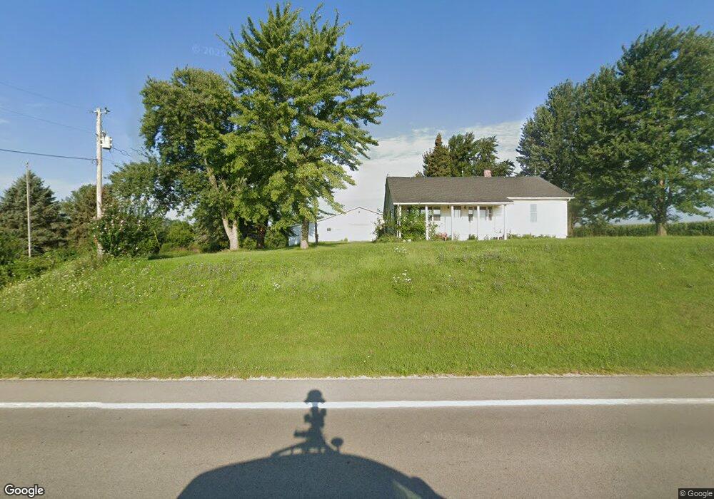
6588 N State Route 235 Conover, OH 45317
Estimated Value: $194,000 - $942,032
3
Beds
1
Bath
1,280
Sq Ft
$444/Sq Ft
Est. Value
About This Home
This home is located at 6588 N State Route 235, Conover, OH 45317 and is currently estimated at $568,016, approximately $443 per square foot. 6588 N State Route 235 is a home located in Champaign County with nearby schools including Graham Elementary School, Graham Middle School, and Graham High School.
Create a Home Valuation Report for This Property
The Home Valuation Report is an in-depth analysis detailing your home's value as well as a comparison with similar homes in the area
Home Values in the Area
Average Home Value in this Area
Tax History Compared to Growth
Tax History
| Year | Tax Paid | Tax Assessment Tax Assessment Total Assessment is a certain percentage of the fair market value that is determined by local assessors to be the total taxable value of land and additions on the property. | Land | Improvement |
|---|---|---|---|---|
| 2024 | $3,770 | $334,280 | $302,620 | $31,660 |
| 2023 | $3,770 | $334,280 | $302,620 | $31,660 |
| 2022 | $3,922 | $334,280 | $302,620 | $31,660 |
| 2021 | $3,638 | $268,480 | $242,100 | $26,380 |
| 2020 | $3,526 | $268,480 | $242,100 | $26,380 |
| 2019 | $3,598 | $268,480 | $242,100 | $26,380 |
| 2018 | $4,709 | $194,070 | $172,960 | $21,110 |
| 2017 | $4,094 | $194,070 | $172,960 | $21,110 |
| 2016 | $4,064 | $194,070 | $172,960 | $21,110 |
| 2015 | $3,831 | $178,000 | $157,750 | $20,250 |
| 2014 | $3,846 | $178,000 | $157,750 | $20,250 |
| 2013 | $3,912 | $178,000 | $157,750 | $20,250 |
Source: Public Records
Map
Nearby Homes
- 13147 Shanley Rd
- 8475 State Route 29
- 207 South St
- 8676 Sidney St
- 148 Dorsey Hageman Rd
- 7650 Calland Rd
- 1262 N Heck Hill Rd
- 5641 Calland Rd
- 101 Maple Dr
- 371 W Lynn St
- 115 S High St
- 203 W Main St
- 632 S Main St
- 572 S Main St
- 380 S Main St
- 126 Bowersock Ave
- 218 W Troy St
- 7210 N Bollinger Rd
- 4401 Knoop-Johnston Rd
- 117 N Boggs St
- 6532 N State Route 235
- 12472 W State Route 29
- 7044 N State Route 235
- 6308 Ohio 235
- 12229 W State Route 29
- 6333 N State Route 235
- 12463 W State Route 29
- 7129 N State Route 235
- 11769 W State Route 29
- 6219 N State Route 235
- 6179 N State Route 235
- 6104 North St
- 12475 W State Route 29
- 6102 N State Route 235
- 6102 N State Route 235
- 6080 North St
- 6078 N State Route 235
- 6078 N State Route 235
- 6078 Ohio 235
- 6078 Ohio 235