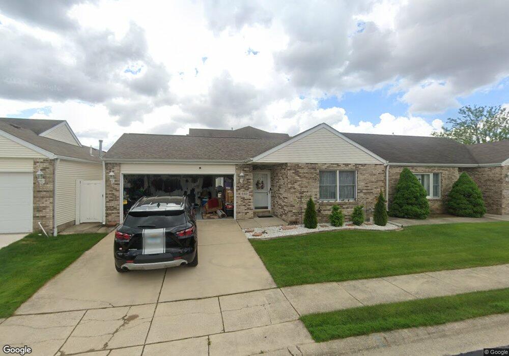
659 Ash Ct Lowell, IN 46356
West Creek NeighborhoodEstimated Value: $223,000 - $253,000
2
Beds
2
Baths
1,260
Sq Ft
$185/Sq Ft
Est. Value
About This Home
This home is located at 659 Ash Ct, Lowell, IN 46356 and is currently estimated at $233,589, approximately $185 per square foot. 659 Ash Ct is a home located in Lake County with nearby schools including Lowell Middle School and Lowell Senior High School.
Ownership History
Date
Name
Owned For
Owner Type
Purchase Details
Closed on
Feb 25, 2005
Sold by
Scalpelli Sharen M and Dillon Sharen M
Bought by
Sobolewski Raymond T and Sobolewski Ruth A
Current Estimated Value
Home Financials for this Owner
Home Financials are based on the most recent Mortgage that was taken out on this home.
Original Mortgage
$65,000
Interest Rate
5.71%
Mortgage Type
Fannie Mae Freddie Mac
Create a Home Valuation Report for This Property
The Home Valuation Report is an in-depth analysis detailing your home's value as well as a comparison with similar homes in the area
Home Values in the Area
Average Home Value in this Area
Purchase History
| Date | Buyer | Sale Price | Title Company |
|---|---|---|---|
| Sobolewski Raymond T | -- | Chicago Title Insurance Comp |
Source: Public Records
Mortgage History
| Date | Status | Borrower | Loan Amount |
|---|---|---|---|
| Closed | Sobolewski Raymond T | $65,000 |
Source: Public Records
Tax History
| Year | Tax Paid | Tax Assessment Tax Assessment Total Assessment is a certain percentage of the fair market value that is determined by local assessors to be the total taxable value of land and additions on the property. | Land | Improvement |
|---|---|---|---|---|
| 2025 | $2,028 | $215,800 | $26,300 | $189,500 |
| 2024 | $5,149 | $205,200 | $26,300 | $178,900 |
| 2023 | $1,756 | $195,700 | $26,300 | $169,400 |
| 2022 | $1,756 | $176,500 | $26,300 | $150,200 |
| 2021 | $1,440 | $150,200 | $18,500 | $131,700 |
| 2020 | $1,286 | $141,600 | $18,500 | $123,100 |
| 2019 | $1,371 | $137,400 | $18,500 | $118,900 |
| 2018 | $1,314 | $133,100 | $18,500 | $114,600 |
| 2017 | $1,286 | $125,500 | $18,500 | $107,000 |
| 2016 | $1,167 | $126,000 | $18,500 | $107,500 |
| 2014 | $1,046 | $118,000 | $18,600 | $99,400 |
| 2013 | $1,116 | $119,200 | $18,500 | $100,700 |
Source: Public Records
Map
Nearby Homes
- 330 Willow St
- 704 Coach Light Ln
- 432 E Briarwood Ln
- 425 E Briarwood Ln
- 322 Valley Ct
- 458 E Briarwood Ln
- 8674 Graystone Dr
- 18501 Percy Ln
- 8626 Graystone Dr
- 8603 Graystone Dr
- Sonoma Plan at Kingston Ridge - Andare Series
- Napa Plan at Kingston Ridge - Andare Series
- Bennett Plan at Kingston Ridge - Andare Series
- Rutherford Plan at Kingston Ridge - Andare Series
- Brooklyn Plan at Kingston Ridge - Landmark Series
- Ontario Plan at Kingston Ridge - Landmark Series
- Galveston Plan at Kingston Ridge - Landmark Series
- Raleigh Plan at Kingston Ridge - Landmark Series
- 8723 Graystone Dr
- 18634 Manor Gate Dr