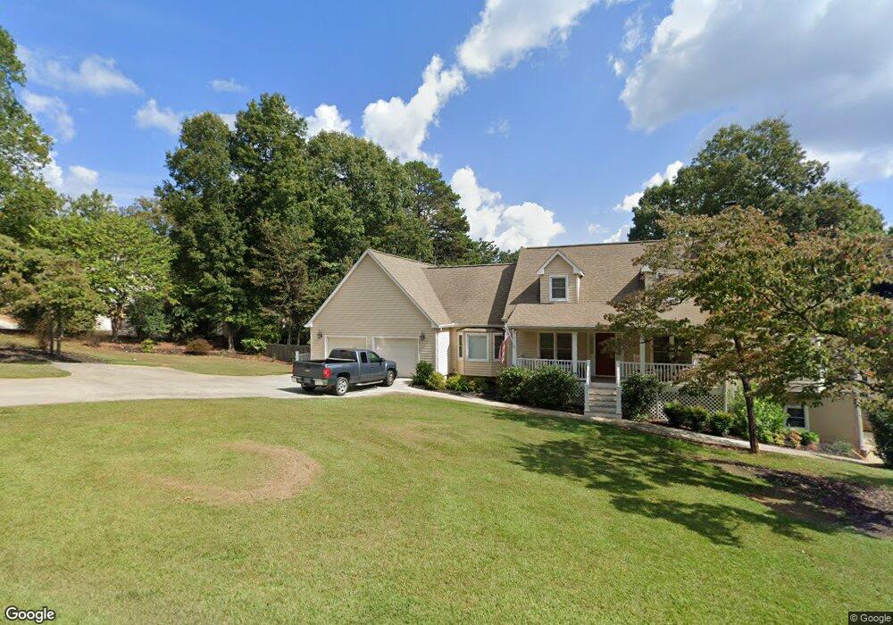
659 Calhoun Rd Dahlonega, GA 30533
Estimated Value: $423,486 - $559,000
--
Bed
3
Baths
2,854
Sq Ft
$174/Sq Ft
Est. Value
About This Home
This home is located at 659 Calhoun Rd, Dahlonega, GA 30533 and is currently estimated at $495,622, approximately $173 per square foot. 659 Calhoun Rd is a home located in Lumpkin County with nearby schools including Clay County Middle School and Lumpkin County High School.
Ownership History
Date
Name
Owned For
Owner Type
Purchase Details
Closed on
Aug 14, 2003
Sold by
Rev Green John Pierce Path Finders
Bought by
Estate Melba Fa Laird
Current Estimated Value
Purchase Details
Closed on
Apr 21, 2003
Sold by
Laird Robert L Estate
Bought by
Wingo Paul W and Wingo Vickie O
Purchase Details
Closed on
Jun 18, 1990
Sold by
Hood Wade Kerry
Bought by
Laird Robert L
Purchase Details
Closed on
Jul 1, 1985
Bought by
Hood Wade Kerry
Create a Home Valuation Report for This Property
The Home Valuation Report is an in-depth analysis detailing your home's value as well as a comparison with similar homes in the area
Home Values in the Area
Average Home Value in this Area
Purchase History
| Date | Buyer | Sale Price | Title Company |
|---|---|---|---|
| Estate Melba Fa Laird | -- | -- | |
| Wingo Paul W | $180,000 | -- | |
| Laire Robert L Estate | -- | -- | |
| Laird Robert L | $150,000 | -- | |
| Hood Wade Kerry | -- | -- |
Source: Public Records
Tax History Compared to Growth
Tax History
| Year | Tax Paid | Tax Assessment Tax Assessment Total Assessment is a certain percentage of the fair market value that is determined by local assessors to be the total taxable value of land and additions on the property. | Land | Improvement |
|---|---|---|---|---|
| 2024 | -- | $127,383 | $16,000 | $111,383 |
| 2023 | $0 | $120,656 | $16,000 | $104,656 |
| 2022 | $3,522 | $115,293 | $16,000 | $99,293 |
| 2021 | $3,450 | $94,777 | $10,000 | $84,777 |
| 2020 | $3,376 | $92,757 | $10,000 | $82,757 |
| 2019 | $5,181 | $96,757 | $14,000 | $82,757 |
| 2018 | $3,167 | $87,010 | $14,000 | $73,010 |
| 2017 | $0 | $86,601 | $14,000 | $72,601 |
| 2016 | -- | $81,334 | $14,000 | $67,334 |
| 2015 | $2 | $81,334 | $14,000 | $67,334 |
| 2014 | $2 | $83,306 | $14,000 | $69,306 |
| 2013 | -- | $85,278 | $14,000 | $71,278 |
Source: Public Records
Map
Nearby Homes
- 735 Calhoun Rd
- 99 Madeline Anthony Road Lots 44 and 45
- 99 Madeline Anthony Rd
- LOT 13 Crown Mountain Way
- Lot 28 Crown Mountain Way
- Lot 30 Crown Mountain Way
- 0 Crown Mountain Unit 7682225
- 0 Crown Mountain Unit 10644759
- Lot 20 Crown Mountain Way
- 0 Crown Mountain Way Unit 7666031
- 567 Crown Mountain Way
- 1170 Calhoun Rd
- 0 Calhoun Rd Unit 7643314
- 0 Calhoun Rd Unit 10598012
- 00 Calhoun Rd
- 1415 Calhoun Rd
- 490 Golden Ave
- 0 Alicia Ln
- 168 W Main St
- 747 Golden Ave
- 591 Calhoun Rd
- 658 Calhoun Rd
- 629 Calhoun Rd
- 677 Calhoun Rd
- 628 Calhoun Rd
- 678 Calhoun Rd
- 712 Calhoun Rd
- 734 Calhoun Rd
- 590 Calhoun Rd
- 771 Calhoun Rd
- 559 Calhoun Rd
- 552 Calhoun Rd
- 764 Calhoun Rd
- LOT 16 Calhoun Rd
- 793 Calhoun Rd
- 542 Calhoun Rd
- 69 Timber Oak Ln
- 501 Calhoun Rd
- 109 Timber Oak Ln
- 0 Timber Oak Ln