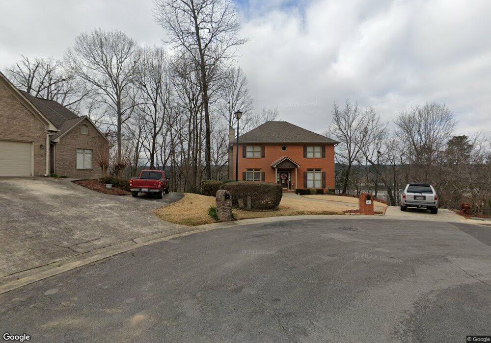
659 Camden Ridge Birmingham, AL 35226
Bluff Park NeighborhoodEstimated Value: $448,000 - $560,000
4
Beds
4
Baths
2,377
Sq Ft
$212/Sq Ft
Est. Value
About This Home
This home is located at 659 Camden Ridge, Birmingham, AL 35226 and is currently estimated at $503,563, approximately $211 per square foot. 659 Camden Ridge is a home located in Jefferson County with nearby schools including Hall-Kent Elementary School, Homewood Middle School, and Homewood High School.
Ownership History
Date
Name
Owned For
Owner Type
Purchase Details
Closed on
Oct 3, 2011
Sold by
Findlay Kristofer K and Findlay Cherry L
Bought by
Surrett Jimmy L and Surrett Norma
Current Estimated Value
Home Financials for this Owner
Home Financials are based on the most recent Mortgage that was taken out on this home.
Original Mortgage
$259,461
Outstanding Balance
$178,322
Interest Rate
4.26%
Mortgage Type
VA
Estimated Equity
$325,241
Purchase Details
Closed on
Oct 1, 2003
Sold by
Gillespie Chris A and Gillespie Deborah R
Bought by
Findlay Kristofer K and Findlay Cherry L
Home Financials for this Owner
Home Financials are based on the most recent Mortgage that was taken out on this home.
Original Mortgage
$200,000
Interest Rate
6.32%
Mortgage Type
Unknown
Create a Home Valuation Report for This Property
The Home Valuation Report is an in-depth analysis detailing your home's value as well as a comparison with similar homes in the area
Home Values in the Area
Average Home Value in this Area
Purchase History
| Date | Buyer | Sale Price | Title Company |
|---|---|---|---|
| Surrett Jimmy L | $254,000 | None Available | |
| Findlay Kristofer K | $273,900 | -- |
Source: Public Records
Mortgage History
| Date | Status | Borrower | Loan Amount |
|---|---|---|---|
| Open | Surrett Jimmy L | $259,461 | |
| Previous Owner | Findlay Kristofer K | $200,000 |
Source: Public Records
Tax History Compared to Growth
Tax History
| Year | Tax Paid | Tax Assessment Tax Assessment Total Assessment is a certain percentage of the fair market value that is determined by local assessors to be the total taxable value of land and additions on the property. | Land | Improvement |
|---|---|---|---|---|
| 2024 | $3,228 | $43,980 | -- | -- |
| 2022 | $3,183 | $43,380 | $11,200 | $32,180 |
| 2021 | $2,550 | $34,930 | $11,200 | $23,730 |
| 2020 | $2,550 | $34,930 | $11,200 | $23,730 |
| 2019 | $2,550 | $34,940 | $0 | $0 |
| 2018 | $2,358 | $32,380 | $0 | $0 |
| 2017 | $2,229 | $30,660 | $0 | $0 |
| 2016 | $2,229 | $30,660 | $0 | $0 |
| 2015 | $1,989 | $27,460 | $0 | $0 |
| 2014 | $1,872 | $25,840 | $0 | $0 |
| 2013 | $1,872 | $25,840 | $0 | $0 |
Source: Public Records
Map
Nearby Homes
- 841 Castlemaine Ct
- 909 Castlemaine Dr
- 892 Alford Ave
- 337 Delcris Ct
- 140 Grove Dr
- 329 Delcris Ct Unit 51
- 937 Alford Ave
- 2137 Tyler Ln
- 2137 Tyler Ln Unit 1
- 2881 Robinson Dr
- 2801 Oxmoor Glen Dr
- 3000 Spencer Way
- 3001 Spencer Way
- 3105 Spencer Dr
- 3087 Tyler Crest Cir
- 2731 Oxmoor Way
- 3048 Spencer Way
- 889 Velmont Ln Unit 15
- 3040 Spencer Way
- 2720 Village Ln
- 660 Camden Ridge
- 655 Camden Ridge
- 651 Camden Ridge
- 656 Camden Ridge
- 574 Bristol Ln
- 578 Bristol Ln
- 647 Camden Ridge
- 652 Camden Ridge
- 570 Bristol Ln
- 588 Bristol Ln
- 640 Camden Ridge
- 648 Camden Ridge
- 566 Bristol Ln
- 820 Castlemaine Ct
- 824 Castlemaine Ct
- 592 Bristol Ln
- 828 Castlemaine Ct
- 812 Castlemaine Ct
- 816 Castlemaine Ct
- 832 Castlemaine Ct