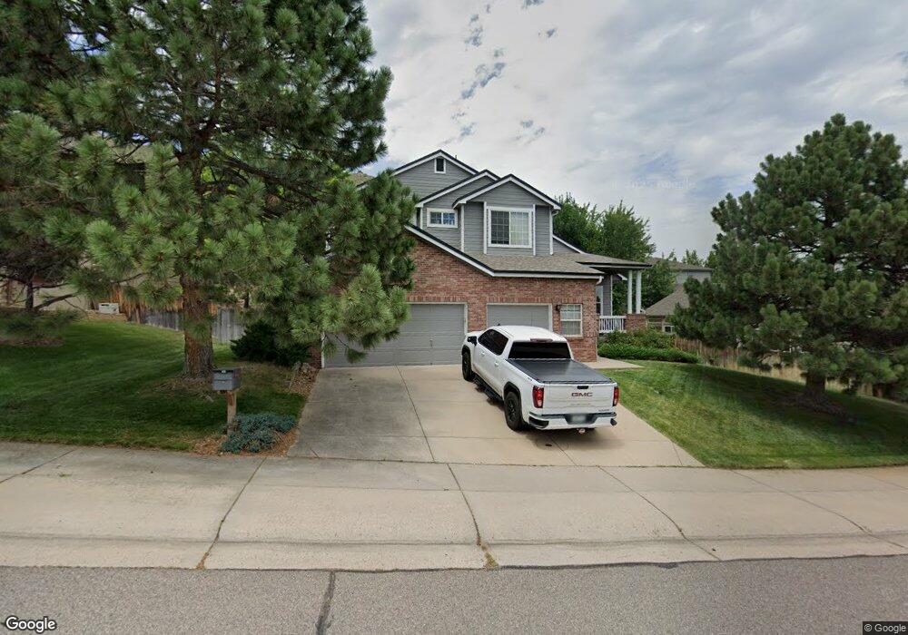
659 Canyon Point Cir Golden, CO 80403
Estimated Value: $1,259,000 - $1,493,000
4
Beds
7
Baths
2,636
Sq Ft
$515/Sq Ft
Est. Value
About This Home
This home is located at 659 Canyon Point Cir, Golden, CO 80403 and is currently estimated at $1,356,962, approximately $514 per square foot. 659 Canyon Point Cir is a home located in Jefferson County with nearby schools including Mitchell Elementary School, Bell Middle School, and Golden High School.
Ownership History
Date
Name
Owned For
Owner Type
Purchase Details
Closed on
Jun 23, 2004
Sold by
Nelson Gerard and Sasala Connie S
Bought by
Workman Robert and Workman Teresa
Current Estimated Value
Home Financials for this Owner
Home Financials are based on the most recent Mortgage that was taken out on this home.
Original Mortgage
$334,000
Outstanding Balance
$143,867
Interest Rate
4.25%
Mortgage Type
Purchase Money Mortgage
Estimated Equity
$1,213,095
Purchase Details
Closed on
Aug 29, 1997
Sold by
Johnson Communities Inc
Bought by
Nelson Gerard and Sasala Connie S
Home Financials for this Owner
Home Financials are based on the most recent Mortgage that was taken out on this home.
Original Mortgage
$27,800
Interest Rate
6.99%
Mortgage Type
Purchase Money Mortgage
Create a Home Valuation Report for This Property
The Home Valuation Report is an in-depth analysis detailing your home's value as well as a comparison with similar homes in the area
Home Values in the Area
Average Home Value in this Area
Purchase History
| Date | Buyer | Sale Price | Title Company |
|---|---|---|---|
| Workman Robert | $470,000 | Land Title | |
| Nelson Gerard | $278,731 | Land Title | |
| Johnson Communities Inc | -- | Land Title |
Source: Public Records
Mortgage History
| Date | Status | Borrower | Loan Amount |
|---|---|---|---|
| Open | Workman Robert | $334,000 | |
| Previous Owner | Johnson Communities Inc | $27,800 | |
| Previous Owner | Nelson Gerard | $222,950 |
Source: Public Records
Tax History Compared to Growth
Tax History
| Year | Tax Paid | Tax Assessment Tax Assessment Total Assessment is a certain percentage of the fair market value that is determined by local assessors to be the total taxable value of land and additions on the property. | Land | Improvement |
|---|---|---|---|---|
| 2024 | $7,002 | $77,081 | $28,640 | $48,441 |
| 2023 | $7,002 | $77,081 | $28,640 | $48,441 |
| 2022 | $5,252 | $60,756 | $22,685 | $38,071 |
| 2021 | $5,337 | $62,504 | $23,337 | $39,167 |
| 2020 | $4,601 | $54,159 | $17,916 | $36,243 |
| 2019 | $4,536 | $54,159 | $17,916 | $36,243 |
| 2018 | $4,565 | $52,888 | $15,618 | $37,270 |
| 2017 | $4,136 | $52,888 | $15,618 | $37,270 |
| 2016 | $4,102 | $49,064 | $11,835 | $37,229 |
| 2015 | $3,575 | $49,064 | $11,835 | $37,229 |
| 2014 | $3,575 | $40,142 | $10,945 | $29,197 |
Source: Public Records
Map
Nearby Homes
- 165 Washington St
- 410 Cheyenne St
- 101 Washington Ave
- 474 Snowberry Ct
- 209 Washington Ave
- 705 1st St
- 613 Iowa St
- 401 N Columbine St
- 407 Washington Ave Unit B
- 911 6th St
- 707 Elm Cir
- 1014 8th St
- 213 Ford St
- 722 Washington Ave Unit 306
- 565 East St
- 807 9th St
- 401 Ridge Rd
- 317 Sunshine Pkwy
- 920 12th St
- 300 Lily Ln
- 647 Canyon Point Cir
- 108 Washington St
- 110 Washington St
- 625 Canyon Point Cir
- 656 Canyon Point Cir
- 654 Canyon Point Cir
- 678 Canyon Point Cir
- 132 Washington St
- 690 Canyon Point Cir
- 632 Canyon Point Cir
- 610 Canyon Point Cir
- 1542 Cougar Ct
- 121 Washington St
- 144 Washington St
- 1540 Cougar Ct
- 1537 Coyote Ct
- 1551 Cougar Ct
- 1540 Coyote Ct
- 133 Washington St
- 1582 Valley View Ct