Estimated Value: $836,414 - $900,000
4
Beds
3
Baths
2,259
Sq Ft
$383/Sq Ft
Est. Value
About This Home
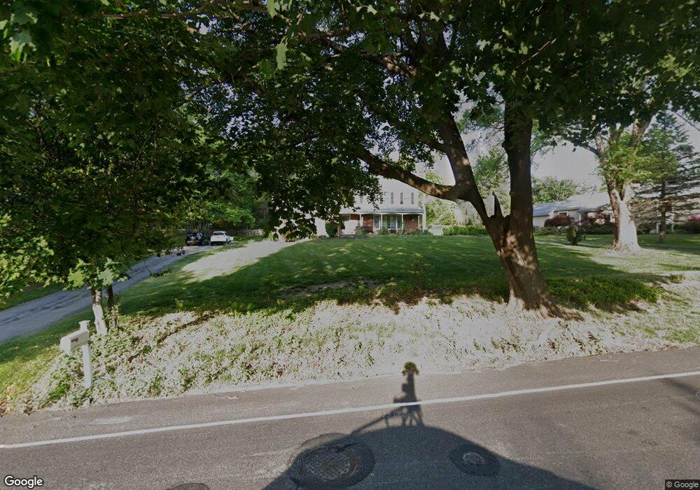
This home is located at 659 N Valley Rd, Paoli, PA 19301 and is currently estimated at $865,104, approximately $382 per square foot. 659 N Valley Rd is a home located in Chester County with nearby schools including Hillside Elementary School, Valley Forge Middle School, and Conestoga Senior High School.
Ownership History
Date
Name
Owned For
Owner Type
Purchase Details
Closed on
May 12, 2000
Sold by
Donovan Deborah A
Bought by
Donovan Patrick J and Donovan Deborah A
Current Estimated Value
Home Financials for this Owner
Home Financials are based on the most recent Mortgage that was taken out on this home.
Original Mortgage
$168,750
Interest Rate
8.24%
Purchase Details
Closed on
Oct 15, 1996
Sold by
Galoonis Francis G and Tracey Florence L
Bought by
Donovan Deborah A
Home Financials for this Owner
Home Financials are based on the most recent Mortgage that was taken out on this home.
Original Mortgage
$151,500
Interest Rate
5%
Create a Home Valuation Report for This Property
The Home Valuation Report is an in-depth analysis detailing your home's value as well as a comparison with similar homes in the area
Home Values in the Area
Average Home Value in this Area
Purchase History
| Date | Buyer | Sale Price | Title Company |
|---|---|---|---|
| Donovan Patrick J | -- | -- | |
| Donovan Deborah A | $189,500 | -- |
Source: Public Records
Mortgage History
| Date | Status | Borrower | Loan Amount |
|---|---|---|---|
| Previous Owner | Donovan Patrick J | $168,750 | |
| Previous Owner | Donovan Deborah A | $151,500 |
Source: Public Records
Tax History Compared to Growth
Tax History
| Year | Tax Paid | Tax Assessment Tax Assessment Total Assessment is a certain percentage of the fair market value that is determined by local assessors to be the total taxable value of land and additions on the property. | Land | Improvement |
|---|---|---|---|---|
| 2025 | $6,846 | $194,370 | $79,160 | $115,210 |
| 2024 | $6,846 | $194,370 | $79,160 | $115,210 |
| 2023 | $6,431 | $194,370 | $79,160 | $115,210 |
| 2022 | $6,265 | $194,370 | $79,160 | $115,210 |
| 2021 | $6,146 | $194,370 | $79,160 | $115,210 |
| 2020 | $5,977 | $194,370 | $79,160 | $115,210 |
| 2019 | $5,788 | $194,370 | $79,160 | $115,210 |
| 2018 | $5,673 | $194,370 | $79,160 | $115,210 |
| 2017 | $5,538 | $194,370 | $79,160 | $115,210 |
| 2016 | -- | $194,370 | $79,160 | $115,210 |
| 2015 | -- | $194,370 | $79,160 | $115,210 |
| 2014 | -- | $194,370 | $79,160 | $115,210 |
Source: Public Records
Map
Nearby Homes
- 1 Whitworth Ave
- 106 N Valley Rd
- 202 Shoreline Dr
- 109 Vincent Rd
- 2175 Swedesford Rd
- 1250 Swedesford Rd
- 21 Manor Rd
- 29 Manor Rd
- 12 Moreland Rd
- 104 Lynbrook Rd
- 340 Beechwood Rd
- 114 Manor Rd
- 201 Penns Ln
- 5 Kent Ln
- 2102 Quail Ridge Dr
- 3 Bryan Ave
- 521 Foxwood Ln
- 1304 Weatherstone Dr Unit 1304
- 10 Arlington Rd
- 1242 Old Lancaster Rd
- 669 N Valley Rd
- 649 N Valley Rd
- 639 N Valley Rd
- 679 N Valley Rd
- 1805 Glenwold Dr
- 42 Lynne Cir
- 629 N Valley Rd
- 32 Lynne Cir
- 689 N Valley Rd
- 1800 Black Rock Ln
- 46 Lynne Cir
- 24 Lynne Cir
- 1779 Jennings Way
- 1818 Glenwold Dr
- 1814 Black Rock Ln
- 14 Lynne Cir
- 1787 Jennings Way
- 699 N Valley Rd
- 1767 Jennings Way
- 1828 Black Rock Ln