Estimated Value: $245,331 - $313,000
4
Beds
1
Bath
1,250
Sq Ft
$222/Sq Ft
Est. Value
About This Home
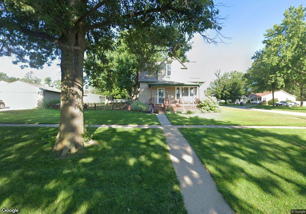
This home is located at 659 N Walnut St, Wahoo, NE 68066 and is currently estimated at $278,083, approximately $222 per square foot. 659 N Walnut St is a home located in Saunders County with nearby schools including Wahoo Elementary School, Wahoo Middle School, and Wahoo High School.
Ownership History
Date
Name
Owned For
Owner Type
Purchase Details
Closed on
Aug 26, 2011
Sold by
Wambold James S and Wambold Susan M
Bought by
Schmidt Brian
Current Estimated Value
Purchase Details
Closed on
Jul 12, 2011
Sold by
Federal Home Loan Mortgage Corporation
Bought by
Wambold James S and Wambold Susan M
Purchase Details
Closed on
Jun 24, 2011
Sold by
Federal Home Loan Mortgage Corporation
Bought by
Wambold James S and Wambold Susan M
Purchase Details
Closed on
Aug 18, 2010
Sold by
Osmera Allan M
Bought by
Osmera Faith A
Purchase Details
Closed on
Jul 23, 2010
Sold by
Osmera Allan M
Bought by
Osmera Faith A
Create a Home Valuation Report for This Property
The Home Valuation Report is an in-depth analysis detailing your home's value as well as a comparison with similar homes in the area
Home Values in the Area
Average Home Value in this Area
Purchase History
| Date | Buyer | Sale Price | Title Company |
|---|---|---|---|
| Schmidt Brian | -- | -- | |
| Wambold James S | -- | -- | |
| Wambold James S | -- | -- | |
| Osmera Faith A | -- | -- | |
| Osmera Faith A | -- | -- |
Source: Public Records
Tax History Compared to Growth
Tax History
| Year | Tax Paid | Tax Assessment Tax Assessment Total Assessment is a certain percentage of the fair market value that is determined by local assessors to be the total taxable value of land and additions on the property. | Land | Improvement |
|---|---|---|---|---|
| 2024 | $2,488 | $183,555 | $30,231 | $153,324 |
| 2023 | $3,078 | $175,868 | $30,231 | $145,637 |
| 2022 | $2,589 | $138,030 | $30,231 | $107,799 |
| 2021 | $2,609 | $135,320 | $30,231 | $105,089 |
| 2020 | $2,560 | $131,898 | $30,231 | $101,667 |
| 2019 | $2,674 | $134,717 | $30,231 | $104,486 |
| 2018 | $2,378 | $114,720 | $30,230 | $84,490 |
| 2017 | $2,370 | $114,720 | $30,230 | $84,490 |
| 2016 | $2,849 | $118,405 | $29,740 | $88,665 |
| 2015 | $2,501 | $118,405 | $29,740 | $88,665 |
| 2014 | $2,072 | $96,410 | $29,740 | $66,670 |
| 2012 | $2,193 | $96,410 | $29,740 | $66,670 |
Source: Public Records
Map
Nearby Homes
- 453 W 7th St
- 453 W 4th St
- 565 W 10th St
- 878 W 8th St
- 1039 N Laurel St
- 720 W 10th St
- 122 E 10th St
- 758 W Park Cir
- 649 W 2nd St
- 327 E 7th St
- 1365 N Chestnut St
- 243 S Linden St
- 820 W 15th St
- 651 W 16th St
- 1561 N Linden St
- 428 E 14th St
- 1530 Highway 77 Unit 4.55 Ac.
- 1273 Spruce St
- 1672 N Linden St
- 1283 Spruce St
- 659 N Walnut St
- 435 W 7th St Unit 437
- 0 W 7th Unit 10132684
- 0 W 7th Unit 21617412
- 611 N Walnut St
- 361 W 7th St
- 715 N Walnut St
- 430 W 6th St
- 440 W 6th St
- 440 W 7th St
- 360 W 6th St
- 343 W 7th St
- 460 W 6th St
- 358 W 7th St
- 350 W 6th St
- 739 N Walnut St
- 458 W 7th St
- 750 N Walnut St
- 348 W 7th St
- 327 W 7th St