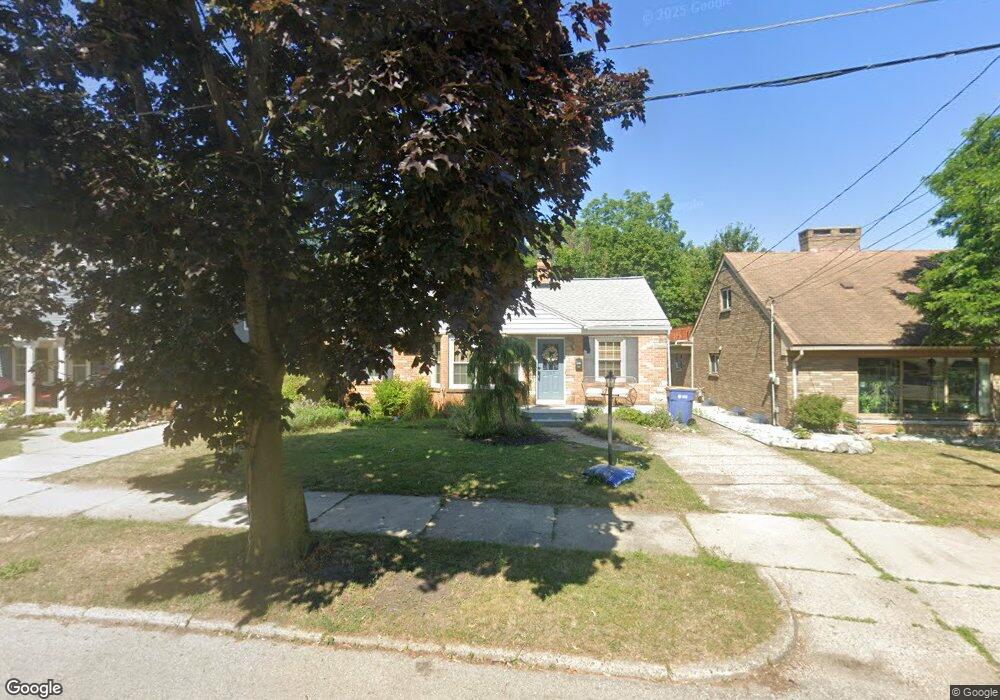
659 Powers Ave NW Grand Rapids, MI 49504
West Grand NeighborhoodEstimated Value: $227,000 - $301,171
3
Beds
1
Bath
1,719
Sq Ft
$157/Sq Ft
Est. Value
About This Home
This home is located at 659 Powers Ave NW, Grand Rapids, MI 49504 and is currently estimated at $269,543, approximately $156 per square foot. 659 Powers Ave NW is a home located in Kent County with nearby schools including Westwood Middle School, Union High School, and Lighthouse Academy - Waalkes Campus.
Ownership History
Date
Name
Owned For
Owner Type
Purchase Details
Closed on
Jun 10, 2011
Sold by
Kutzli Thomas F
Bought by
Stoffel Christopher B and Stoffel Kimberly
Current Estimated Value
Home Financials for this Owner
Home Financials are based on the most recent Mortgage that was taken out on this home.
Original Mortgage
$65,788
Outstanding Balance
$45,353
Interest Rate
4.63%
Mortgage Type
FHA
Estimated Equity
$224,190
Create a Home Valuation Report for This Property
The Home Valuation Report is an in-depth analysis detailing your home's value as well as a comparison with similar homes in the area
Home Values in the Area
Average Home Value in this Area
Purchase History
| Date | Buyer | Sale Price | Title Company |
|---|---|---|---|
| Stoffel Christopher B | $67,500 | Multiple |
Source: Public Records
Mortgage History
| Date | Status | Borrower | Loan Amount |
|---|---|---|---|
| Open | Stoffel Christopher B | $65,788 |
Source: Public Records
Tax History Compared to Growth
Tax History
| Year | Tax Paid | Tax Assessment Tax Assessment Total Assessment is a certain percentage of the fair market value that is determined by local assessors to be the total taxable value of land and additions on the property. | Land | Improvement |
|---|---|---|---|---|
| 2025 | $1,638 | $128,800 | $0 | $0 |
| 2024 | $1,638 | $118,100 | $0 | $0 |
| 2023 | $1,569 | $101,700 | $0 | $0 |
| 2022 | $1,578 | $86,700 | $0 | $0 |
| 2021 | $1,543 | $77,200 | $0 | $0 |
| 2020 | $1,475 | $69,000 | $0 | $0 |
| 2019 | $1,545 | $63,100 | $0 | $0 |
| 2018 | $1,492 | $58,200 | $0 | $0 |
| 2017 | $1,452 | $53,500 | $0 | $0 |
| 2016 | $1,470 | $47,200 | $0 | $0 |
| 2015 | $1,367 | $47,200 | $0 | $0 |
| 2013 | -- | $40,200 | $0 | $0 |
Source: Public Records
Map
Nearby Homes
- 609 Lincoln Ave NW
- 921 4th St NW
- 561 Lane Ave NW
- 539 Pine Ave NW
- 1169 3rd St NW
- 1009 Second St NW
- 564 Garfield Ave NW
- 1163 Second St NW
- 833 Pine Ave NW
- 545 Garfield Ave NW
- 1115 Atlantic St NW
- 828 4th St NW
- 1020 10th St NW
- 819 Van Buren Ave NW
- 854 First St NW
- 1153 Bridge St NW
- 964 Lincoln Ave NW
- 343 Garfield Ave NW
- 855 Alpine Ave NW
- 815 Mcreynolds Ave NW
- 655 Powers Ave NW
- 665 Powers Ave NW
- 1110 5th St NW
- 671 Powers Ave NW
- 1118 5th St NW
- 1113 4th St NW
- 1105 4th St NW
- 1101 4th St NW
- 1117 4th St NW
- 1122 5th St NW
- 1123 4th St NW
- 660 Powers Ave NW
- 654 Powers Ave NW
- 648 Powers Ave NW
- 670 Powers Ave NW
- 658 Lincoln Ave NW
- 654 Lincoln Ave NW
- 662 Lincoln Ave NW
- 650 Lincoln Ave NW
- 666 Lincoln Ave NW