Estimated Value: $685,000 - $740,000
4
Beds
3
Baths
2,258
Sq Ft
$313/Sq Ft
Est. Value
About This Home
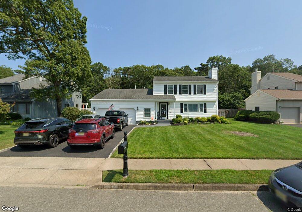
This home is located at 659 Preston St, Brick, NJ 08723 and is currently estimated at $706,937, approximately $313 per square foot. 659 Preston St is a home located in Ocean County with nearby schools including Osbornville Elementary School, Lake Riviera Middle School, and Brick Township High School.
Ownership History
Date
Name
Owned For
Owner Type
Purchase Details
Closed on
Nov 22, 2000
Current Estimated Value
Purchase Details
Closed on
Jul 12, 1996
Sold by
Johnson Gary
Bought by
Bittenbinder Gerald
Home Financials for this Owner
Home Financials are based on the most recent Mortgage that was taken out on this home.
Original Mortgage
$148,000
Interest Rate
8.37%
Create a Home Valuation Report for This Property
The Home Valuation Report is an in-depth analysis detailing your home's value as well as a comparison with similar homes in the area
Home Values in the Area
Average Home Value in this Area
Purchase History
| Date | Buyer | Sale Price | Title Company |
|---|---|---|---|
| -- | $100 | -- | |
| Bittenbinder Gerald | $185,000 | -- |
Source: Public Records
Mortgage History
| Date | Status | Borrower | Loan Amount |
|---|---|---|---|
| Previous Owner | Bittenbinder Gerald | $148,000 |
Source: Public Records
Tax History
| Year | Tax Paid | Tax Assessment Tax Assessment Total Assessment is a certain percentage of the fair market value that is determined by local assessors to be the total taxable value of land and additions on the property. | Land | Improvement |
|---|---|---|---|---|
| 2025 | $9,179 | $338,200 | $132,600 | $205,600 |
| 2024 | $8,303 | $338,200 | $132,600 | $205,600 |
| 2023 | $8,195 | $338,200 | $132,600 | $205,600 |
| 2022 | $8,195 | $338,200 | $132,600 | $205,600 |
| 2021 | $7,730 | $338,200 | $132,600 | $205,600 |
| 2020 | $7,921 | $338,200 | $132,600 | $205,600 |
| 2019 | $7,789 | $338,200 | $132,600 | $205,600 |
| 2018 | $7,610 | $338,200 | $132,600 | $205,600 |
| 2017 | $7,403 | $338,200 | $132,600 | $205,600 |
| 2016 | $7,366 | $338,200 | $132,600 | $205,600 |
| 2015 | $7,173 | $338,200 | $132,600 | $205,600 |
| 2014 | $7,116 | $338,200 | $132,600 | $205,600 |
Source: Public Records
Map
Nearby Homes
- 507 Adamston Rd
- 440 Drum Point Rd
- 484 Bara St
- 0 Mantoloking Rd Unit 11584872
- 22 Evelyn Ct
- 65 Glenn Dr
- 72 Baywood Blvd
- 48 Birch Dr
- 79 Baywood Blvd
- 9 Bayberry Ave
- 474 Burnt Bark Rd
- 570 Mantoloking Rd
- 299 Huppert Dr
- 00 Mantoloking Rd
- 39 Bonair Dr
- 15 Hulse Landing Rd
- 56 Tall Timber Dr
- 15 Woodland Dr
- 61 Reservation Row
- 53 Country Club Ct
Your Personal Tour Guide
Ask me questions while you tour the home.