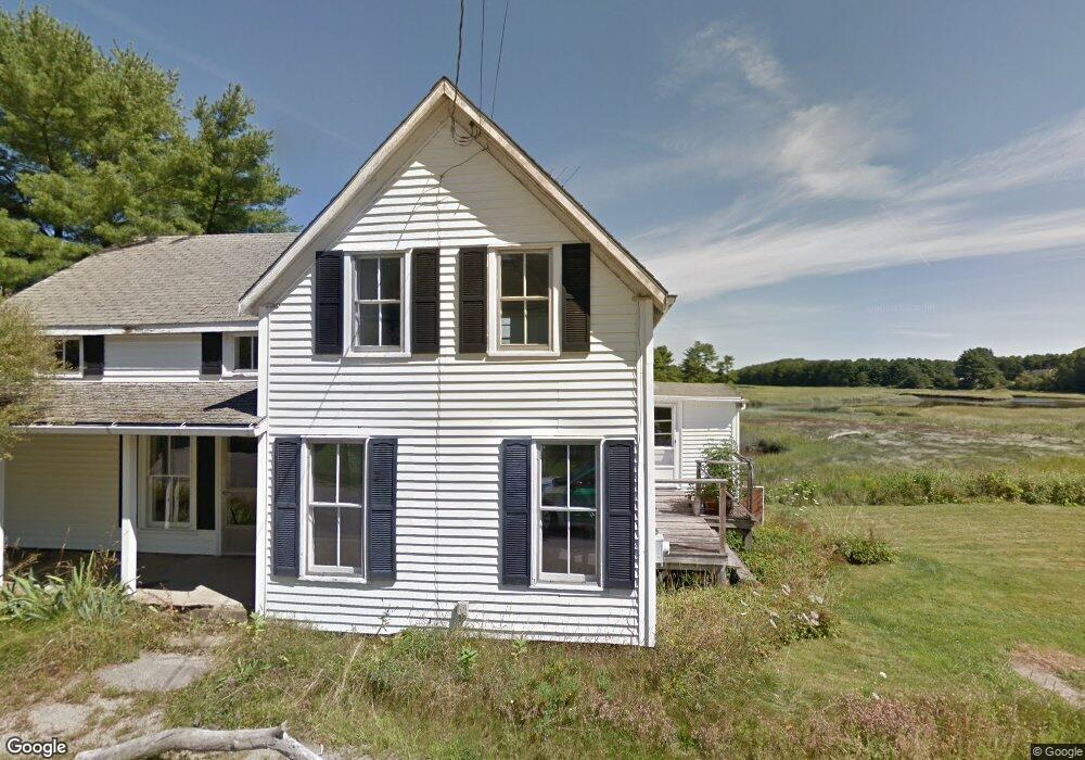
659 Sheepscot Rd Newcastle, ME 04553
Estimated Value: $313,498 - $458,000
2
Beds
1
Bath
1,100
Sq Ft
$369/Sq Ft
Est. Value
About This Home
This home is located at 659 Sheepscot Rd, Newcastle, ME 04553 and is currently estimated at $405,625, approximately $368 per square foot. 659 Sheepscot Rd is a home located in Lincoln County with nearby schools including Great Salt Bay Community School, Juniper Hill School, and Sheepscot Valley Children's House.
Ownership History
Date
Name
Owned For
Owner Type
Purchase Details
Closed on
Sep 24, 2015
Sold by
Sheepscot Village Rd Llc
Bought by
Vanabshoven Michelle M
Current Estimated Value
Home Financials for this Owner
Home Financials are based on the most recent Mortgage that was taken out on this home.
Original Mortgage
$118,750
Outstanding Balance
$93,205
Interest Rate
3.97%
Mortgage Type
Commercial
Estimated Equity
$312,420
Purchase Details
Closed on
Jan 12, 2015
Sold by
Mocarski Nancy E
Bought by
Sheepscot Village Rd Llc
Purchase Details
Closed on
Sep 22, 2009
Sold by
Hartley Michael O
Bought by
Mocarski Nancy E
Create a Home Valuation Report for This Property
The Home Valuation Report is an in-depth analysis detailing your home's value as well as a comparison with similar homes in the area
Home Values in the Area
Average Home Value in this Area
Purchase History
| Date | Buyer | Sale Price | Title Company |
|---|---|---|---|
| Vanabshoven Michelle M | -- | -- | |
| Sheepscot Village Rd Llc | -- | -- | |
| Mocarski Nancy E | -- | -- |
Source: Public Records
Mortgage History
| Date | Status | Borrower | Loan Amount |
|---|---|---|---|
| Open | Vanabshoven Michelle M | $118,750 |
Source: Public Records
Tax History Compared to Growth
Tax History
| Year | Tax Paid | Tax Assessment Tax Assessment Total Assessment is a certain percentage of the fair market value that is determined by local assessors to be the total taxable value of land and additions on the property. | Land | Improvement |
|---|---|---|---|---|
| 2024 | $3,369 | $247,700 | $93,600 | $154,100 |
| 2023 | $3,491 | $218,200 | $127,700 | $90,500 |
| 2022 | $3,469 | $218,200 | $127,700 | $90,500 |
| 2021 | $3,338 | $218,200 | $127,700 | $90,500 |
| 2020 | $1,871 | $104,500 | $42,600 | $61,900 |
| 2019 | $1,871 | $104,500 | $42,600 | $61,900 |
| 2018 | $1,871 | $104,500 | $42,600 | $61,900 |
| 2017 | $1,886 | $104,500 | $42,600 | $61,900 |
| 2016 | $1,886 | $104,500 | $42,600 | $61,900 |
| 2015 | $1,886 | $104,500 | $42,600 | $61,900 |
| 2013 | $1,614 | $101,500 | $42,600 | $58,900 |
Source: Public Records
Map
Nearby Homes
- 977 Alna Rd
- LOT #4 Lewis Hill Rd
- 583 W Alna Rd
- 611 W Alna Rd
- 105 Old Sheepscot Rd
- Lot# Route 1
- 00 W Alna Rd
- R05-58A W Alna Rd
- 02-37 Route 1
- Lot#4 Bay View Trail
- Lot # 0 Deer Ridge Rd
- Lot #3 Bay View Trail
- 27 Dodge Rd
- 1165 W Alna Rd
- 0 Hopkins Hill Rd
- 8 Foye Rd
- 10 Foye Rd
- 80 Academy Hill Rd
- 29 Pleasant St
- 26 Lake Meadow Ln
- 657 Sheepscot Rd
- 4 the Kings Hwy
- 10 the Kings Hwy
- 10 & 12 the Kings Hwy
- 647 Sheepscot Rd
- 12 the Kings Hwy
- 676 Sheepscot Rd
- 6 S Dyer Neck Rd
- 8-B S Dyer Neck Rd
- 0 S Dyer Neck Rd Unit 872757
- 0 S Dyer Neck Rd Unit 851871
- 0 S Dyer Neck Rd Unit 789207
- 0 S Dyer Neck Rd Unit 769864
- 0 S Dyer Neck Rd Unit 520837
- 0 S Dyer Neck Rd Unit 209357
- 0 S Dyer Neck Rd Unit 212877
- 00 So Dyers Neck Rd
- 0 S Dyer Neck Rd Unit 1013081
- 0 S Dyer Neck Rd Unit 1121156
- Lot 5 the King's Hwy