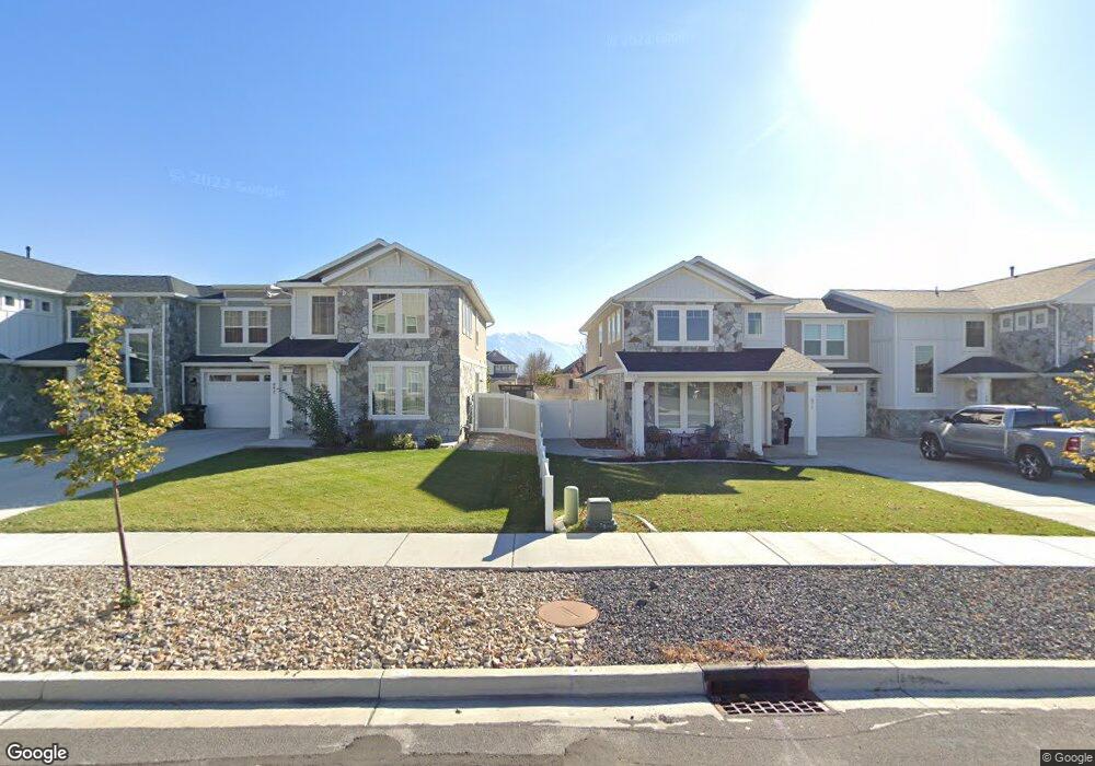
659 W 550 S Mapleton, UT 84664
Estimated Value: $1,144,000 - $1,255,000
6
Beds
4
Baths
5,677
Sq Ft
$211/Sq Ft
Est. Value
About This Home
This home is located at 659 W 550 S, Mapleton, UT 84664 and is currently estimated at $1,195,262, approximately $210 per square foot. 659 W 550 S is a home located in Utah County with nearby schools including Mapleton School, Mapleton Junior High School, and Maple Mountain High School.
Ownership History
Date
Name
Owned For
Owner Type
Purchase Details
Closed on
Aug 23, 2021
Sold by
Lundell Catherine E
Bought by
Ashby John and Ashby Lenore
Current Estimated Value
Home Financials for this Owner
Home Financials are based on the most recent Mortgage that was taken out on this home.
Original Mortgage
$512,000
Outstanding Balance
$465,567
Interest Rate
2.9%
Mortgage Type
New Conventional
Estimated Equity
$729,695
Purchase Details
Closed on
Mar 20, 2019
Sold by
Lundell Randy Roy and Lundell Catherine
Bought by
Lundell Catherine E
Home Financials for this Owner
Home Financials are based on the most recent Mortgage that was taken out on this home.
Original Mortgage
$254,000
Interest Rate
4.4%
Mortgage Type
New Conventional
Purchase Details
Closed on
Apr 27, 2012
Sold by
Crosby Gary L and Crosby Jeri Lynn
Bought by
Lundell Randy Roy and Lundell Catherine
Home Financials for this Owner
Home Financials are based on the most recent Mortgage that was taken out on this home.
Original Mortgage
$337,600
Interest Rate
3.9%
Mortgage Type
New Conventional
Purchase Details
Closed on
Apr 25, 2011
Sold by
Federal Deposit Insurance Corporation
Bought by
Crosby Gary L and Crosby Jeri Lynn
Home Financials for this Owner
Home Financials are based on the most recent Mortgage that was taken out on this home.
Original Mortgage
$115,000
Interest Rate
4.83%
Mortgage Type
New Conventional
Purchase Details
Closed on
Feb 23, 2009
Sold by
Weakley Royal
Bought by
Centennial Bank Inc
Purchase Details
Closed on
Nov 22, 2006
Sold by
Powell Scott L
Bought by
Weakley Royal
Home Financials for this Owner
Home Financials are based on the most recent Mortgage that was taken out on this home.
Original Mortgage
$499,000
Interest Rate
6.36%
Mortgage Type
Construction
Purchase Details
Closed on
Sep 7, 2006
Sold by
Silver Leafe Cove Llc
Bought by
Powell Scott L
Home Financials for this Owner
Home Financials are based on the most recent Mortgage that was taken out on this home.
Original Mortgage
$196,000
Interest Rate
6.67%
Mortgage Type
Purchase Money Mortgage
Create a Home Valuation Report for This Property
The Home Valuation Report is an in-depth analysis detailing your home's value as well as a comparison with similar homes in the area
Home Values in the Area
Average Home Value in this Area
Purchase History
| Date | Buyer | Sale Price | Title Company |
|---|---|---|---|
| Ashby John | -- | Sutherland Title | |
| Lundell Catherine E | -- | Lydolph & Weierholt Ttl Ins | |
| Lundell Randy Roy | -- | Inwest Title Ser | |
| Crosby Gary L | -- | First American Union Heig | |
| Centennial Bank Inc | $510,000 | Title West Title Company | |
| Weakley Royal | -- | Horizon Title Insurance | |
| Powell Scott L | -- | Horizon Title Insurance |
Source: Public Records
Mortgage History
| Date | Status | Borrower | Loan Amount |
|---|---|---|---|
| Open | Ashby John | $512,000 | |
| Previous Owner | Lundell Catherine E | $254,000 | |
| Previous Owner | Lundell Randy Roy | $337,600 | |
| Previous Owner | Crosby Gary L | $115,000 | |
| Previous Owner | Weakley Royal | $499,000 | |
| Previous Owner | Weakley Royal | $45,235 | |
| Previous Owner | Powell Scott L | $196,000 |
Source: Public Records
Tax History
| Year | Tax Paid | Tax Assessment Tax Assessment Total Assessment is a certain percentage of the fair market value that is determined by local assessors to be the total taxable value of land and additions on the property. | Land | Improvement |
|---|---|---|---|---|
| 2025 | $5,347 | $589,985 | -- | -- |
| 2024 | $5,619 | $523,820 | $0 | $0 |
| 2023 | $5,619 | $553,960 | $0 | $0 |
| 2022 | $5,851 | $570,350 | $0 | $0 |
| 2021 | $5,054 | $756,300 | $215,300 | $541,000 |
| 2020 | $4,910 | $710,700 | $190,500 | $520,200 |
| 2019 | $4,678 | $691,200 | $190,500 | $500,700 |
| 2018 | $4,646 | $653,500 | $162,700 | $490,800 |
| 2017 | $4,727 | $352,880 | $0 | $0 |
| 2016 | $4,233 | $314,105 | $0 | $0 |
| 2015 | $3,712 | $273,790 | $0 | $0 |
| 2014 | $3,608 | $261,360 | $0 | $0 |
Source: Public Records
Map
Nearby Homes
- 509 W 350 S Unit 30
- 509 W 350 S
- 896 W 675 S
- 4664 S 680 W Unit S204
- 4664 S 680 W Unit S203
- 4664 S 680 W Unit S302
- 4664 S 680 W Unit S303
- 4664 S 680 W Unit S201
- 4664 S 680 W Unit S202
- 4664 S 680 W Unit S304
- 4664 S 680 W Unit S301
- 4664 S 680 W Unit S102
- 4664 S 680 W Unit S101
- 415 S 1200 W
- 1158 S 980 W
- 1352 W 900 S
- 1222 W 190 N
- 1142 W 220 N
- 715 W 4600 S Unit Lot I101
- 715 W 4600 S Unit Lot I303
- 681 W 550 S
- 681 W 550 S Unit 23
- 569 S 700 W
- 569 S 700 W Unit 35
- 641 W 550 S
- 684 W Fallen Leafe Dr
- 646 W Fallen Leafe Dr
- 583 S 700 W
- 646 W 550 S
- 629 W 550 S
- 662 W 600 S
- 662 W 600 S Unit 32
- 568 S 600 W Unit 27
- 572 S 700 W Unit 22
- 572 S 700 W Unit 20
- 572 S 700 W
- 648 W 600 S
- 546 S 700 W Unit 20
- 634 W 550 S
- 678 W 600 S
Your Personal Tour Guide
Ask me questions while you tour the home.