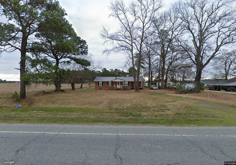
6591 Taylors Bridge Hwy Clinton, NC 28328
Estimated Value: $118,267 - $163,000
3
Beds
1
Bath
1,025
Sq Ft
$130/Sq Ft
Est. Value
About This Home
This home is located at 6591 Taylors Bridge Hwy, Clinton, NC 28328 and is currently estimated at $132,817, approximately $129 per square foot. 6591 Taylors Bridge Hwy is a home located in Sampson County with nearby schools including Union Elementary School, Union Intermediate School, and Union Middle School.
Ownership History
Date
Name
Owned For
Owner Type
Purchase Details
Closed on
Sep 15, 2006
Sold by
Mitchell Rosa Lee Williams and Mitchell Odell
Bought by
Murphy Faye D
Current Estimated Value
Home Financials for this Owner
Home Financials are based on the most recent Mortgage that was taken out on this home.
Original Mortgage
$58,800
Outstanding Balance
$35,138
Interest Rate
6.58%
Mortgage Type
New Conventional
Estimated Equity
$97,679
Create a Home Valuation Report for This Property
The Home Valuation Report is an in-depth analysis detailing your home's value as well as a comparison with similar homes in the area
Home Values in the Area
Average Home Value in this Area
Purchase History
| Date | Buyer | Sale Price | Title Company |
|---|---|---|---|
| Murphy Faye D | $73,500 | -- |
Source: Public Records
Mortgage History
| Date | Status | Borrower | Loan Amount |
|---|---|---|---|
| Open | Murphy Faye D | $58,800 |
Source: Public Records
Tax History Compared to Growth
Tax History
| Year | Tax Paid | Tax Assessment Tax Assessment Total Assessment is a certain percentage of the fair market value that is determined by local assessors to be the total taxable value of land and additions on the property. | Land | Improvement |
|---|---|---|---|---|
| 2025 | $701 | $89,883 | $10,557 | $79,326 |
| 2024 | $638 | $89,883 | $10,557 | $79,326 |
| 2023 | $538 | $58,155 | $9,180 | $48,975 |
| 2022 | $538 | $58,155 | $9,180 | $48,975 |
| 2021 | $538 | $58,155 | $9,180 | $48,975 |
| 2020 | $538 | $58,155 | $9,180 | $48,975 |
| 2019 | $538 | $58,155 | $0 | $0 |
| 2018 | $483 | $53,926 | $0 | $0 |
| 2017 | $483 | $53,926 | $0 | $0 |
| 2016 | $485 | $53,926 | $0 | $0 |
| 2015 | $485 | $53,926 | $0 | $0 |
| 2014 | $485 | $53,926 | $0 | $0 |
Source: Public Records
Map
Nearby Homes
- 2317 River Rd
- 1560 Register Sutton Rd
- 0 Waycross Rd
- 0 Kader Merritt Rd
- 00 Kader Merritt Rd
- Off of Reedsford Rd Unit LotWP001
- 0 Reedsford Rd
- 0 Hillside Ln
- 865 Cecil Odie Rd
- N11 0 1 Sr 1004
- 1539 Old Us 701 Hwy
- 75 Lisbon Bridge Rd
- 2153 Rowan Rd
- 3443 New Hope Church Rd
- 3833 N Carolina 903
- 2228 Indian Town Rd
- 2080 Indian Town Rd
- 393 Moltonville Rd
- 500 Rowan Rd
- 190 Halls Pond Rd
- 6611 Taylors Bridge Hwy
- 6564 Taylors Bridge Hwy
- 6658 Taylors Bridge Hwy
- 6688 Taylors Bridge Hwy
- 6401 Taylors Bridge Hwy
- 6820 Taylors Bridge Hwy
- 6315 Taylors Bridge Hwy
- 6255 Taylors Bridge Hwy
- 6219 Moseley Ave
- 6160 Moseley Ave
- 7031 Taylors Bridge Hwy
- 6100 Moseley Ave
- 6100 Moseley Ave
- 6151 Moseley Ave
- 1 River Rd
- 6714 Waycross Rd
- 51 River Rd
- 6109 Moseley Ave
- 6080 Moseley Ave
- 6040 Moseley Ave