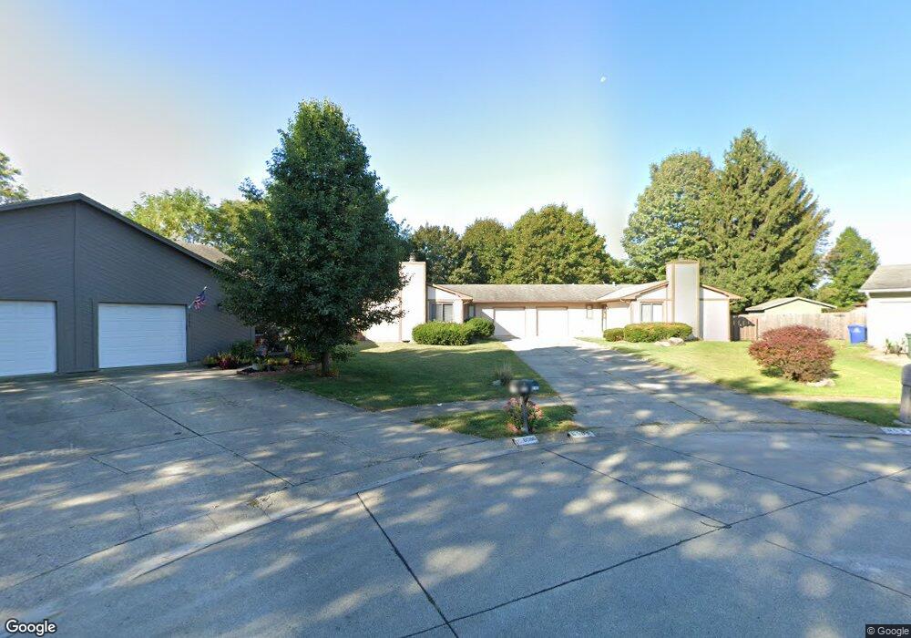
6595-6597 Farlook Ct Columbus, OH 43231
Northern Woods NeighborhoodEstimated Value: $357,612 - $439,000
4
Beds
2
Baths
2,152
Sq Ft
$186/Sq Ft
Est. Value
About This Home
This home is located at 6595-6597 Farlook Ct, Columbus, OH 43231 and is currently estimated at $401,153, approximately $186 per square foot. 6595-6597 Farlook Ct is a home located in Franklin County with nearby schools including Cherrington Elementary School, Genoa Middle School, and Westerville South High School.
Ownership History
Date
Name
Owned For
Owner Type
Purchase Details
Closed on
May 22, 2019
Sold by
Stegall Carrie A and Lucarell Carrie A
Bought by
Hammer Christopher and Wood Matthew
Current Estimated Value
Purchase Details
Closed on
Feb 23, 2007
Sold by
Donovan Karen J and Donovan Karen Jo
Bought by
Lucarell Carrie A
Home Financials for this Owner
Home Financials are based on the most recent Mortgage that was taken out on this home.
Original Mortgage
$189,150
Interest Rate
6.27%
Mortgage Type
Purchase Money Mortgage
Purchase Details
Closed on
Oct 12, 1993
Bought by
Donovan Karen J
Purchase Details
Closed on
Jul 18, 1991
Purchase Details
Closed on
May 25, 1988
Create a Home Valuation Report for This Property
The Home Valuation Report is an in-depth analysis detailing your home's value as well as a comparison with similar homes in the area
Home Values in the Area
Average Home Value in this Area
Purchase History
| Date | Buyer | Sale Price | Title Company |
|---|---|---|---|
| Hammer Christopher | $232,000 | None Available | |
| Lucarell Carrie A | $195,000 | The Talon Group | |
| Donovan Karen J | $122,900 | -- | |
| -- | $59,000 | -- | |
| -- | $120,000 | -- |
Source: Public Records
Mortgage History
| Date | Status | Borrower | Loan Amount |
|---|---|---|---|
| Previous Owner | Lucarell Carrie A | $189,150 |
Source: Public Records
Tax History Compared to Growth
Tax History
| Year | Tax Paid | Tax Assessment Tax Assessment Total Assessment is a certain percentage of the fair market value that is determined by local assessors to be the total taxable value of land and additions on the property. | Land | Improvement |
|---|---|---|---|---|
| 2024 | $4,988 | $97,720 | $29,400 | $68,320 |
| 2023 | $4,871 | $97,720 | $29,400 | $68,320 |
| 2022 | $5,301 | $81,200 | $12,250 | $68,950 |
| 2021 | $5,353 | $81,200 | $12,250 | $68,950 |
| 2020 | $5,485 | $81,200 | $12,250 | $68,950 |
| 2019 | $3,757 | $55,160 | $12,250 | $42,910 |
| 2018 | $3,701 | $55,160 | $12,250 | $42,910 |
| 2017 | $3,685 | $55,160 | $12,250 | $42,910 |
| 2016 | $3,720 | $50,790 | $13,440 | $37,350 |
| 2015 | $3,728 | $50,790 | $13,440 | $37,350 |
| 2014 | $3,731 | $50,790 | $13,440 | $37,350 |
| 2013 | $1,957 | $53,480 | $14,175 | $39,305 |
Source: Public Records
Map
Nearby Homes
- 465 W Schrock Rd
- 2721 Woodland Trail Dr Unit 2721
- 3066 Ravine Pointe Dr Unit 3066
- 2727 Patrick Ave
- 6658 Walbridge St
- 2981 Blendon Woods Blvd Unit 983
- 502 Foxtrail Cir E Unit 502
- 89 Lancelot Ln Unit 89
- 3038 Highcliff Ct
- 2623 Blendon Woods Blvd
- 2120 Willowick Dr Unit B
- 3070 Highcliff Ct Unit 3070
- 3068 Highcliff Ct Unit 3068
- 3001 Cooper Bluff Dr Unit 3001
- 2677-2679 Blossom Ave
- 25 King Arthur Blvd
- 2292 Laurelwood Dr Unit 2292L
- 2197 Bayfield Dr
- 95 Central Ave
- 6448 Sharon Woods Blvd Unit B
- 6595 Farlook Ct Unit 597
- 6586 Farlook Ct Unit 588
- 6610 Treeview Ct Unit 612
- 6610-6612 Treeview Ct
- 6603 Farlook Ct Unit 605
- 6618-6620 Treeview Ct
- 6618 Treeview Ct Unit 620
- 6592 Farlook Ct Unit 594
- 6609 Farlook Ct Unit 611
- 6615 Treeview Ct Unit 617
- 2785-2787 Cooper Ridge Rd
- 6598 Farlook Ct Unit 600
- 2785 Cooper Ridge Rd Unit 787
- 2771 Cooper Ridge Rd Unit 773
- 6626 Treeview Ct Unit 628
- 6623 Treeview Ct Unit 625
- 6587 Hawksway Ct Unit 589
- 6579 Hawksway Ct Unit 581
- 6633 Treeview Ct Unit 635
- 2812 Cooper Ridge Rd