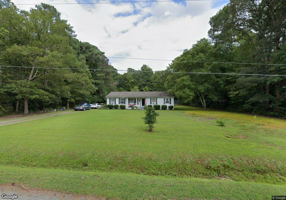
6597 Mcfarland Ln Gloucester, VA 23061
Gloucester South NeighborhoodEstimated Value: $286,000 - $323,000
3
Beds
2
Baths
1,568
Sq Ft
$191/Sq Ft
Est. Value
About This Home
This home is located at 6597 Mcfarland Ln, Gloucester, VA 23061 and is currently estimated at $299,040, approximately $190 per square foot. 6597 Mcfarland Ln is a home located in Gloucester County with nearby schools including Bethel Elementary School, Peasley Middle School, and Gloucester High School.
Ownership History
Date
Name
Owned For
Owner Type
Purchase Details
Closed on
Aug 28, 2025
Sold by
Mcfarland Harry Lewis and Mcfarland Glenda Forrest
Bought by
Lewis Ashton Hannah and Lowther Garrison Neal
Current Estimated Value
Home Financials for this Owner
Home Financials are based on the most recent Mortgage that was taken out on this home.
Original Mortgage
$270,750
Outstanding Balance
$270,750
Interest Rate
6.75%
Mortgage Type
New Conventional
Estimated Equity
$28,290
Create a Home Valuation Report for This Property
The Home Valuation Report is an in-depth analysis detailing your home's value as well as a comparison with similar homes in the area
Home Values in the Area
Average Home Value in this Area
Purchase History
| Date | Buyer | Sale Price | Title Company |
|---|---|---|---|
| Lewis Ashton Hannah | $285,000 | Old Republic National Title In |
Source: Public Records
Mortgage History
| Date | Status | Borrower | Loan Amount |
|---|---|---|---|
| Open | Lewis Ashton Hannah | $270,750 |
Source: Public Records
Tax History
| Year | Tax Paid | Tax Assessment Tax Assessment Total Assessment is a certain percentage of the fair market value that is determined by local assessors to be the total taxable value of land and additions on the property. | Land | Improvement |
|---|---|---|---|---|
| 2025 | $1,540 | $250,800 | $59,590 | $191,210 |
| 2024 | $1,540 | $250,800 | $59,590 | $191,210 |
| 2023 | $1,462 | $250,800 | $59,590 | $191,210 |
| 2022 | $1,458 | $201,150 | $44,990 | $156,160 |
| 2021 | $1,398 | $201,150 | $44,990 | $156,160 |
| 2020 | $1,398 | $201,150 | $44,990 | $156,160 |
| 2019 | $1,157 | $166,450 | $44,810 | $121,640 |
| 2017 | $1,157 | $166,450 | $44,810 | $121,640 |
| 2016 | $1,128 | $162,290 | $44,810 | $117,480 |
| 2015 | $1,104 | $184,700 | $38,000 | $146,700 |
| 2014 | $1,201 | $184,700 | $38,000 | $146,700 |
Source: Public Records
Map
Nearby Homes
- 6916 Deerfield Ln
- 6630 Valley Dr
- 7056 Hunters Pointe Dr
- 5731 Kings Ridge Rd
- 6663 Hickory Fork Rd
- 00 Hickory Fork Rd
- 4783 Stephens Way
- 4805 Stephens Way
- 4152 Hickory Fork Rd
- Lot 8 Stephens Way
- Lot 4 Stephens Way
- Lot 3 Stephens Way
- 4871 Stephens Way
- 00 Chestnut Fork Rd
- 6381 Bolling Brook Ln
- 5403 Jonquil Ln
- 10+AC Whitetail Dr
- 00 Whitetail Dr
- 6223 Ruth Dr
- 7397 Sinclair Way Unit 4-A-1
- 6590 Mcfarland Ln
- 3.02ac Mcfarland Ln
- 6570 Mcfarland Ln
- 6550 Mcfarland Ln
- 6538 Mcfarland Ln
- 6687 Mcfarland Ln
- 6528 Mcfarland Ln
- 7021 Belroi Rd
- 6493 Mcfarland Ln
- 6985 Belroi Rd
- 6965 Belroi Rd
- 6975 Belroi Rd
- 6541 Johnny Walker Ln
- 6998 Belroi Rd
- 7030 Belroi Rd
- 6992 Belroi Rd
- 6909 Belroi Rd
- 6735 Belroi Rd
- 6944 Belroi Rd
- 6932 Belroi Rd
Your Personal Tour Guide
Ask me questions while you tour the home.