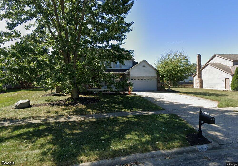
6598 Windstar Dr Westerville, OH 43082
Genoa NeighborhoodEstimated Value: $479,000 - $546,000
4
Beds
3
Baths
2,924
Sq Ft
$177/Sq Ft
Est. Value
About This Home
This home is located at 6598 Windstar Dr, Westerville, OH 43082 and is currently estimated at $516,190, approximately $176 per square foot. 6598 Windstar Dr is a home located in Delaware County with nearby schools including Alcott Elementary School, Genoa Middle School, and Westerville Central High School.
Ownership History
Date
Name
Owned For
Owner Type
Purchase Details
Closed on
Jul 22, 2016
Sold by
Nardone Michael D and Nardone Michael
Bought by
Nardone Michael D
Current Estimated Value
Home Financials for this Owner
Home Financials are based on the most recent Mortgage that was taken out on this home.
Original Mortgage
$224,348
Interest Rate
3.56%
Mortgage Type
New Conventional
Purchase Details
Closed on
Jun 20, 2008
Sold by
Dickey James K and Dickey Dawn T
Bought by
Nardone Michael and Nardone Aimee
Home Financials for this Owner
Home Financials are based on the most recent Mortgage that was taken out on this home.
Original Mortgage
$255,983
Interest Rate
5.96%
Mortgage Type
Purchase Money Mortgage
Create a Home Valuation Report for This Property
The Home Valuation Report is an in-depth analysis detailing your home's value as well as a comparison with similar homes in the area
Home Values in the Area
Average Home Value in this Area
Purchase History
| Date | Buyer | Sale Price | Title Company |
|---|---|---|---|
| Nardone Michael D | -- | None Available | |
| Nardone Michael | $263,900 | Landamerica |
Source: Public Records
Mortgage History
| Date | Status | Borrower | Loan Amount |
|---|---|---|---|
| Closed | Nardone Michael D | $224,348 | |
| Closed | Nardone Michael | $255,983 |
Source: Public Records
Tax History Compared to Growth
Tax History
| Year | Tax Paid | Tax Assessment Tax Assessment Total Assessment is a certain percentage of the fair market value that is determined by local assessors to be the total taxable value of land and additions on the property. | Land | Improvement |
|---|---|---|---|---|
| 2024 | $7,253 | $140,210 | $31,500 | $108,710 |
| 2023 | $7,110 | $140,210 | $31,500 | $108,710 |
| 2022 | $6,814 | $103,430 | $21,000 | $82,430 |
| 2021 | $6,882 | $103,430 | $21,000 | $82,430 |
| 2020 | $6,924 | $103,430 | $21,000 | $82,430 |
| 2019 | $6,218 | $89,180 | $17,500 | $71,680 |
| 2018 | $6,028 | $89,180 | $17,500 | $71,680 |
| 2017 | $5,984 | $84,070 | $15,120 | $68,950 |
| 2016 | $6,112 | $84,070 | $15,120 | $68,950 |
| 2015 | $6,063 | $84,070 | $15,120 | $68,950 |
| 2014 | $5,989 | $84,070 | $15,120 | $68,950 |
| 2013 | $5,764 | $81,410 | $15,120 | $66,290 |
Source: Public Records
Map
Nearby Homes
- 754 Kingsmead Rd Unit 18754
- 764 Mill Crossing Dr
- 6685 Tussic Street Rd
- 7568 Park Bend Ct
- 6618 Wild Rose Ln
- 705 N State St Unit 211
- 718 Sugar Ct
- 6410 Steinbeck Way
- 7268 Clancy Way
- 6460 Bromfield Dr
- 0 Paul Rd Unit 225001038
- 223 Dogwood Ln
- 267 Windemere Place
- 6082 Hilmar Dr
- 7663 Rolling Ridge Way
- 543 N State St
- 6086 Hemingway Place
- 114 Canterbrick Dr
- 8357 Danbridge Way
- 137 Abbeycross Ln
- 6592 Windstar Dr
- 6606 Windstar Dr
- 7171 Hilmar Dr
- 6554 Oak Shadow Dr
- 7187 Hilmar Dr
- 6618 Windstar Dr
- 6609 Windstar Dr
- 6595 Windstar Dr
- 6633 Windstar Dr
- 6630 Windstar Dr
- 6585 Oak Shadow Dr
- 6569 Oak Shadow Dr
- 6605 Oak Shadow Dr
- 6551 Oak Shadow Dr
- 6652 Hillegas Farm Dr
- 7180 Hilmar Dr
- 7166 Hilmar Dr
- 6655 Windstar Dr
- 783 Kingsmead Rd Unit 23783
- 6648 Windstar Dr