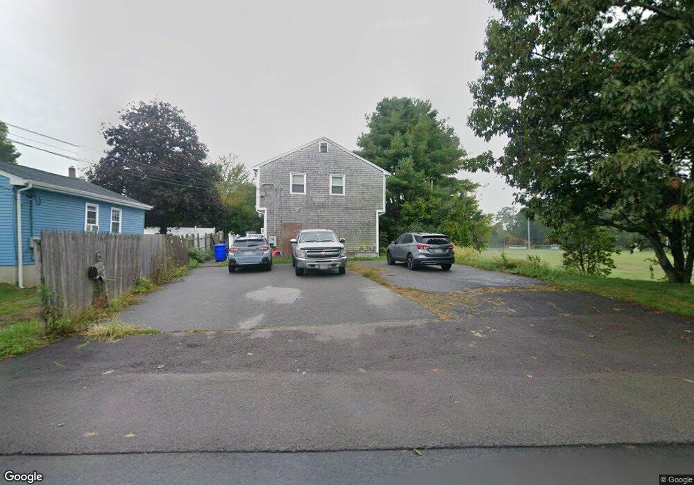
66 1st St Unit A Taunton, MA 02780
Estimated Value: $295,000 - $414,000
3
Beds
2
Baths
1,050
Sq Ft
$318/Sq Ft
Est. Value
About This Home
This home is located at 66 1st St Unit A, Taunton, MA 02780 and is currently estimated at $333,690, approximately $317 per square foot. 66 1st St Unit A is a home located in Bristol County with nearby schools including Mulcahey Elementary School, Taunton High School, and Our Lady of Lourdes School.
Ownership History
Date
Name
Owned For
Owner Type
Purchase Details
Closed on
Dec 15, 2011
Sold by
Mutual Fsb
Bought by
Leblanc Roger J
Current Estimated Value
Home Financials for this Owner
Home Financials are based on the most recent Mortgage that was taken out on this home.
Original Mortgage
$105,000
Outstanding Balance
$69,384
Interest Rate
3%
Mortgage Type
Purchase Money Mortgage
Estimated Equity
$264,306
Purchase Details
Closed on
Dec 1, 2006
Sold by
Feeney Heather S and Feeney James M
Bought by
Wheaton Donald P and Wheaton Nelia
Home Financials for this Owner
Home Financials are based on the most recent Mortgage that was taken out on this home.
Original Mortgage
$221,000
Interest Rate
6.36%
Mortgage Type
Purchase Money Mortgage
Purchase Details
Closed on
Apr 28, 2005
Sold by
Perry Carol R
Bought by
Feeney Heather S and Feeney James M
Home Financials for this Owner
Home Financials are based on the most recent Mortgage that was taken out on this home.
Original Mortgage
$194,750
Interest Rate
5.95%
Mortgage Type
Purchase Money Mortgage
Purchase Details
Closed on
Nov 1, 1991
Sold by
Bank Of Fall River Cp
Bought by
Murteira Amaro and Murteira Lina B
Purchase Details
Closed on
Sep 23, 1991
Sold by
Rand Curtis E
Bought by
Bk Of Fr Coop
Purchase Details
Closed on
Jun 9, 1989
Sold by
First Rt
Bought by
Rand Curtis E
Create a Home Valuation Report for This Property
The Home Valuation Report is an in-depth analysis detailing your home's value as well as a comparison with similar homes in the area
Home Values in the Area
Average Home Value in this Area
Purchase History
| Date | Buyer | Sale Price | Title Company |
|---|---|---|---|
| Leblanc Roger J | $105,000 | -- | |
| Leblanc Roger J | $105,000 | -- | |
| Wheaton Donald P | $221,000 | -- | |
| Wheaton Donald P | $221,000 | -- | |
| Feeney Heather S | $205,000 | -- | |
| Feeney Heather S | $205,000 | -- | |
| Murteira Amaro | $52,500 | -- | |
| Bk Of Fr Coop | $60,000 | -- | |
| Rand Curtis E | $115,000 | -- |
Source: Public Records
Mortgage History
| Date | Status | Borrower | Loan Amount |
|---|---|---|---|
| Open | Leblanc Roger J | $105,000 | |
| Closed | Rand Curtis E | $105,000 | |
| Previous Owner | Wheaton Donald P | $221,000 | |
| Previous Owner | Feeney Heather S | $194,750 |
Source: Public Records
Tax History Compared to Growth
Tax History
| Year | Tax Paid | Tax Assessment Tax Assessment Total Assessment is a certain percentage of the fair market value that is determined by local assessors to be the total taxable value of land and additions on the property. | Land | Improvement |
|---|---|---|---|---|
| 2025 | $2,365 | $216,200 | $0 | $216,200 |
| 2024 | $2,306 | $206,100 | $0 | $206,100 |
| 2023 | $2,350 | $195,000 | $0 | $195,000 |
| 2022 | $2,328 | $176,600 | $0 | $176,600 |
| 2021 | $2,440 | $171,800 | $0 | $171,800 |
| 2020 | $2,369 | $159,400 | $0 | $159,400 |
| 2019 | $2,512 | $159,400 | $0 | $159,400 |
| 2018 | $2,460 | $156,500 | $0 | $156,500 |
| 2017 | $2,250 | $143,200 | $0 | $143,200 |
| 2016 | $2,173 | $138,600 | $0 | $138,600 |
| 2015 | $2,005 | $133,600 | $0 | $133,600 |
| 2014 | $1,952 | $133,600 | $0 | $133,600 |
Source: Public Records
Map
Nearby Homes
- 4 Parkin Ct
- 450 Somerset Ave Unit 2-7
- 450 Somerset Ave Unit 6-6
- 16 Clinton St
- 72 Barnum St
- 278 Cohannet St
- 132 Winthrop St
- 98 Winthrop St
- 6 Southeast St
- 46 Harrison St Unit 4
- 215 High St Unit 21
- 215 High St Unit 20
- 19 Mason St
- 125 Highland St Unit 103
- 39 Myrtle St
- 6 W Summer St
- 0, M64 L51 Knapp St
- 0 M64 L39 Knapp St
- 0, M64 L49 Knapp St
- 0, M64 L50 Knapp St