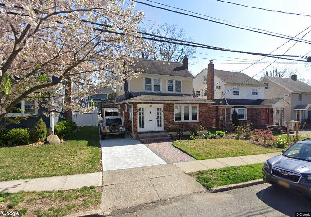
66 Bar Beach Rd Port Washington, NY 11050
Estimated Value: $1,056,435 - $1,073,000
--
Bed
1
Bath
1,365
Sq Ft
$780/Sq Ft
Est. Value
About This Home
This home is located at 66 Bar Beach Rd, Port Washington, NY 11050 and is currently estimated at $1,064,718, approximately $780 per square foot. 66 Bar Beach Rd is a home located in Nassau County with nearby schools including Carrie Palmer Weber Middle School, Paul D. Schreiber Senior High School, and Happy Montessori School.
Ownership History
Date
Name
Owned For
Owner Type
Purchase Details
Closed on
Jan 20, 2005
Sold by
Madover Jennifer
Bought by
Gerbasi Richard
Current Estimated Value
Purchase Details
Closed on
Jun 18, 2003
Sold by
Adams Denise
Bought by
Madover Jennifer
Purchase Details
Closed on
Mar 27, 2002
Purchase Details
Closed on
Oct 7, 1997
Sold by
Debruin Robert
Bought by
Shunick Gregory and Adams Denise
Create a Home Valuation Report for This Property
The Home Valuation Report is an in-depth analysis detailing your home's value as well as a comparison with similar homes in the area
Home Values in the Area
Average Home Value in this Area
Purchase History
| Date | Buyer | Sale Price | Title Company |
|---|---|---|---|
| Gerbasi Richard | $613,000 | -- | |
| Madover Jennifer | $572,000 | -- | |
| -- | -- | -- | |
| Shunick Gregory | $292,500 | -- |
Source: Public Records
Tax History Compared to Growth
Tax History
| Year | Tax Paid | Tax Assessment Tax Assessment Total Assessment is a certain percentage of the fair market value that is determined by local assessors to be the total taxable value of land and additions on the property. | Land | Improvement |
|---|---|---|---|---|
| 2025 | $18,564 | $784 | $362 | $422 |
| 2024 | $5,858 | $784 | $362 | $422 |
| 2023 | $17,433 | $784 | $362 | $422 |
| 2022 | $17,433 | $784 | $362 | $422 |
| 2021 | $17,755 | $765 | $353 | $412 |
| 2020 | $17,640 | $1,228 | $945 | $283 |
| 2019 | $16,222 | $1,228 | $945 | $283 |
| 2018 | $15,161 | $1,228 | $0 | $0 |
| 2017 | $8,459 | $1,228 | $945 | $283 |
| 2016 | $13,446 | $1,228 | $945 | $283 |
| 2015 | $4,852 | $1,228 | $945 | $283 |
| 2014 | $4,852 | $1,228 | $945 | $283 |
| 2013 | $4,560 | $1,228 | $945 | $283 |
Source: Public Records
Map
Nearby Homes
- 70 Highland Ave
- 108 Highland Ave
- 32 Fairview Ave
- 11 Park Ave
- 8 Fairview Ave
- 19 Concord Rd
- 41 Birch St
- 21 Beechwood Ave
- 92 W Overlook
- 155 Eagle Crest
- 22 N Maryland Ave
- 100 Harbor View Dr Unit 423
- 100 Harbor View Dr Unit 439
- 34 Davis Rd
- 1 Hillcrest Rd
- 21A Neulist Ave
- 22 Franklin Ave
- 35 Evergreen Ave
- 57 Beacon Hill Rd
- 18 Neulist Ave