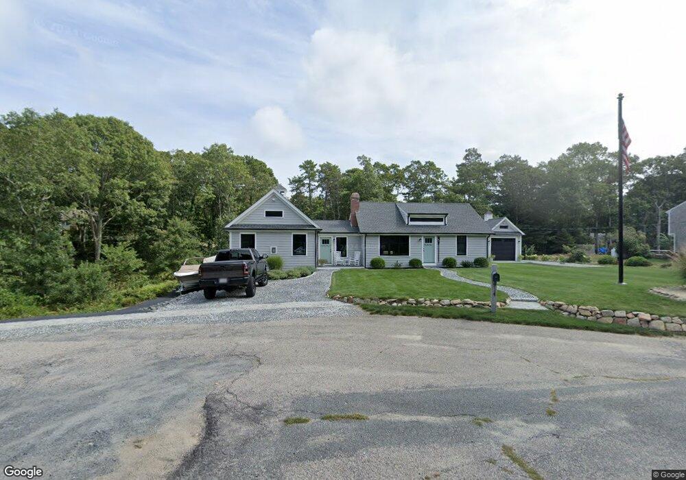
66 Captain Walsh Rd Dennis, MA 02638
East Dennis NeighborhoodEstimated Value: $738,000 - $903,000
2
Beds
1
Bath
650
Sq Ft
$1,277/Sq Ft
Est. Value
About This Home
This home is located at 66 Captain Walsh Rd, Dennis, MA 02638 and is currently estimated at $830,241, approximately $1,277 per square foot. 66 Captain Walsh Rd is a home located in Barnstable County with nearby schools including Dennis-Yarmouth Regional High School.
Ownership History
Date
Name
Owned For
Owner Type
Purchase Details
Closed on
Nov 21, 2017
Sold by
Abele Richard W
Bought by
Scaduto John A and Scaduto Marcy L
Current Estimated Value
Home Financials for this Owner
Home Financials are based on the most recent Mortgage that was taken out on this home.
Original Mortgage
$190,000
Outstanding Balance
$159,211
Interest Rate
3.85%
Mortgage Type
New Conventional
Estimated Equity
$671,030
Purchase Details
Closed on
May 22, 2012
Sold by
Lynch Cheryl A
Bought by
Lynch Cheryl A
Purchase Details
Closed on
Feb 28, 1997
Sold by
Waddington Albert A
Bought by
Abele Richard W
Create a Home Valuation Report for This Property
The Home Valuation Report is an in-depth analysis detailing your home's value as well as a comparison with similar homes in the area
Home Values in the Area
Average Home Value in this Area
Purchase History
| Date | Buyer | Sale Price | Title Company |
|---|---|---|---|
| Scaduto John A | $285,000 | -- | |
| Lynch Cheryl A | -- | -- | |
| Abele Richard W | $86,000 | -- |
Source: Public Records
Mortgage History
| Date | Status | Borrower | Loan Amount |
|---|---|---|---|
| Open | Scaduto John A | $190,000 |
Source: Public Records
Tax History Compared to Growth
Tax History
| Year | Tax Paid | Tax Assessment Tax Assessment Total Assessment is a certain percentage of the fair market value that is determined by local assessors to be the total taxable value of land and additions on the property. | Land | Improvement |
|---|---|---|---|---|
| 2025 | $3,905 | $901,900 | $164,600 | $737,300 |
| 2024 | $3,545 | $807,500 | $158,300 | $649,200 |
| 2023 | $3,460 | $740,800 | $143,900 | $596,900 |
| 2022 | $3,345 | $597,400 | $144,000 | $453,400 |
| 2021 | $3,500 | $580,400 | $141,200 | $439,200 |
| 2020 | $3,051 | $500,200 | $141,200 | $359,000 |
| 2019 | $2,215 | $359,000 | $138,400 | $220,600 |
| 2018 | $1,438 | $226,800 | $118,600 | $108,200 |
| 2017 | $1,373 | $223,300 | $118,600 | $104,700 |
| 2016 | $1,439 | $220,300 | $131,800 | $88,500 |
| 2015 | $1,410 | $220,300 | $131,800 | $88,500 |
| 2014 | $1,399 | $220,300 | $131,800 | $88,500 |
Source: Public Records
Map
Nearby Homes
- 32 Captain Walsh Dr
- 31 Acorn Rd
- 43 Barque Cir
- 15 Trudy Cir
- 1146 Massachusetts 134 Unit 4C
- 6 Match Point
- 15 Captain Jud Rd
- 16 Uncle Stanleys Way
- 102 Prince Way
- 35 Crown Grant Dr
- 15 Sallys Way
- 10 Devonshire Ln
- 42 Agnes Rd
- 6 Thomas Ct
- 15 Signal Hill Dr
- 4 Ebb Rd
- 268 Main St
- 60 Covey Dr
- 46 Jays Dr
- 46 Jays Dr
- 60 Captain Walsh Rd
- 60 Captain Walsh Dr
- 61 Morning Glory Dr
- 55 Morning Glory Dr
- 59 Captain Walsh Dr
- 59 Captain Walsh Rd
- 53 Captain Walsh Rd
- 54 Captain Walsh Rd
- 54 Captain Walsh Dr
- 47 Morning Glory Dr
- 69 Morning Glory Dr
- 47 Captain Walsh Rd
- 58 Morning Glory Dr
- 52 Morning Glory Dr
- 64 Morning Glory Dr
- 46 Captain Walsh Rd
- 39 Morning Glory Dr
- 46 Captain Walsh Dr
- 46 Morning Glory Dr
- 51 Captain Walsh Rd