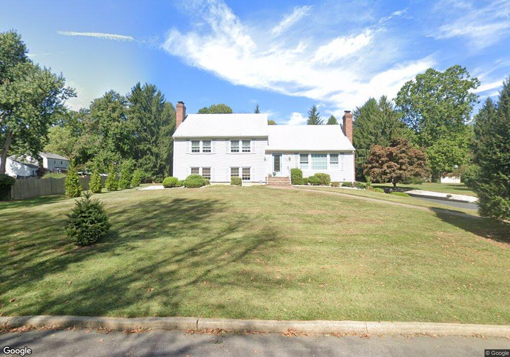
66 Dale Rd Middletown, NJ 07748
New Monmouth NeighborhoodEstimated Value: $829,143 - $977,000
3
Beds
2
Baths
2,296
Sq Ft
$399/Sq Ft
Est. Value
About This Home
This home is located at 66 Dale Rd, Middletown, NJ 07748 and is currently estimated at $916,036, approximately $398 per square foot. 66 Dale Rd is a home located in Monmouth County with nearby schools including Nut Swamp Elementary School, Thompson Middle School, and Middletown - South High School.
Create a Home Valuation Report for This Property
The Home Valuation Report is an in-depth analysis detailing your home's value as well as a comparison with similar homes in the area
Home Values in the Area
Average Home Value in this Area
Tax History Compared to Growth
Tax History
| Year | Tax Paid | Tax Assessment Tax Assessment Total Assessment is a certain percentage of the fair market value that is determined by local assessors to be the total taxable value of land and additions on the property. | Land | Improvement |
|---|---|---|---|---|
| 2025 | $11,584 | $901,100 | $596,800 | $304,300 |
| 2024 | $13,068 | $704,200 | $405,500 | $298,700 |
| 2023 | $13,068 | $751,900 | $455,600 | $296,300 |
| 2022 | $11,619 | $645,800 | $363,700 | $282,100 |
| 2021 | $11,619 | $604,300 | $345,700 | $258,600 |
| 2020 | $12,520 | $585,600 | $332,800 | $252,800 |
| 2019 | $12,414 | $587,800 | $332,800 | $255,000 |
| 2018 | $12,387 | $571,600 | $332,800 | $238,800 |
| 2017 | $12,058 | $567,700 | $332,800 | $234,900 |
| 2016 | $11,335 | $531,900 | $322,800 | $209,100 |
| 2015 | $10,906 | $510,600 | $302,800 | $207,800 |
| 2014 | $8,966 | $409,600 | $292,800 | $116,800 |
Source: Public Records
Map
Nearby Homes
- 185 Ballantine Rd
- 234 Borden Rd
- 7 Cormorant Dr
- 20 Cormorant Dr
- 83 Green Meadow Blvd
- 911 Middletown Lincroft Rd
- 246 Sunnyside Rd
- 17 Terry Ln
- 111 Crawfords Corner Rd
- 86 Stillwell Rd
- 74 Fish Hawk Dr
- 7 Mccampbell Rd
- 1476 W Front St
- 17 Spalding Dr
- 45 Galloping Hill Cir
- 93 Wallace Rd
- 1497 W Front St
- 23 Stratford Ln Unit 483
- 4 E Parkway Place
- 11 Jansky Dr