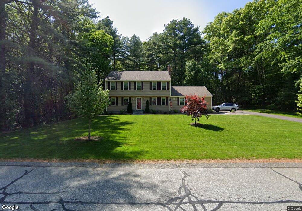
66 Deanna Dr Uxbridge, MA 01569
Estimated Value: $627,000 - $693,000
3
Beds
2
Baths
2,232
Sq Ft
$291/Sq Ft
Est. Value
About This Home
This home is located at 66 Deanna Dr, Uxbridge, MA 01569 and is currently estimated at $650,293, approximately $291 per square foot. 66 Deanna Dr is a home located in Worcester County with nearby schools including Uxbridge High School, Our Lady of the Valley Regional School, and Whitinsville Christian School.
Ownership History
Date
Name
Owned For
Owner Type
Purchase Details
Closed on
Jul 30, 1993
Sold by
Walunas Ronald M and Walunas Joan
Bought by
Auciello Michael J and Auciello Debra
Current Estimated Value
Home Financials for this Owner
Home Financials are based on the most recent Mortgage that was taken out on this home.
Original Mortgage
$126,500
Interest Rate
7.32%
Mortgage Type
Purchase Money Mortgage
Create a Home Valuation Report for This Property
The Home Valuation Report is an in-depth analysis detailing your home's value as well as a comparison with similar homes in the area
Home Values in the Area
Average Home Value in this Area
Purchase History
| Date | Buyer | Sale Price | Title Company |
|---|---|---|---|
| Auciello Michael J | $162,000 | -- |
Source: Public Records
Mortgage History
| Date | Status | Borrower | Loan Amount |
|---|---|---|---|
| Open | Auciello Michael J | $125,000 | |
| Closed | Auciello Michael J | $30,000 | |
| Closed | Auciello Michael J | $126,500 |
Source: Public Records
Tax History Compared to Growth
Tax History
| Year | Tax Paid | Tax Assessment Tax Assessment Total Assessment is a certain percentage of the fair market value that is determined by local assessors to be the total taxable value of land and additions on the property. | Land | Improvement |
|---|---|---|---|---|
| 2025 | $67 | $514,500 | $156,200 | $358,300 |
| 2024 | $6,393 | $494,800 | $148,400 | $346,400 |
| 2023 | $6,109 | $437,900 | $128,100 | $309,800 |
| 2022 | $5,521 | $364,200 | $112,400 | $251,800 |
| 2021 | $5,724 | $361,800 | $110,000 | $251,800 |
| 2020 | $5,429 | $324,300 | $108,500 | $215,800 |
| 2019 | $5,379 | $310,000 | $108,500 | $201,500 |
| 2018 | $5,184 | $301,900 | $108,500 | $193,400 |
| 2017 | $4,934 | $290,900 | $106,200 | $184,700 |
| 2016 | $5,122 | $291,500 | $97,600 | $193,900 |
| 2015 | $5,011 | $288,000 | $97,600 | $190,400 |
Source: Public Records
Map
Nearby Homes
- 304 W River Rd
- 390 Hartford Ave E
- 41 Pouts Ln
- 440 Quaker St
- 29 Pouts Ln Unit 29
- 46 Pouts Ln Unit 46
- 38 William Ward St
- 69 Pouts Ln
- 45 Nature View Dr
- 94 Carrington Ln Unit 94
- 55 Hartford Ave W
- 50 Carrington Ln
- 0 Louis St
- 110 Northbridge Rd
- next 191 Mendon Rd
- 37 Elizabeth St
- 334 Mendon Rd
- 46 Capron St
- 7 Wall St
- 19 Harvard St