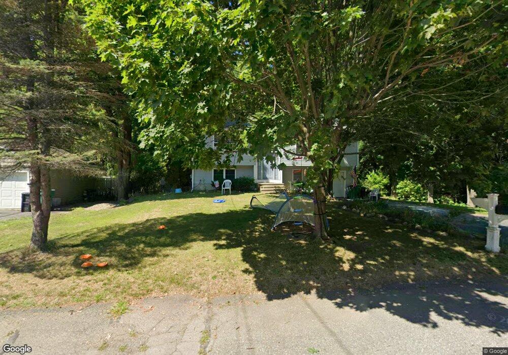
66 Donald Tennant Cir North Attleboro, MA 02760
North Attleboro NeighborhoodEstimated Value: $530,432 - $672,000
3
Beds
2
Baths
1,092
Sq Ft
$534/Sq Ft
Est. Value
About This Home
This home is located at 66 Donald Tennant Cir, North Attleboro, MA 02760 and is currently estimated at $583,608, approximately $534 per square foot. 66 Donald Tennant Cir is a home located in Bristol County with nearby schools including North Attleboro High School, Cadence Academy Preschool - North Attleborough, and Bishop Feehan High School.
Ownership History
Date
Name
Owned For
Owner Type
Purchase Details
Closed on
Nov 18, 2011
Sold by
Ranker Richard A and Ranker Dana M
Bought by
Jeffrey Ra J
Current Estimated Value
Purchase Details
Closed on
Nov 30, 1994
Sold by
Cerrone Bldrs & Dev
Bought by
Ranker Richard A and Ranker Dana M
Home Financials for this Owner
Home Financials are based on the most recent Mortgage that was taken out on this home.
Original Mortgage
$127,000
Interest Rate
8.81%
Mortgage Type
Purchase Money Mortgage
Purchase Details
Closed on
Nov 19, 1993
Sold by
Mollins Katharine A
Bought by
Cerrone Bldrs & Dev and Cerrone Donald
Create a Home Valuation Report for This Property
The Home Valuation Report is an in-depth analysis detailing your home's value as well as a comparison with similar homes in the area
Home Values in the Area
Average Home Value in this Area
Purchase History
| Date | Buyer | Sale Price | Title Company |
|---|---|---|---|
| Jeffrey Ra J | $275,555 | -- | |
| Ranker Richard A | $144,790 | -- | |
| Cerrone Bldrs & Dev | $40,000 | -- |
Source: Public Records
Mortgage History
| Date | Status | Borrower | Loan Amount |
|---|---|---|---|
| Previous Owner | Cerrone Bldrs & Dev | $125,000 | |
| Previous Owner | Cerrone Bldrs & Dev | $127,000 |
Source: Public Records
Tax History Compared to Growth
Tax History
| Year | Tax Paid | Tax Assessment Tax Assessment Total Assessment is a certain percentage of the fair market value that is determined by local assessors to be the total taxable value of land and additions on the property. | Land | Improvement |
|---|---|---|---|---|
| 2025 | $5,368 | $455,300 | $137,500 | $317,800 |
| 2024 | $5,169 | $447,900 | $137,500 | $310,400 |
| 2023 | $5,368 | $419,700 | $137,500 | $282,200 |
| 2022 | $5,155 | $370,100 | $137,500 | $232,600 |
| 2021 | $5,007 | $350,900 | $137,500 | $213,400 |
| 2020 | $3,474 | $339,100 | $137,500 | $201,600 |
| 2019 | $4,684 | $328,900 | $125,000 | $203,900 |
| 2018 | $3,064 | $312,000 | $125,000 | $187,000 |
| 2017 | $3,967 | $300,100 | $125,000 | $175,100 |
| 2016 | $3,770 | $285,200 | $138,900 | $146,300 |
| 2015 | $3,511 | $267,200 | $138,900 | $128,300 |
| 2014 | -- | $247,200 | $121,900 | $125,300 |
Source: Public Records
Map
Nearby Homes
- 196 Donald Tennant Cir
- 115 Westfield Dr
- 11 Landry Ave
- 57 Vine St
- 11 Buckthorn Ln
- Lot 2 Jeffrey Dr
- Lot 5 Jeffrey Dr
- 5 Old Wood Rd
- 116 George St
- 255 Mckeon Dr
- 546 Towne St
- 12 Houde St
- 150 Gilbert St
- 40 Natalie Dr
- 24 Maverick Dr
- 20 Sperry Ln
- 835 Mt Hope St Unit 39
- 21 Shady Ln
- 28 Messenger St
- 9 Sunnyside Dr Unit 9
- 56 Donald Tennant Cir
- 70 Donald Tennant Cir
- 48 Donald Tennant Cir
- 53 Donald Tennant Cir
- 84 Donald Tennant Cir
- 190 Donald Tennant Cir
- 47 Donald Tennant Cir
- 42 Donald Tennant Cir
- 73 Donald Tennant Cir
- 191 Donald Tennant Cir
- 39 Donald Tennant Cir
- 85 Donald Tennant Cir
- 34 Donald Tennant Cir
- 90 Donald Tennant Cir
- 199 Donald Tennant Cir
- 33 Donald Tennant Cir
- 98 Donald Tennant Cir
- 91 Donald Tennant Cir
- 206 Donald Tennant Cir
- 206 Donald Tennant Cir