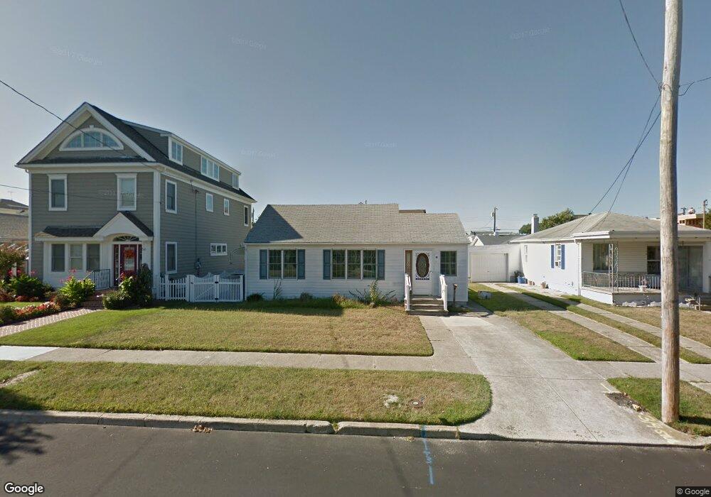
66 E Station Rd Ocean City, NJ 08226
Estimated Value: $1,190,764 - $1,798,000
--
Bed
--
Bath
794
Sq Ft
$1,833/Sq Ft
Est. Value
About This Home
This home is located at 66 E Station Rd, Ocean City, NJ 08226 and is currently estimated at $1,455,691, approximately $1,833 per square foot. 66 E Station Rd is a home located in Cape May County with nearby schools including Ocean City Primary School, Ocean City Intermediate School, and Ocean City High School.
Ownership History
Date
Name
Owned For
Owner Type
Purchase Details
Closed on
Feb 10, 2003
Sold by
O'Hare Patrick J
Bought by
Schramm William M and Schramm Joan
Current Estimated Value
Home Financials for this Owner
Home Financials are based on the most recent Mortgage that was taken out on this home.
Original Mortgage
$150,000
Outstanding Balance
$63,913
Interest Rate
5.88%
Estimated Equity
$1,391,778
Purchase Details
Closed on
May 22, 2000
Sold by
Rogers Patricia A
Bought by
O'Hare Patrick J
Home Financials for this Owner
Home Financials are based on the most recent Mortgage that was taken out on this home.
Original Mortgage
$60,000
Interest Rate
8.1%
Purchase Details
Closed on
Sep 17, 1997
Sold by
Quaid Joseph
Bought by
Rogers Patricia
Home Financials for this Owner
Home Financials are based on the most recent Mortgage that was taken out on this home.
Original Mortgage
$92,000
Interest Rate
7.38%
Create a Home Valuation Report for This Property
The Home Valuation Report is an in-depth analysis detailing your home's value as well as a comparison with similar homes in the area
Home Values in the Area
Average Home Value in this Area
Purchase History
| Date | Buyer | Sale Price | Title Company |
|---|---|---|---|
| Schramm William M | $280,000 | -- | |
| O'Hare Patrick J | $180,000 | -- | |
| Rogers Patricia | $115,000 | -- |
Source: Public Records
Mortgage History
| Date | Status | Borrower | Loan Amount |
|---|---|---|---|
| Open | Schramm William M | $150,000 | |
| Previous Owner | O'Hare Patrick J | $60,000 | |
| Previous Owner | Rogers Patricia | $92,000 |
Source: Public Records
Tax History Compared to Growth
Tax History
| Year | Tax Paid | Tax Assessment Tax Assessment Total Assessment is a certain percentage of the fair market value that is determined by local assessors to be the total taxable value of land and additions on the property. | Land | Improvement |
|---|---|---|---|---|
| 2025 | $9,599 | $855,500 | $338,600 | $516,900 |
| 2024 | $9,599 | $855,500 | $338,600 | $516,900 |
| 2023 | $9,162 | $855,500 | $338,600 | $516,900 |
| 2022 | $8,803 | $855,500 | $338,600 | $516,900 |
| 2021 | $6,382 | $855,500 | $338,600 | $516,900 |
| 2020 | $8,367 | $855,500 | $338,600 | $516,900 |
| 2019 | $8,037 | $831,100 | $338,600 | $492,500 |
| 2018 | $7,962 | $831,100 | $338,600 | $492,500 |
| 2017 | $7,837 | $831,100 | $338,600 | $492,500 |
| 2016 | $3,071 | $338,600 | $338,600 | $0 |
| 2015 | $3,030 | $338,600 | $338,600 | $0 |
| 2014 | $2,986 | $338,600 | $338,600 | $0 |
Source: Public Records
Map
Nearby Homes
- 312 W Surf Rd
- 51 Simpson Rd Unit 2
- 112 W Atlantic Blvd
- 336 W Surf Rd
- 3408 Haven Ave Unit 301
- 3408 Haven Ave Unit 223
- 24 Haven Ave
- 50 Wesley Rd
- 70 Bay Rd
- 211 W Seaspray Rd
- 114 Wesley Rd
- 230 W Seaspray Rd
- 57 Central Ave
- 112 Pinnacle Rd
- 118 Pinnacle Rd
- 703 North St Unit 5
- 129 Simpson Ave Unit 1
- 510 Gardens Pkwy
- 301 Wesley Rd
- 132 Simpson Ave
- 56 E Station Rd
- 72 E Station Rd
- 21 Sindia Rd
- 46 E Station Rd
- 82 E Station Rd
- 25 Sindia Rd
- 44 E Station Rd
- 17 Sindia Rd
- 40 E Station Rd Unit 42
- 53 E Station Rd
- 61 E Station Rd
- 65 E Station Rd
- 234 Battersea Rd
- 29 Sindia Rd
- 45 E Station Rd
- 51 E Station Rd Unit 2
- 51 E Station Rd Unit 2nd floor
- 69 E Station Rd
- 22 Sindia Rd
- 26 Sindia Rd