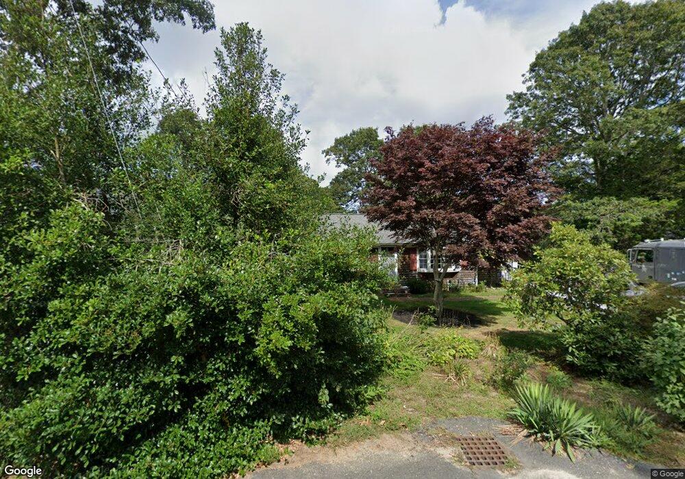
66 Elizabeth Ln South Dennis, MA 02660
South Dennis NeighborhoodEstimated Value: $507,000 - $539,000
2
Beds
1
Bath
1,001
Sq Ft
$528/Sq Ft
Est. Value
About This Home
This home is located at 66 Elizabeth Ln, South Dennis, MA 02660 and is currently estimated at $528,960, approximately $528 per square foot. 66 Elizabeth Ln is a home located in Barnstable County with nearby schools including Dennis-Yarmouth Regional High School.
Ownership History
Date
Name
Owned For
Owner Type
Purchase Details
Closed on
Aug 17, 1994
Sold by
Karen A Corp
Bought by
Norton Margo K
Current Estimated Value
Home Financials for this Owner
Home Financials are based on the most recent Mortgage that was taken out on this home.
Original Mortgage
$640,000
Interest Rate
8.61%
Mortgage Type
Purchase Money Mortgage
Create a Home Valuation Report for This Property
The Home Valuation Report is an in-depth analysis detailing your home's value as well as a comparison with similar homes in the area
Home Values in the Area
Average Home Value in this Area
Purchase History
| Date | Buyer | Sale Price | Title Company |
|---|---|---|---|
| Norton Margo K | $80,000 | -- |
Source: Public Records
Mortgage History
| Date | Status | Borrower | Loan Amount |
|---|---|---|---|
| Closed | Norton Margo K | $640,000 |
Source: Public Records
Tax History Compared to Growth
Tax History
| Year | Tax Paid | Tax Assessment Tax Assessment Total Assessment is a certain percentage of the fair market value that is determined by local assessors to be the total taxable value of land and additions on the property. | Land | Improvement |
|---|---|---|---|---|
| 2025 | $2,006 | $463,200 | $131,100 | $332,100 |
| 2024 | $1,878 | $427,900 | $126,100 | $301,800 |
| 2023 | $1,817 | $389,000 | $114,600 | $274,400 |
| 2022 | $1,782 | $318,300 | $114,700 | $203,600 |
| 2021 | $1,693 | $280,700 | $112,500 | $168,200 |
| 2020 | $1,617 | $265,000 | $112,500 | $152,500 |
| 2019 | $1,596 | $258,700 | $121,300 | $137,400 |
| 2018 | $1,458 | $229,900 | $105,000 | $124,900 |
| 2017 | $1,369 | $222,600 | $105,000 | $117,600 |
| 2016 | $1,256 | $192,400 | $110,200 | $82,200 |
| 2015 | $1,231 | $192,400 | $110,200 | $82,200 |
| 2014 | $1,248 | $196,600 | $94,500 | $102,100 |
Source: Public Records
Map
Nearby Homes
- 17 Margate Ln
- 11 Uncle Stanleys Way
- 15 Captain Jud Rd
- 153 Bayridge Dr
- 4 Ebb Rd
- 10 Joanne Dr
- 17 Fairmount Rd
- 17 Fairmount Rd
- 25 Skerry Rd
- 7 Vinland Dr
- 13 Covey Dr
- 118 Driftwood Ln
- 1 Norseman Dr
- 129 Driftwood Ln
- 111 Merchant Ave
- 32 Captain Walsh Dr
- 62 Old Fish House Rd
- 6 Hawthorn St
- 6 Nimble Hill Dr
- 4 Old Colony Way
- 70 Elizabeth Ln
- 62 Elizabeth Ln
- 57 Uncle Bills Way
- 53 Uncle Bills Way
- 13 Bob White Ln
- 58 Elizabeth Ln
- 72 Uncle Bill's
- 74 Elizabeth Ln
- 67 Uncle Bills Way
- 12 Henrys Way
- 14 Bob White Ln
- 49 Uncle Bills Way
- 60 Uncle Bills Way
- 56 Uncle Bills Way
- 54 Elizabeth Ln
- 64 Uncle Bills Way
- 78 Elizabeth Ln
- 8 Henrys Way
- 52 Uncle Bills Way
- 10 Bob White Ln