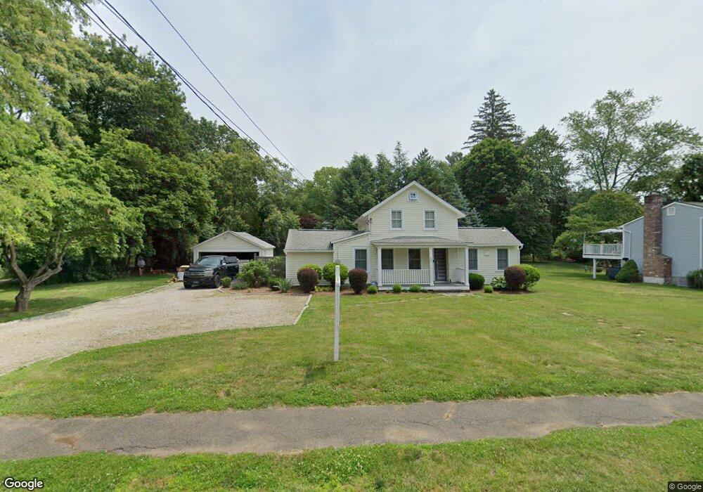
66 Grumman Ave Norwalk, CT 06851
Cranbury NeighborhoodEstimated Value: $963,000 - $1,043,000
4
Beds
3
Baths
2,621
Sq Ft
$382/Sq Ft
Est. Value
About This Home
This home is located at 66 Grumman Ave, Norwalk, CT 06851 and is currently estimated at $1,001,196, approximately $381 per square foot. 66 Grumman Ave is a home located in Fairfield County with nearby schools including Cranbury Elementary School, West Rocks Middle School, and Norwalk High School.
Ownership History
Date
Name
Owned For
Owner Type
Purchase Details
Closed on
Oct 26, 2001
Sold by
Turgeon Ghislain and Simard Carole
Bought by
Cormier Paul and Cormier Rosalind
Current Estimated Value
Home Financials for this Owner
Home Financials are based on the most recent Mortgage that was taken out on this home.
Original Mortgage
$412,400
Interest Rate
6.86%
Purchase Details
Closed on
Dec 27, 1990
Sold by
Whaley Joan
Bought by
Demelis Guildo
Create a Home Valuation Report for This Property
The Home Valuation Report is an in-depth analysis detailing your home's value as well as a comparison with similar homes in the area
Home Values in the Area
Average Home Value in this Area
Purchase History
| Date | Buyer | Sale Price | Title Company |
|---|---|---|---|
| Cormier Paul | $515,500 | -- | |
| Cormier Paul | $515,500 | -- | |
| Demelis Guildo | $315,000 | -- |
Source: Public Records
Mortgage History
| Date | Status | Borrower | Loan Amount |
|---|---|---|---|
| Open | Demelis Guildo | $400,000 | |
| Closed | Demelis Guildo | $459,000 | |
| Closed | Demelis Guildo | $412,400 |
Source: Public Records
Tax History
| Year | Tax Paid | Tax Assessment Tax Assessment Total Assessment is a certain percentage of the fair market value that is determined by local assessors to be the total taxable value of land and additions on the property. | Land | Improvement |
|---|---|---|---|---|
| 2025 | $13,413 | $564,980 | $221,500 | $343,480 |
| 2024 | $13,206 | $564,980 | $221,500 | $343,480 |
| 2023 | $10,945 | $438,400 | $176,550 | $261,850 |
| 2022 | $10,773 | $438,400 | $176,550 | $261,850 |
| 2021 | $9,167 | $438,400 | $176,550 | $261,850 |
| 2020 | $10,349 | $438,400 | $176,550 | $261,850 |
| 2019 | $9,995 | $438,400 | $176,550 | $261,850 |
| 2018 | $9,863 | $380,360 | $190,530 | $189,830 |
| 2017 | $9,518 | $380,360 | $190,530 | $189,830 |
| 2016 | $9,676 | $380,360 | $190,530 | $189,830 |
| 2015 | $8,691 | $380,360 | $190,530 | $189,830 |
| 2014 | $9,524 | $380,360 | $190,530 | $189,830 |
Source: Public Records
Map
Nearby Homes
- 64 Grumman Ave
- 5 Spinning Wheel Ln
- 60 Grumman Ave
- 4 Spinning Wheel Ln
- 70 Grumman Ave
- 50 Grumman Ave
- 6 Spinning Wheel Ln
- 7 Spinning Wheel Ln
- 63 Grumman Ave
- 72 Grumman Ave
- 55 Grumman Ave
- 48 Grumman Ave
- 53 Grumman Ave
- 8 Spinning Wheel Ln
- 28 Shepherd St
- 78 Grumman Ave
- 47 Grumman Ave
- 19 Mola Rd
- 18 Mola Rd
- 71 Grumman Ave
Your Personal Tour Guide
Ask me questions while you tour the home.