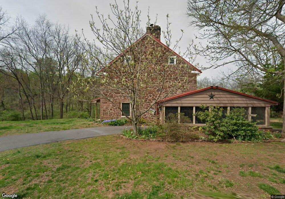
66 Gunhart Rd Mohnton, PA 19540
Estimated Value: $399,675 - $571,000
4
Beds
2
Baths
2,160
Sq Ft
$217/Sq Ft
Est. Value
About This Home
This home is located at 66 Gunhart Rd, Mohnton, PA 19540 and is currently estimated at $468,919, approximately $217 per square foot. 66 Gunhart Rd is a home located in Berks County with nearby schools including Robeson Elementary Center, Twin Valley Middle School, and Twin Valley High School.
Ownership History
Date
Name
Owned For
Owner Type
Purchase Details
Closed on
Aug 15, 2025
Sold by
Sardone Joseph and Sardone Deborah L
Bought by
Sardone Irrevocable Family Trust and Sardone
Current Estimated Value
Purchase Details
Closed on
Nov 15, 2004
Sold by
Thorpe Brian L and Thorpe Virginia E
Bought by
Sardone Joseph and Sardone Deborah L
Home Financials for this Owner
Home Financials are based on the most recent Mortgage that was taken out on this home.
Original Mortgage
$228,000
Interest Rate
5.67%
Mortgage Type
Fannie Mae Freddie Mac
Create a Home Valuation Report for This Property
The Home Valuation Report is an in-depth analysis detailing your home's value as well as a comparison with similar homes in the area
Home Values in the Area
Average Home Value in this Area
Purchase History
| Date | Buyer | Sale Price | Title Company |
|---|---|---|---|
| Sardone Irrevocable Family Trust | -- | None Listed On Document | |
| Sardone Joseph | $285,000 | -- |
Source: Public Records
Mortgage History
| Date | Status | Borrower | Loan Amount |
|---|---|---|---|
| Previous Owner | Sardone Joseph | $228,000 |
Source: Public Records
Tax History Compared to Growth
Tax History
| Year | Tax Paid | Tax Assessment Tax Assessment Total Assessment is a certain percentage of the fair market value that is determined by local assessors to be the total taxable value of land and additions on the property. | Land | Improvement |
|---|---|---|---|---|
| 2025 | $1,221 | $99,600 | $50,300 | $49,300 |
| 2024 | $3,974 | $99,600 | $50,300 | $49,300 |
| 2023 | $3,977 | $99,600 | $50,300 | $49,300 |
| 2022 | $3,882 | $99,600 | $50,300 | $49,300 |
| 2021 | $3,766 | $99,600 | $50,300 | $49,300 |
| 2020 | $3,832 | $99,600 | $50,300 | $49,300 |
| 2019 | $3,805 | $99,600 | $50,300 | $49,300 |
| 2018 | $3,780 | $99,600 | $50,300 | $49,300 |
| 2017 | $3,674 | $99,600 | $50,300 | $49,300 |
| 2016 | $988 | $99,600 | $50,300 | $49,300 |
| 2015 | $988 | $99,600 | $50,300 | $49,300 |
| 2014 | $988 | $99,600 | $50,300 | $49,300 |
Source: Public Records
Map
Nearby Homes
- 45 Lindsay Ct
- 142 Dithridge Dr
- 350 Dithridge Dr
- 51 Dithridge Dr
- 21 Bayard Dr
- 17 Bayard Dr
- 96 Dithridge Dr
- Columbia Plan at Green Hills
- Allegheny Plan at Green Hills
- Powell Plan at Green Hills
- 90 Dithridge Dr
- 338 Candy Rd
- 74 Redcay Rd
- 70 Joy Dr
- 5 Quail Ridge Dr
- 297 Oakbrook Dr
- 180 Candy Rd
- 8 Hessian Blvd
- 31 Imperial Dr
- 32 Stonehill Dr