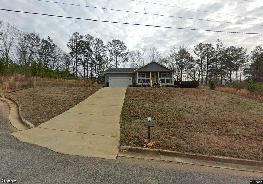
66 Janie Trace Anniston, AL 36201
Estimated Value: $205,685 - $266,000
3
Beds
2
Baths
1,291
Sq Ft
$179/Sq Ft
Est. Value
About This Home
This home is located at 66 Janie Trace, Anniston, AL 36201 and is currently estimated at $230,671, approximately $178 per square foot. 66 Janie Trace is a home with nearby schools including Oxford Middle School, Oxford High School, and Word Alive Academy.
Ownership History
Date
Name
Owned For
Owner Type
Purchase Details
Closed on
Jun 26, 2020
Sold by
Jones John W and Jones Amanda K
Bought by
Smith Austin Storm and Rojas Alin
Current Estimated Value
Home Financials for this Owner
Home Financials are based on the most recent Mortgage that was taken out on this home.
Original Mortgage
$147,283
Outstanding Balance
$130,601
Interest Rate
3.1%
Mortgage Type
New Conventional
Estimated Equity
$100,070
Purchase Details
Closed on
Jul 30, 2019
Sold by
Harrison Jeremie W
Bought by
Jones Amanda
Create a Home Valuation Report for This Property
The Home Valuation Report is an in-depth analysis detailing your home's value as well as a comparison with similar homes in the area
Home Values in the Area
Average Home Value in this Area
Purchase History
| Date | Buyer | Sale Price | Title Company |
|---|---|---|---|
| Smith Austin Storm | $150,000 | None Available | |
| Jones Amanda | $10,000 | None Available |
Source: Public Records
Mortgage History
| Date | Status | Borrower | Loan Amount |
|---|---|---|---|
| Open | Smith Austin Storm | $147,283 |
Source: Public Records
Tax History Compared to Growth
Tax History
| Year | Tax Paid | Tax Assessment Tax Assessment Total Assessment is a certain percentage of the fair market value that is determined by local assessors to be the total taxable value of land and additions on the property. | Land | Improvement |
|---|---|---|---|---|
| 2024 | $705 | $17,626 | $2,700 | $14,926 |
| 2023 | $786 | $34,064 | $5,400 | $28,664 |
| 2022 | $711 | $32,088 | $5,400 | $26,688 |
| 2021 | $569 | $26,112 | $5,400 | $20,712 |
| 2020 | $128 | $5,400 | $5,400 | $0 |
| 2019 | $103 | $2,160 | $2,160 | $0 |
| 2018 | $103 | $2,160 | $0 | $0 |
| 2017 | $1,027 | $2,140 | $0 | $0 |
| 2016 | $102 | $2,140 | $0 | $0 |
| 2013 | -- | $1,080 | $0 | $0 |
Source: Public Records
Map
Nearby Homes
- 130 Digby Rd
- 77 Greenvale Dr
- 68 Skyline Loop
- 209 Skyline Loop
- 201 Skyline Loop
- 124 Skyline Loop
- 23 Horizon St
- 37 Skyline Loop
- 19 Skyline Loop
- 20 Skyline Loop
- 140 Skyline Loop
- 185 Skyline Loop
- 193 Skyline Loop
- RC Cooper Plan at Carterton Heights
- RC Magnolia Plan at Carterton Heights
- RC Baltimore Plan at Carterton Heights
- RC Ashton Plan at Carterton Heights
- RC Murrow II Plan at Carterton Heights
- RC Mitchell Plan at Carterton Heights
- RC Davenport Plan at Carterton Heights
- Lot #4 Janie Trace Unit 4
- Lot #1 Janie Trace Unit 1
- Lot #5 Janie Trace Unit 5
- Lot #3 Janie Trace Unit 3
- 73 Luallen Dr
- 89 Luallen Dr
- 51 Luallen Dr
- Lot #6 Janie Trace Unit 6
- Lot #7 Janie Trace Unit 7
- 73 Janie Trace
- 896 Taylors Chapel Rd
- Lot #15 Janie Trace Unit 15
- 115 Luallen Dr
- 29 Luallen Dr
- 0 Janie Trace Unit Lot 1 884354
- 29 Janie Trace
- 0 Luallen Dr Unit 1 21364263
- 0 Luallen Dr Unit 1
- 72 Luallen Dr
- 141 Luallen Dr