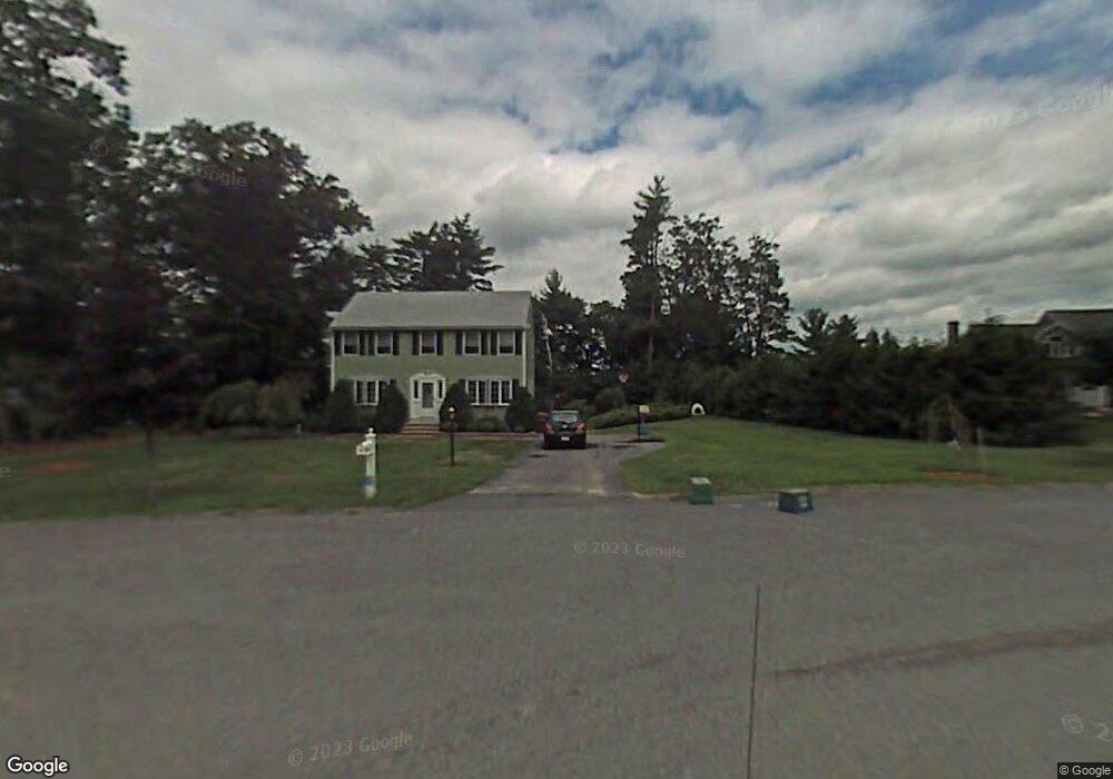
66 Jefferson Rd Dracut, MA 01826
Estimated Value: $639,646 - $723,000
3
Beds
2
Baths
1,666
Sq Ft
$404/Sq Ft
Est. Value
About This Home
This home is located at 66 Jefferson Rd, Dracut, MA 01826 and is currently estimated at $673,162, approximately $404 per square foot. 66 Jefferson Rd is a home located in Middlesex County with nearby schools including George H. Englesby Elementary School, Richardson Middle School, and Dracut Senior High School.
Ownership History
Date
Name
Owned For
Owner Type
Purchase Details
Closed on
Jul 10, 2006
Sold by
Solov Brian D and Mcgonagle Carol A
Bought by
Zanelotti Azar and Zanelotti Jeffrey D
Current Estimated Value
Home Financials for this Owner
Home Financials are based on the most recent Mortgage that was taken out on this home.
Original Mortgage
$320,000
Interest Rate
6.6%
Mortgage Type
Purchase Money Mortgage
Purchase Details
Closed on
Jul 17, 1992
Sold by
Premier Homes Inc
Bought by
Mcgonagle Carol and Solov Brian
Home Financials for this Owner
Home Financials are based on the most recent Mortgage that was taken out on this home.
Original Mortgage
$137,000
Interest Rate
8.54%
Mortgage Type
Purchase Money Mortgage
Create a Home Valuation Report for This Property
The Home Valuation Report is an in-depth analysis detailing your home's value as well as a comparison with similar homes in the area
Home Values in the Area
Average Home Value in this Area
Purchase History
| Date | Buyer | Sale Price | Title Company |
|---|---|---|---|
| Zanelotti Azar | $400,000 | -- | |
| Mcgonagle Carol | $152,925 | -- |
Source: Public Records
Mortgage History
| Date | Status | Borrower | Loan Amount |
|---|---|---|---|
| Open | Mcgonagle Carol | $314,000 | |
| Closed | Zanelotti Azar | $320,000 | |
| Previous Owner | Mcgonagle Carol | $136,500 | |
| Previous Owner | Mcgonagle Carol | $137,000 |
Source: Public Records
Tax History Compared to Growth
Tax History
| Year | Tax Paid | Tax Assessment Tax Assessment Total Assessment is a certain percentage of the fair market value that is determined by local assessors to be the total taxable value of land and additions on the property. | Land | Improvement |
|---|---|---|---|---|
| 2025 | $5,674 | $560,700 | $251,700 | $309,000 |
| 2024 | $5,493 | $525,600 | $239,800 | $285,800 |
| 2023 | $5,314 | $458,900 | $208,600 | $250,300 |
| 2022 | $5,146 | $418,700 | $189,700 | $229,000 |
| 2021 | $6,055 | $381,100 | $172,300 | $208,800 |
| 2020 | $4,907 | $367,600 | $167,100 | $200,500 |
| 2019 | $5,979 | $344,400 | $159,100 | $185,300 |
| 2018 | $4,755 | $336,300 | $159,100 | $177,200 |
| 2017 | $4,737 | $336,300 | $159,100 | $177,200 |
| 2016 | $4,716 | $317,800 | $159,900 | $157,900 |
| 2015 | $4,654 | $311,700 | $159,900 | $151,800 |
| 2014 | $4,372 | $301,700 | $159,900 | $141,800 |
Source: Public Records
Map
Nearby Homes
- 9 Cornstalk Ln
- 73 Mammoth Rd Unit A&B
- 73 Mammoth Rd
- 73 A&B Mammoth Rd
- 10 Edwards St
- 97 Passaconaway Dr
- 50 Stephen Ave
- 1905 Lakeview Ave
- 35 Camilla Ave
- 17 Spare St
- 53 Vinal St
- 53 4th St
- 83 Turgeon Ave
- 29 Mill St Unit B
- 67 2nd St
- 999 Hildreth St
- 124 Tennis Plaza Rd Unit 22
- 79 B St
- 74 Tennis Plaza Rd Unit 34
- 14 D St