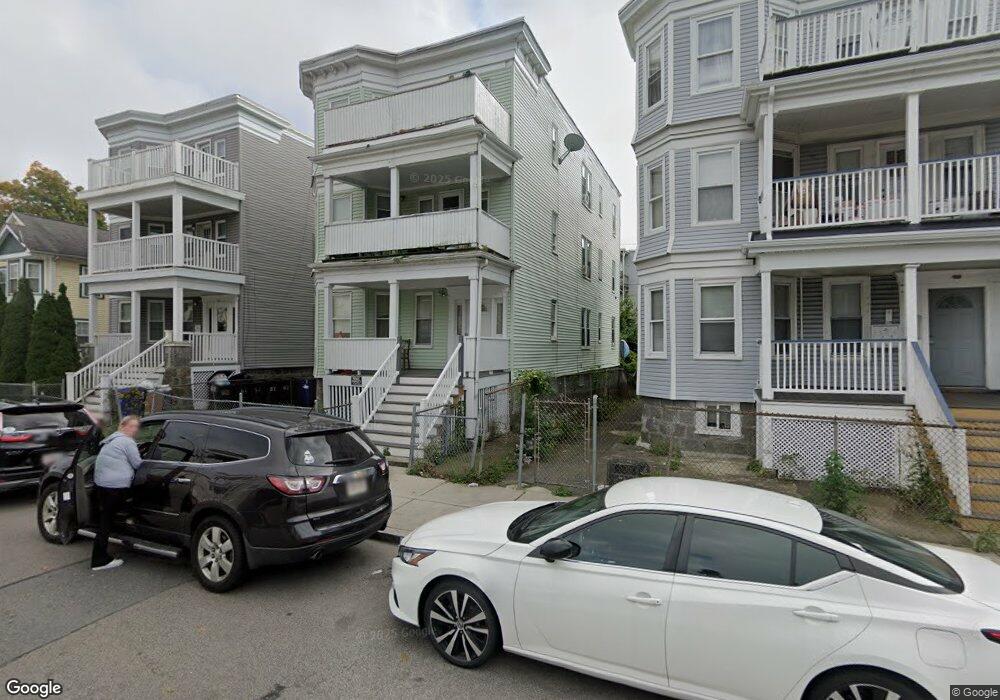
66 Johnston Rd Unit 3 Dorchester Center, MA 02124
Franklin Field South NeighborhoodEstimated Value: $1,190,000 - $1,332,000
3
Beds
1
Bath
1,200
Sq Ft
$1,032/Sq Ft
Est. Value
About This Home
This home is located at 66 Johnston Rd Unit 3, Dorchester Center, MA 02124 and is currently estimated at $1,238,333, approximately $1,031 per square foot. 66 Johnston Rd Unit 3 is a home located in Suffolk County with nearby schools including KIPP Academy Boston Charter School and Berea Seventh-day Adventist Academy.
Ownership History
Date
Name
Owned For
Owner Type
Purchase Details
Closed on
Oct 25, 2021
Sold by
66 Johnston Road Rt
Bought by
Rice John R and Rice Gwendolyn M
Current Estimated Value
Purchase Details
Closed on
May 5, 2020
Sold by
Rice John R and Rice Gwendolyn
Bought by
66 Johnston Road Rt
Create a Home Valuation Report for This Property
The Home Valuation Report is an in-depth analysis detailing your home's value as well as a comparison with similar homes in the area
Home Values in the Area
Average Home Value in this Area
Purchase History
| Date | Buyer | Sale Price | Title Company |
|---|---|---|---|
| Rice John R | -- | None Available | |
| 66 Johnston Road Rt | -- | None Available |
Source: Public Records
Tax History Compared to Growth
Tax History
| Year | Tax Paid | Tax Assessment Tax Assessment Total Assessment is a certain percentage of the fair market value that is determined by local assessors to be the total taxable value of land and additions on the property. | Land | Improvement |
|---|---|---|---|---|
| 2025 | $8,531 | $736,700 | $200,900 | $535,800 |
| 2024 | $7,633 | $700,300 | $189,100 | $511,200 |
| 2023 | $7,030 | $654,600 | $176,800 | $477,800 |
| 2022 | $6,531 | $600,300 | $162,100 | $438,200 |
| 2021 | $6,100 | $571,700 | $154,400 | $417,300 |
| 2020 | $4,989 | $472,400 | $179,700 | $292,700 |
| 2019 | $4,331 | $410,900 | $110,400 | $300,500 |
| 2018 | $3,745 | $357,300 | $110,400 | $246,900 |
| 2017 | $3,534 | $333,700 | $110,400 | $223,300 |
| 2016 | $3,192 | $290,200 | $110,400 | $179,800 |
| 2015 | $3,368 | $278,100 | $100,700 | $177,400 |
| 2014 | $3,041 | $241,700 | $100,700 | $141,000 |
Source: Public Records
Map
Nearby Homes
- 492 Harvard St
- 14 Estella St Unit 2
- 29 Havelock St
- 27 Havelock St
- 28 Hansborough St Unit 2
- 28 Hansborough St Unit 5
- 17 Greendale Rd Unit 2F
- 14 Fabyan St
- 21 Ashton St Unit 1
- 69 Lucerne St
- 30-32 Westmore Rd
- 6 Deering Rd
- 84 W Main St Unit 84
- 1 Finch St Unit 1
- 44 Floyd St
- 12 Finch St Unit 12
- 57 Stratton St
- 67 Wildwood St
- 24 Marden Ave
- 4 Gilmer St
- 66 Johnston Rd
- 62 Johnston Rd
- 68 Johnston Rd
- 68 Johnston Rd Unit 3
- 58 Johnston Rd
- 492 Harvard St Unit 2
- 622 Morton St Unit 3
- 622 Morton St Unit 2
- 622 Morton St Unit 1
- 622 Morton St
- 55 Wilcock St
- 55 Wilcock St Unit 3
- 55 Wilcock St Unit 2
- 59 Wilcock St
- 59 Wilcock St Unit 3
- 59 Wilcock St Unit 1
- 51 Wilcock St
- 59 Johnston Rd
- 47 Wilcock St
- 55 Johnston Rd