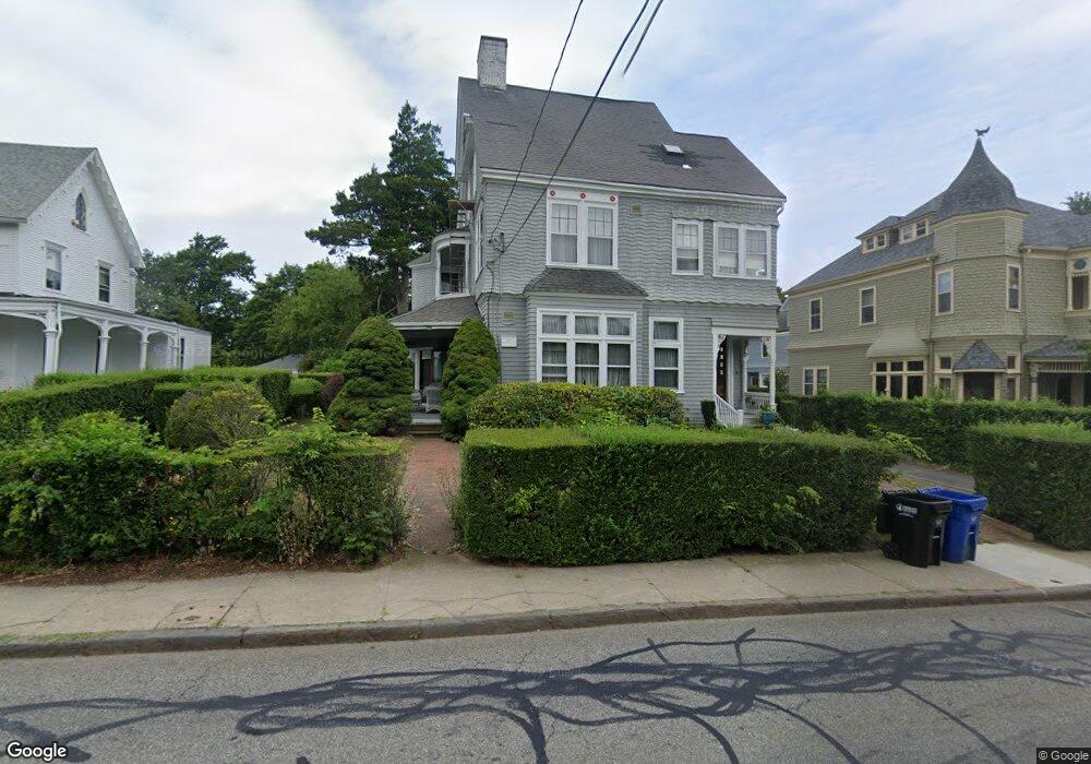
66 Kay St Unit 1 Newport, RI 02840
Kay-Catherine NeighborhoodEstimated Value: $764,000 - $887,000
2
Beds
1
Bath
1,518
Sq Ft
$543/Sq Ft
Est. Value
About This Home
This home is located at 66 Kay St Unit 1, Newport, RI 02840 and is currently estimated at $824,887, approximately $543 per square foot. 66 Kay St Unit 1 is a home located in Newport County with nearby schools including Rogers High School, St Michael's Country Day School, and St George's School.
Ownership History
Date
Name
Owned For
Owner Type
Purchase Details
Closed on
Jan 25, 1999
Sold by
Roiff Paul G
Bought by
Galivan John H and Galivan Nancy S
Current Estimated Value
Home Financials for this Owner
Home Financials are based on the most recent Mortgage that was taken out on this home.
Original Mortgage
$112,000
Outstanding Balance
$26,419
Interest Rate
6.7%
Estimated Equity
$798,468
Create a Home Valuation Report for This Property
The Home Valuation Report is an in-depth analysis detailing your home's value as well as a comparison with similar homes in the area
Home Values in the Area
Average Home Value in this Area
Purchase History
| Date | Buyer | Sale Price | Title Company |
|---|---|---|---|
| Galivan John H | $140,000 | -- |
Source: Public Records
Mortgage History
| Date | Status | Borrower | Loan Amount |
|---|---|---|---|
| Open | Galivan John H | $112,000 |
Source: Public Records
Tax History Compared to Growth
Tax History
| Year | Tax Paid | Tax Assessment Tax Assessment Total Assessment is a certain percentage of the fair market value that is determined by local assessors to be the total taxable value of land and additions on the property. | Land | Improvement |
|---|---|---|---|---|
| 2025 | $5,113 | $588,500 | $0 | $588,500 |
| 2024 | $4,837 | $588,500 | $0 | $588,500 |
| 2023 | $3,872 | $390,300 | $0 | $390,300 |
| 2022 | $3,751 | $390,300 | $0 | $390,300 |
| 2021 | $3,641 | $390,300 | $0 | $390,300 |
| 2020 | $3,683 | $358,300 | $0 | $358,300 |
| 2019 | $3,683 | $358,300 | $0 | $358,300 |
| 2018 | $3,579 | $358,300 | $0 | $358,300 |
| 2017 | $4,017 | $358,300 | $0 | $358,300 |
| 2016 | $3,916 | $358,300 | $0 | $358,300 |
| 2015 | $3,823 | $358,300 | $0 | $358,300 |
| 2014 | $3,786 | $313,900 | $0 | $313,900 |
Source: Public Records
Map
Nearby Homes
- 78 Rhode Island Ave Unit 6
- 78 Rhode Island Ave Unit 8
- 42 Mann Ave
- 8 Champlin St
- 5 Pell St
- 1 Pell St
- 17 Lincoln St
- 23 Mann Ave Unit 4
- 33 Kay St
- 34 Bull St
- 198 Gibbs Ave
- 103 Champlin Place N
- 102 Broadway Unit 2B
- 27 Soar Way
- 128 Eustis Ave
- 12 Mount Vernon St Unit 5
- 4 Newport Ave Unit B2
- 5 Bowser Ct
- 10 Barney St Unit 102
- 10 Barney St Unit 107
- 66 Kay St Unit 3
- 66 Kay St Unit 2
- 64 Kay St
- 64 Kay St Unit A
- 70 Kay St
- 41 Cranston Ave Unit 5
- 41 Cranston Ave Unit 2
- 41 Cranston Ave Unit 4
- 71 Kay St
- 71 Kay St Unit 1
- 73 Kay St
- 39 Cranston Ave Unit 41
- 39 Cranston Ave Unit 41
- 39 Cranston Ave Unit 41
- 39 Cranston Ave Unit 41
- 39 Cranston Ave Unit 41
- 39 Cranston Ave Unit 1
- 39 Cranston Ave Unit 4
- 39- 41 Cranston Ave Unit 3
- 39 Cranston Ave Unit 5