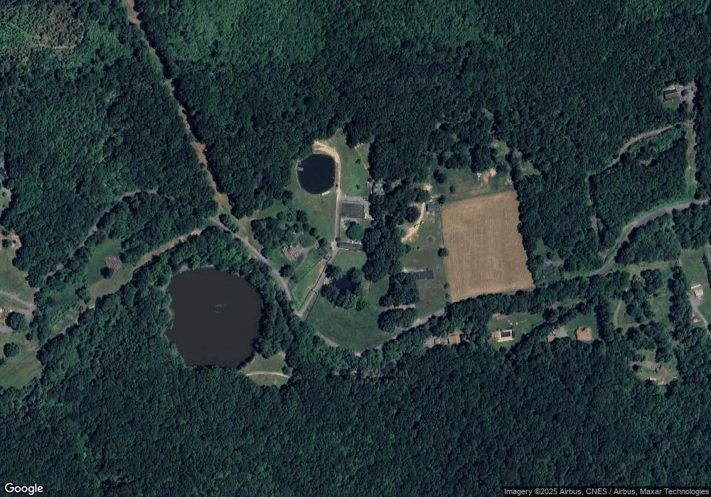
66 Lone Oak Ln Rocky Gap, VA 24366
Estimated Value: $154,000 - $895,000
3
Beds
3
Baths
1,346
Sq Ft
$315/Sq Ft
Est. Value
About This Home
This home is located at 66 Lone Oak Ln, Rocky Gap, VA 24366 and is currently estimated at $423,622, approximately $314 per square foot. 66 Lone Oak Ln is a home located in Bland County with nearby schools including Bland County Elementary School and Bland County High School.
Ownership History
Date
Name
Owned For
Owner Type
Purchase Details
Closed on
Feb 13, 2014
Sold by
First Century Bank Inc
Bought by
Bowen William H
Current Estimated Value
Home Financials for this Owner
Home Financials are based on the most recent Mortgage that was taken out on this home.
Original Mortgage
$382,500
Outstanding Balance
$291,047
Interest Rate
4.52%
Estimated Equity
$132,575
Purchase Details
Closed on
Dec 14, 2012
Sold by
Black Mark A
Bought by
First Century Bank Inc
Create a Home Valuation Report for This Property
The Home Valuation Report is an in-depth analysis detailing your home's value as well as a comparison with similar homes in the area
Home Values in the Area
Average Home Value in this Area
Purchase History
| Date | Buyer | Sale Price | Title Company |
|---|---|---|---|
| Bowen William H | $450,000 | -- | |
| First Century Bank Inc | $500,000 | -- |
Source: Public Records
Mortgage History
| Date | Status | Borrower | Loan Amount |
|---|---|---|---|
| Open | First Century Bank Inc | $382,500 |
Source: Public Records
Tax History Compared to Growth
Tax History
| Year | Tax Paid | Tax Assessment Tax Assessment Total Assessment is a certain percentage of the fair market value that is determined by local assessors to be the total taxable value of land and additions on the property. | Land | Improvement |
|---|---|---|---|---|
| 2024 | $1,030 | $171,600 | $24,700 | $146,900 |
| 2023 | $1,030 | $171,600 | $24,700 | $146,900 |
| 2022 | $1,030 | $171,600 | $24,700 | $146,900 |
| 2021 | $1,030 | $171,600 | $24,700 | $146,900 |
| 2020 | $1,030 | $171,600 | $24,700 | $146,900 |
| 2019 | $1,263 | $210,500 | $24,700 | $185,800 |
| 2018 | $1,263 | $210,500 | $24,700 | $185,800 |
| 2017 | $1,263 | $210,500 | $24,700 | $185,800 |
| 2016 | $1,263 | $210,500 | $24,700 | $185,800 |
| 2015 | -- | $0 | $0 | $0 |
| 2014 | -- | $0 | $0 | $0 |
| 2013 | -- | $0 | $0 | $0 |
Source: Public Records
Map
Nearby Homes
- 92 Acres Laurel Fork Rd
- 6441 Laurel Fork Rd
- TBD Laurel Fork Rd
- 83 Sparrow Ln
- 0 Wolf Creek Rd
- 4694 Laurel Fork Rd
- 954 Wolf Creek Hwy
- 172 Alder Ln
- 0 John Nash Blvd
- 291 Karis Ln
- 2843 Horton Rd
- 0 Dry Fork Rd Unit 55221
- 18 Chanticlear Rd
- 3604 Meadow St
- 0 Ingleside Rd
- 3236 Ridgecrest Rd
- 3229 Ridgecrest Rd
- 116 Atomic Ct
- 2424 Fairfield Ave
- 727 Heatherwood Rd
- 7401 Laurel Fork Rd
- 7401 Laurel Fork Rd
- 7551 Laurel Fork Rd
- 7702 Laurel Fork Rd
- 105 Lone Oak Ln
- 7667 Laurel Fork Rd
- 7708 Laurel Fork Rd
- 0 Lot Unit 7 45727
- 0 Lot Unit 7 64033
- 0 Lot Unit 45727
- 0 Lot Unit 64033
- 7115 Laurel Fork Rd
- 7124 Laurel Fork Rd
- 7125 Laurel Fork Rd
- 7068 Laurel Fork Rd
- 7834 Laurel Fork Rd
- 7757 Laurel Fork Rd
- 7856 Laurel Fork Rd
- 7028 Laurel Fork Rd
- 7796 Laurel Fork Rd
