Estimated Value: $155,576 - $216,000
3
Beds
1
Bath
1,120
Sq Ft
$162/Sq Ft
Est. Value
About This Home
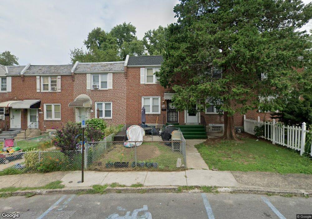
This home is located at 66 Mermont Cir, Darby, PA 19023 and is currently estimated at $180,894, approximately $161 per square foot. 66 Mermont Cir is a home located in Delaware County with nearby schools including Park Lane Elementary School, Penn Wood Middle School, and Penn Wood High School - Cypress Street Campus.
Ownership History
Date
Name
Owned For
Owner Type
Purchase Details
Closed on
Apr 19, 2013
Sold by
Hunter Curtis
Bought by
Hunter Roslyn
Current Estimated Value
Purchase Details
Closed on
Aug 23, 1996
Sold by
Barba Frank J and Barba Edward J
Bought by
Hunter Curtis
Home Financials for this Owner
Home Financials are based on the most recent Mortgage that was taken out on this home.
Original Mortgage
$48,327
Outstanding Balance
$3,786
Interest Rate
8.11%
Estimated Equity
$177,108
Create a Home Valuation Report for This Property
The Home Valuation Report is an in-depth analysis detailing your home's value as well as a comparison with similar homes in the area
Home Values in the Area
Average Home Value in this Area
Purchase History
| Date | Buyer | Sale Price | Title Company |
|---|---|---|---|
| Hunter Roslyn | -- | None Available | |
| Hunter Curtis | $56,000 | Commonwealth Land Title Ins |
Source: Public Records
Mortgage History
| Date | Status | Borrower | Loan Amount |
|---|---|---|---|
| Open | Hunter Curtis | $48,327 |
Source: Public Records
Tax History Compared to Growth
Tax History
| Year | Tax Paid | Tax Assessment Tax Assessment Total Assessment is a certain percentage of the fair market value that is determined by local assessors to be the total taxable value of land and additions on the property. | Land | Improvement |
|---|---|---|---|---|
| 2025 | $3,104 | $62,680 | $18,720 | $43,960 |
| 2024 | $3,104 | $62,680 | $18,720 | $43,960 |
| 2023 | $2,920 | $62,680 | $18,720 | $43,960 |
| 2022 | $2,841 | $62,680 | $18,720 | $43,960 |
| 2021 | $3,964 | $62,680 | $18,720 | $43,960 |
| 2020 | $3,867 | $52,930 | $15,170 | $37,760 |
| 2019 | $3,703 | $52,930 | $15,170 | $37,760 |
| 2018 | $3,658 | $52,930 | $0 | $0 |
| 2017 | $3,590 | $52,930 | $0 | $0 |
| 2016 | $290 | $52,930 | $0 | $0 |
| 2015 | $290 | $52,930 | $0 | $0 |
| 2014 | $296 | $52,930 | $0 | $0 |
Source: Public Records
Map
Nearby Homes
- 33 Mermont Cir
- 129 Branford Rd
- 29 Concord Rd
- 27 Concord Rd
- 1345 Park Ln
- 1210 Berkley Rd
- 306 Golf Rd
- 209 Weymouth Rd
- 1232 Edgehill Rd
- 1237 Edgehill Rd
- 1246 Wycombe Ave
- 1125 Main St
- 1203 Edgehill Rd
- 28 S 12th St
- 1143 Chestnut St
- 14 N Macdade Blvd
- 1115 Chestnut St
- 32 Elder Ave
- 30 E Providence Rd
- 14 W Providence Rd
- 68 Mermont Cir
- 64 Mermont Cir
- 70 Mermont Cir
- 72 Mermont Cir
- 62 Mermont Cir
- 74 Mermont Cir
- 60 Mermont Cir
- 58 Mermont Cir
- 53 Mermont Cir
- 56 Mermont Cir
- 110 Branford Rd
- 51 Mermont Cir
- 54 Mermont Cir
- 112 Branford Rd
- 49 Mermont Cir
- 52 Mermont Cir
- 114 Branford Rd
- 47 Mermont Cir
- 100 Branford Rd
- 102 Branford Rd